Proposal of a domain model for 3D representation of buildings in Ecuador
Luis Alejandro Velastegui Cáceres, Julia Desirée Velastegui Cáceres, Pedro A Carretero Poblete, Manuel Fabian Moyón Gusqui, María Alejandra Cevallos Díaz, John Samuel, Pedro Antonio Carretero Poblete, Uznir Ujang, Pedro Antonio Carretero Poblete

TL;DR
This paper proposes a 3D building model for Ecuador to improve urban planning and land management.
Contribution
A novel domain model for 3D building representation aligned with Ecuadorian and international standards.
Findings
The domain model was successfully applied in Riobamba canton using a geodatabase in pgAdmin4.
The model supports efficient cadastral management and 3D representation in open-source GIS.
The proposal serves as a benchmark for other countries facing similar urban development challenges.
Abstract
The accelerated urban sprawl of cities around the world presents major challenges for urban planning and land resource management. In this context, it is crucial to have a detailed 3D representation of buildings enriched with accurate alphanumeric information. A distinctive aspect of this proposal is its specific focus on the spatial unit corresponding to buildings. In order to propose a domain model for the 3D representation of buildings, the national standard of Ecuador and the international standard (ISO 19152:2012 LADM) were considered. The proposal includes a detailed specification of attributes, both for the general subclass of buildings and for their infrastructure. The application of the domain model proposal was crucial in a study area located in the Riobamba canton, due to the characteristics of the buildings in that area. For this purpose, a geodatabase was created in…
Genes, proteins, chemicals, diseases, species, mutations and cell lines named across the full text — each resolved to its canonical identifier and authoritative record.
Click any figure to enlarge with its caption.
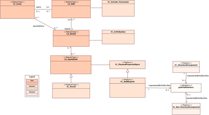 Figure 1
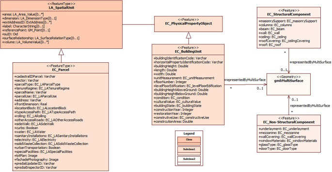 Figure 2
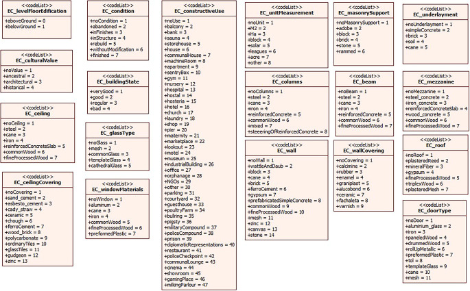 Figure 3
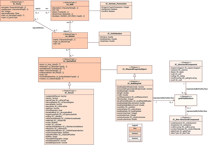 Figure 4
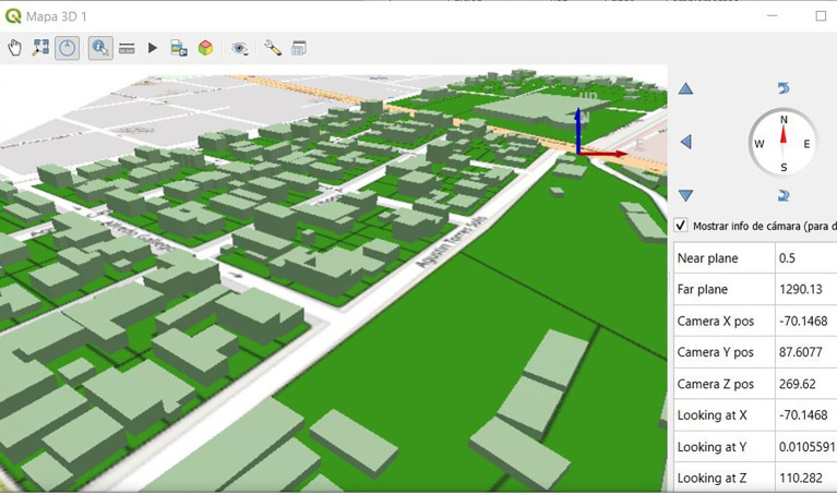 Figure 5
Peer Reviews
No public reviews on file for this paper yet. If you reviewed it on a platform where reviews are public (OpenReview, ICLR, NeurIPS, ICML), you can paste yours below so the community can read it here.
Videos
No videos yet. Explain this paper in a talk, walkthrough, or lecture? Add one.
Taxonomy
Topics3D Modeling in Geospatial Applications · 3D Surveying and Cultural Heritage · Geological Modeling and Analysis