Mapping and predicting groundwater accumulations using remote sensing and aeromagnetic data: a case study from Bahariya Oasis, Western Desert, Egypt
Hussein T. El-Badrawy, Saif M. Abo Khashaba, Sultan A. S. Araffa, Moamena Kassab, Mostafa Nagy

TL;DR
This study uses remote sensing and aeromagnetic data to map groundwater potential in Egypt's Bahariya Oasis, helping prioritize sustainable water resource planning.
Contribution
The first application of a GIS-AHP model combined with high-resolution aeromagnetic data in the Bahariya area for groundwater prediction.
Findings
High groundwater potential zones are concentrated in the southern and southeastern sectors of the Bahariya Oasis.
The model achieved 93.4% predictive accuracy when validated against well occurrences.
Aeromagnetic data revealed a thick sedimentary cover in the south and southeast, supporting enhanced groundwater storage potential.
Abstract
The Bahariya Oasis in Egypt’s Western Desert faces critical water security challenges due to intensive groundwater exploitation and limited renewable recharge. To address this challenge, this study integrates a GIS-AHP model for the first time in the Bahariya area and incorporates high-resolution aeromagnetic data to enhance the prediction of groundwater potential zones. Nine groundwater-controlling thematic layers were compiled from multi-source datasets, classified, and weighted using the AHP model: structural geology (lineament density), terrain (slope), hydrology (drainage density and rainfall), hydrogeology (lithology and soil moisture), land-surface conditions (NDVI and LU/LC), and the RTP aeromagnetic signal. The resulting groundwater potential map delineates coherent “very-high” potential corridors concentrated in the southern and southeastern sectors, where high lineament…
Genes, proteins, chemicals, diseases, species, mutations and cell lines named across the full text — each resolved to its canonical identifier and authoritative record.
Click any figure to enlarge with its caption.
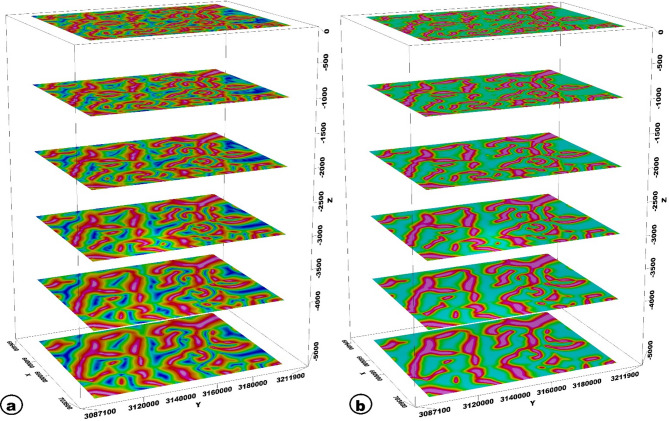 Figure 10
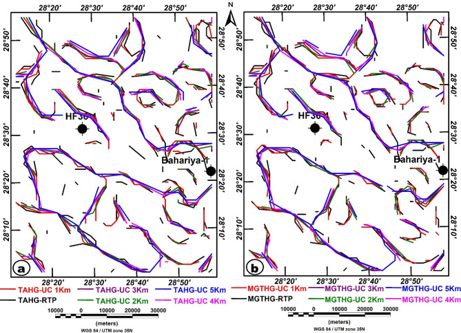 Figure 11
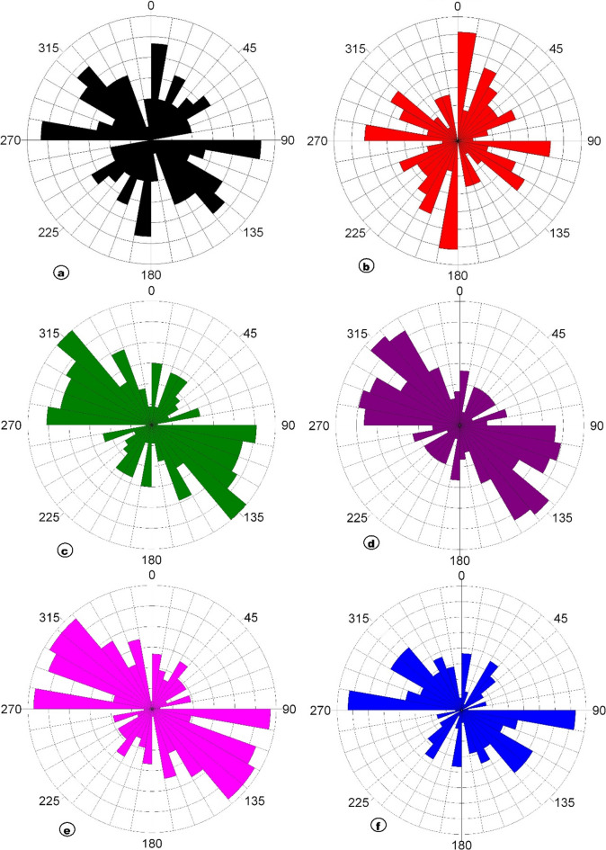 Figure 12
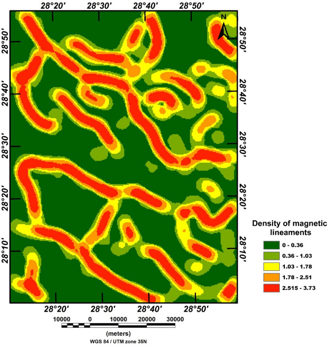 Figure 13
 Figure 14
 Figure 15
 Figure 16
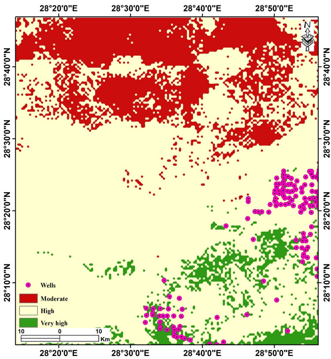 Figure 17
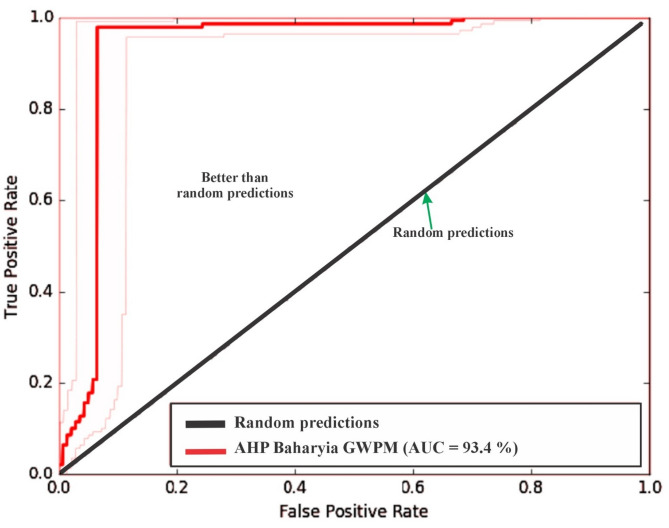 Figure 18
 Figure 1
 Figure 2
 Figure 3
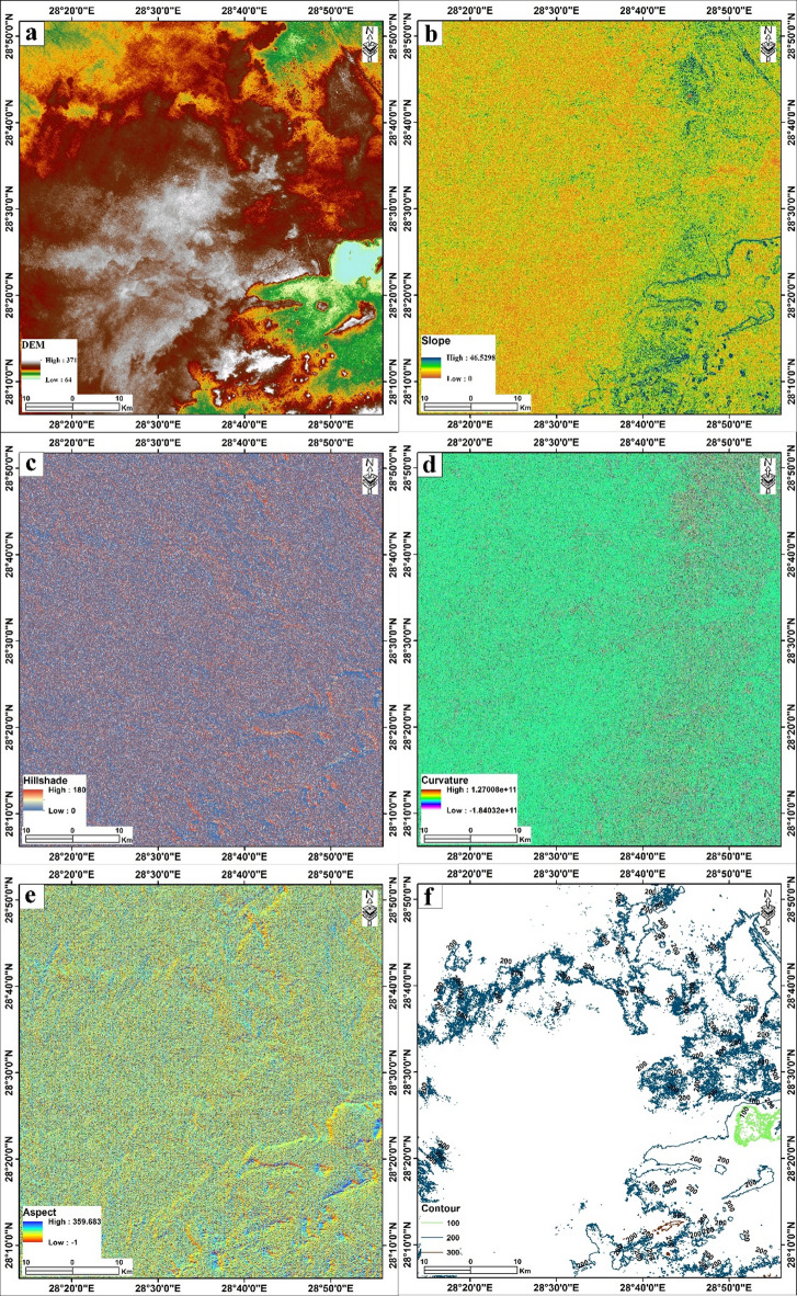 Figure 4
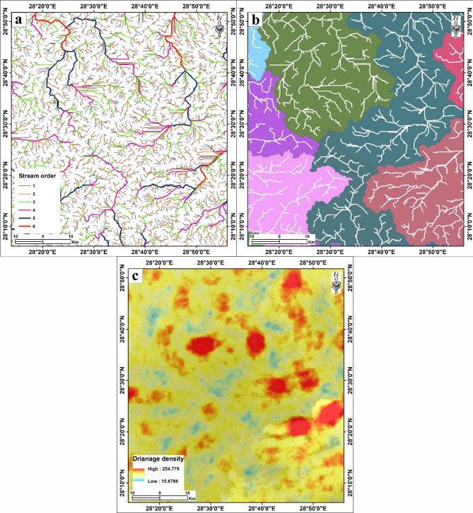 Figure 5
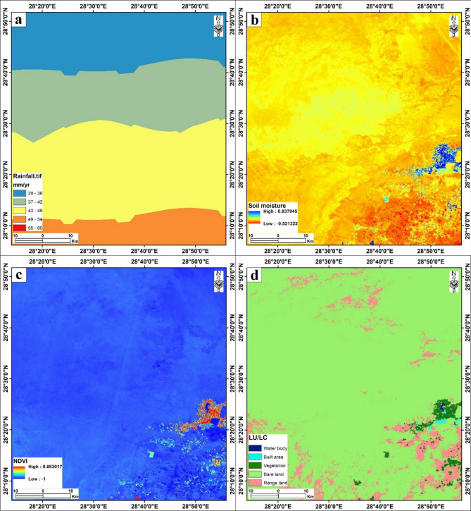 Figure 6
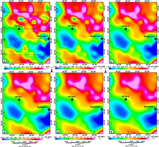 Figure 7
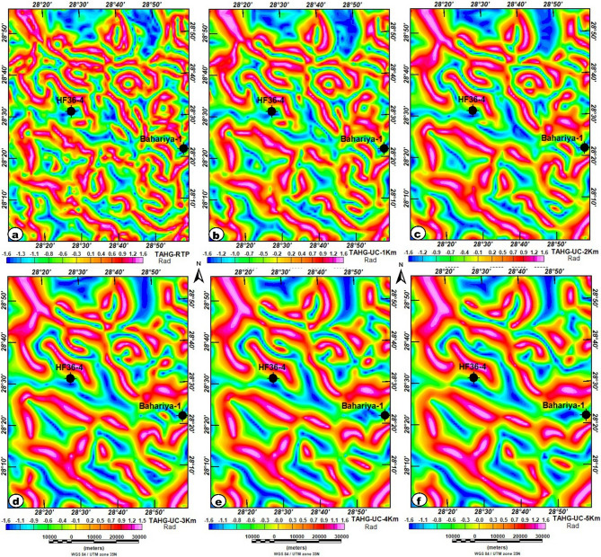 Figure 8
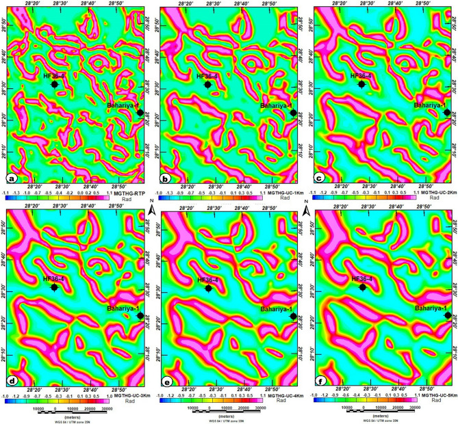 Figure 9
Peer Reviews
No public reviews on file for this paper yet. If you reviewed it on a platform where reviews are public (OpenReview, ICLR, NeurIPS, ICML), you can paste yours below so the community can read it here.
Videos
No videos yet. Explain this paper in a talk, walkthrough, or lecture? Add one.
Taxonomy
TopicsGroundwater and Watershed Analysis · Geophysical and Geoelectrical Methods · Geochemistry and Geologic Mapping