Strategic dam site selection and hazard mapping using remote sensing: insights from Wadi Araba, Egypt
Mona A. Mesallam, Zenhom E. Salem, Ayman M. Al Temamy, Tamer S. Abu-Alam, Amr S. Fahil

TL;DR
This study uses remote sensing and GIS to identify flood-prone areas and optimal dam locations in Wadi Araba, Egypt, to mitigate flash floods.
Contribution
A novel geospatial decision-support framework using remote sensing and AHP for flash flood hazard mapping and dam site selection in hyper-arid regions.
Findings
Wadi Araba was classified into high, moderate, and low-risk zones for flash flooding using a remote sensing-GIS/AHP model.
Optimal dam sites with favorable storage geometry were identified and validated with AUC scores of 0.7–0.8 for dam suitability.
High-risk zones are concentrated in the southern Galala Plateau, while low-risk zones are in the northern and western areas.
Abstract
Flash floods represent one of the most recurrent and devastating geohazards affecting Egypt’s northern area of the Red Sea coast, particularly in hyper-arid catchments such as Wadi Araba. This study develops a geospatial decision-support framework to identify flash-flood-prone areas and determine optimal dam locations for flood mitigation and groundwater recharge. The analysis incorporates eight thematic layers: slope, LULC, rainfall, DEM, drainage density, lineament density, distance to main streams and roads. The data used for thematic layers was derived from satellite imagery and ancillary datasets, processed using remote sensing and GIS tools. A multi-criteria decision analysis (AHP) generated a weighted overlay model of flood susceptibility. The resulting map classified Wadi Araba into high-risk (0.53 km²), moderate-risk (2354.8 km²), and low-risk (1671.34 km²) zones, with the…
Genes, proteins, chemicals, diseases, species, mutations and cell lines named across the full text — each resolved to its canonical identifier and authoritative record.
Click any figure to enlarge with its caption.
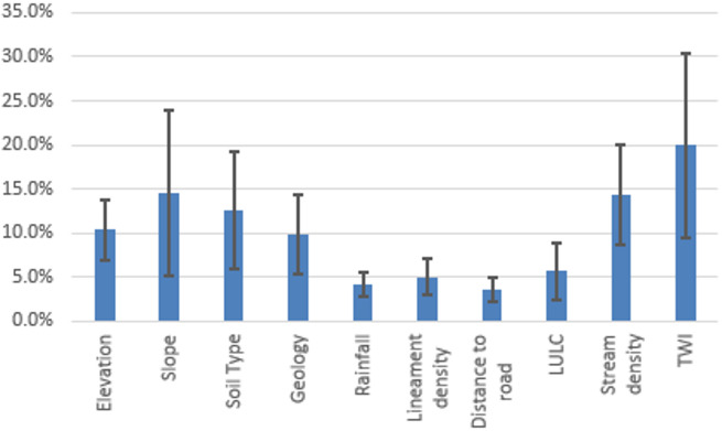 Figure 10
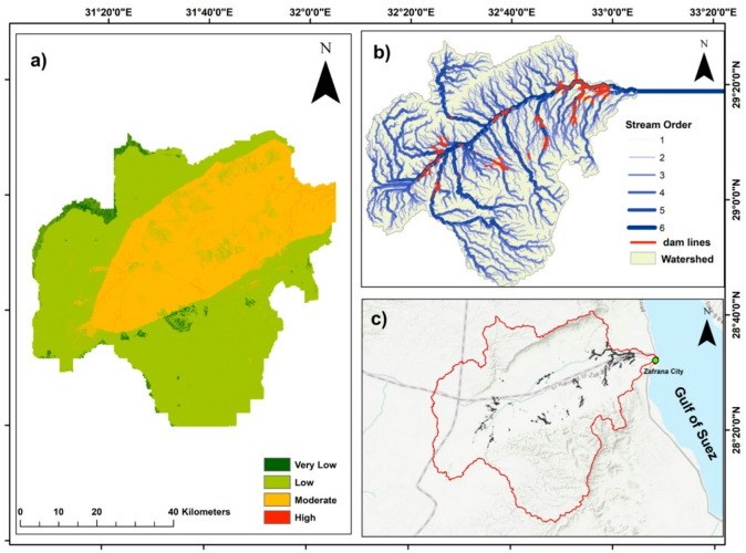 Figure 11
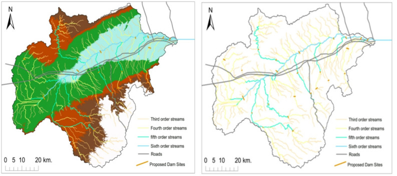 Figure 12
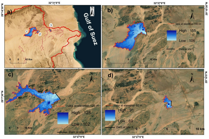 Figure 13
 Figure 14
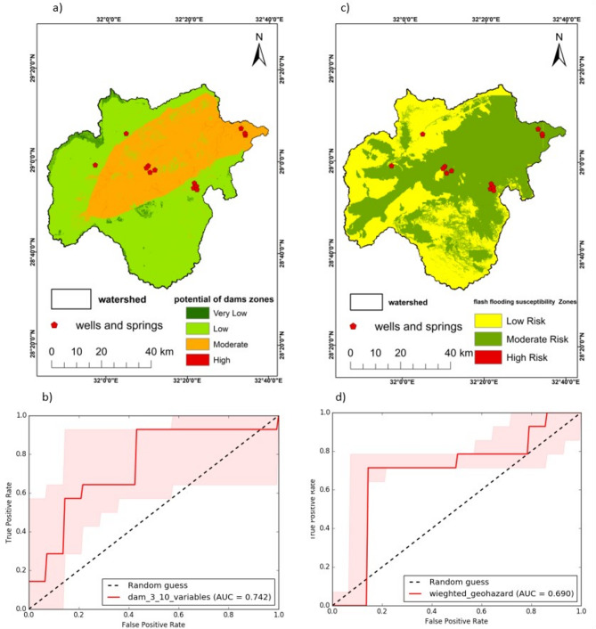 Figure 15
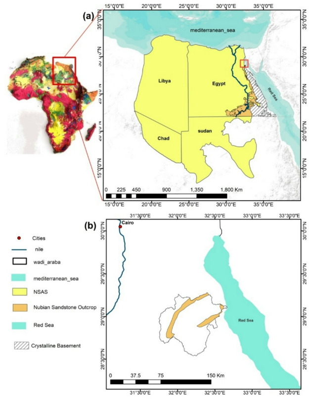 Figure 2
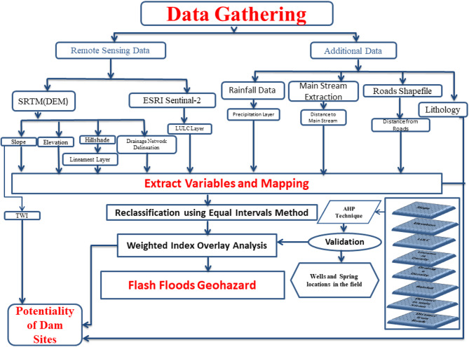 Figure 3
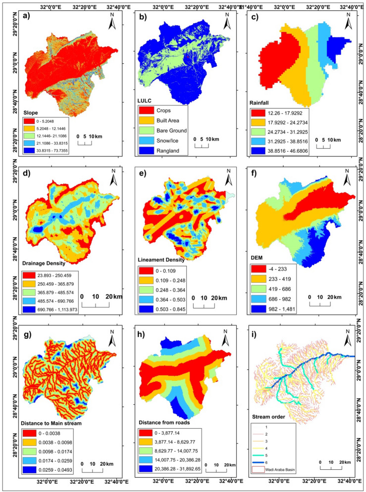 Figure 4
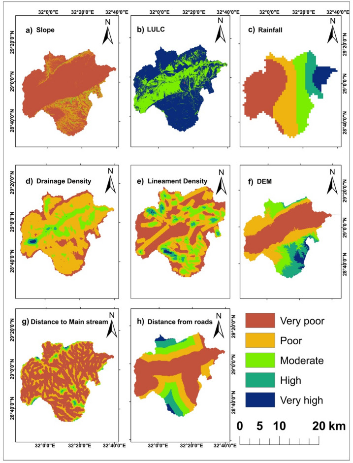 Figure 5
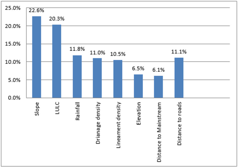 Figure 6
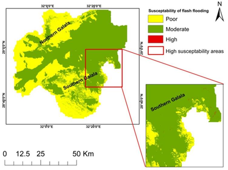 Figure 7
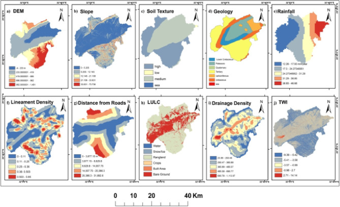 Figure 8
 Figure 9
Peer Reviews
No public reviews on file for this paper yet. If you reviewed it on a platform where reviews are public (OpenReview, ICLR, NeurIPS, ICML), you can paste yours below so the community can read it here.
Videos
No videos yet. Explain this paper in a talk, walkthrough, or lecture? Add one.
Taxonomy
TopicsGroundwater and Watershed Analysis · Flood Risk Assessment and Management · Dam Engineering and Safety