Wide-swath altimetry maps bank shapes and storage changes in global rivers
A. Cerbelaud, J. Wade, C. H. David, M. Durand, R. P. M. Frasson, T. Pavelsky, H. Oubanas

TL;DR
A new satellite mission provides global insights into river channel shapes and water storage changes, revealing significant discrepancies with previous models.
Contribution
The study introduces the first near-global-scale observations of river geometry and water storage changes using the SWOT satellite mission.
Findings
SWOT observations show global annual river storage variability is 28% lower than previous model estimates.
Clear patterns of riverbed shape and storage variability emerge across major basins.
Observational challenges in the Arctic and the Amazon drought contribute to discrepancies in estimates.
Abstract
Rivers are Earth’s most renewable and accessible freshwater resource1, yet global estimates of the magnitude and variability in river water storage have remained few and inconsistent1–9. Previous estimates of variability have relied either on sparse and asynchronous remote-sensing observations10 or on hydrological models constrained by incomplete understanding of surface-water balance and poorly known river channel characteristics2,3. The insufficient knowledge of temporal variations in river water storage across space hinders effective management of this critical freshwater resource11,12. Here we present near-global-scale observations of active river channel geometry and associated monthly changes in water storage at the reach scale derived from the first water year (October 2023 to September 2024) of the Surface Water and Ocean Topography (SWOT) mission at 126,674 reaches worldwide.…
Genes, proteins, chemicals, diseases, species, mutations and cell lines named across the full text — each resolved to its canonical identifier and authoritative record.
Click any figure to enlarge with its caption.
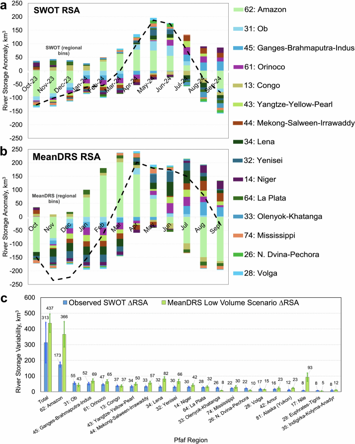 Figure 10
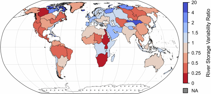 Figure 11
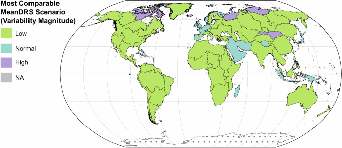 Figure 12
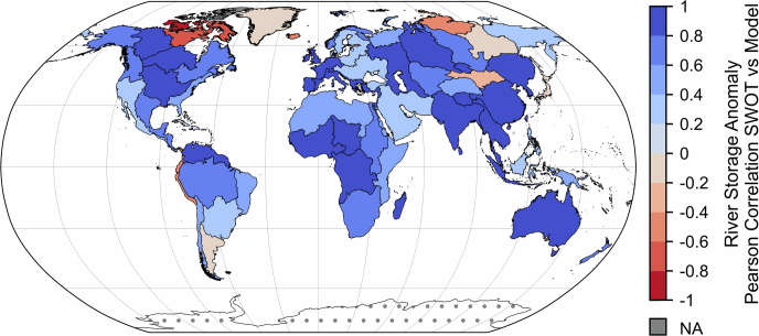 Figure 13
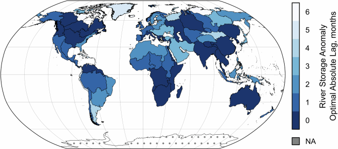 Figure 14
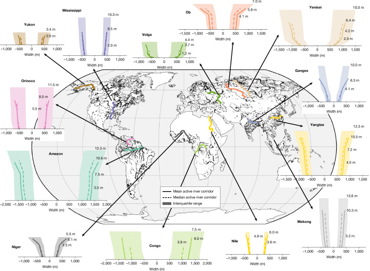 Figure 1
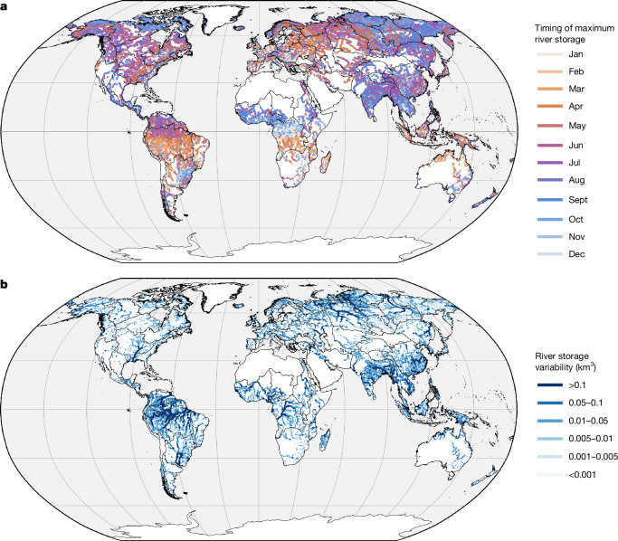 Figure 2
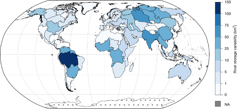 Figure 3
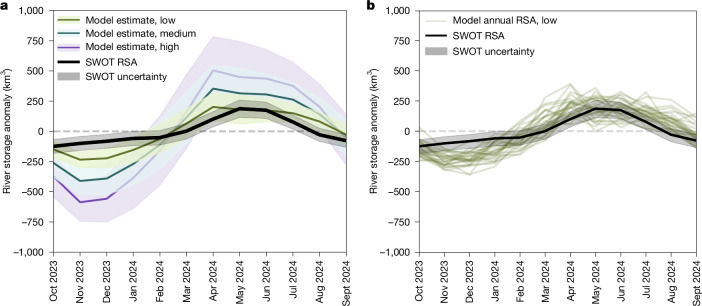 Figure 4
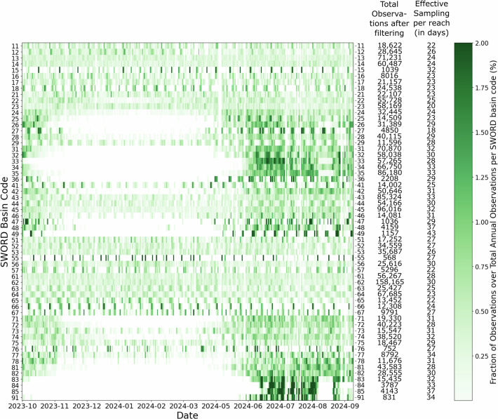 Figure 5
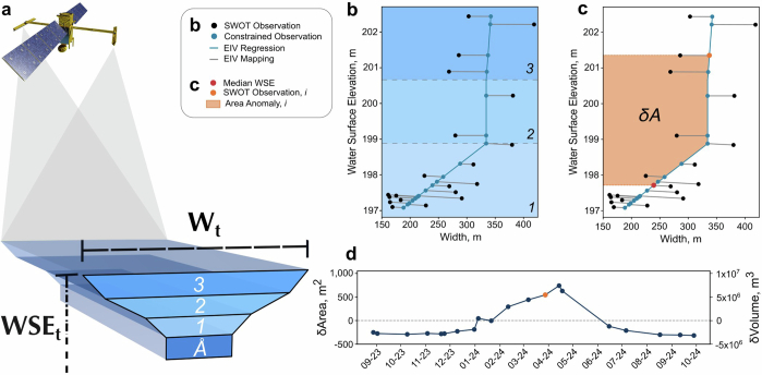 Figure 6
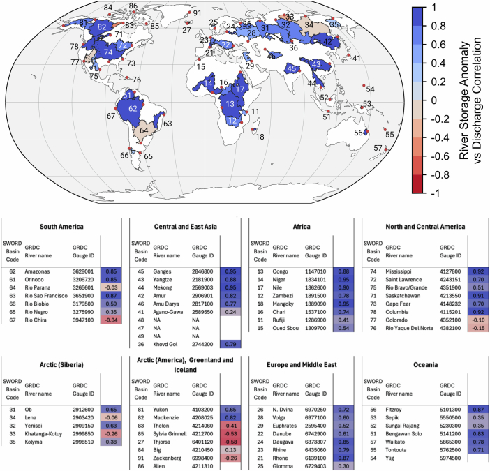 Figure 7
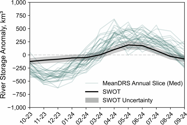 Figure 8
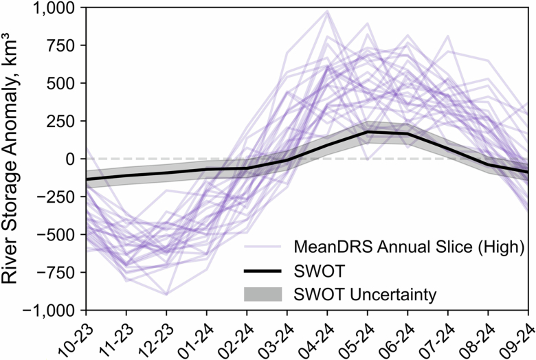 Figure 9
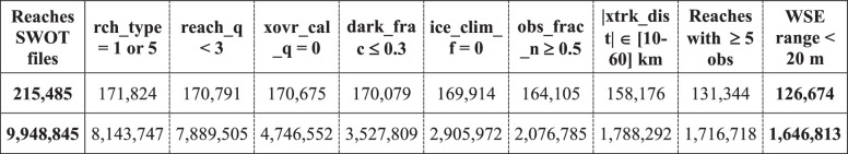 Figure 15
Peer Reviews
No public reviews on file for this paper yet. If you reviewed it on a platform where reviews are public (OpenReview, ICLR, NeurIPS, ICML), you can paste yours below so the community can read it here.
Videos
No videos yet. Explain this paper in a talk, walkthrough, or lecture? Add one.
Taxonomy
TopicsFlood Risk Assessment and Management · Hydrology and Watershed Management Studies · Geophysics and Gravity Measurements