Geolocalization of Unmanned Aerial Vehicle Images and Mapping onto Satellite Images Utilizing 3D Gaussian Splatting
Satoshi Arakawa, Kaiyu Suzuki, Tomofumi Matsuzawa

TL;DR
This paper introduces a new method for geolocalizing UAV images in GPS-denied areas by aligning them with satellite images using 3D Gaussian Splatting.
Contribution
The novel approach uses 3DGS to render images from satellite-like viewpoints and directly match them with satellite images for improved geolocalization.
Findings
The proposed method achieves higher geolocalization accuracy compared to existing image retrieval techniques.
The method enables geographically consistent integration of independently captured 3DGS models.
Pixel-level matching between 3DGS-rendered and satellite images improves alignment accuracy.
Abstract
Geolocalization of images captured by unmanned aerial vehicles (UAVs) remains a significant challenge in Global Navigation Satellite System-denied environments. Although geolocalization is typically achieved by matching UAV images with satellite images, the viewpoint discrepancy between oblique UAV and nadir satellite images complicates this task. In this study, we employ 3D Gaussian Splatting (3DGS) to generate images from viewpoints close to the satellite viewpoint based on multiview UAV images. Assuming that the approximate flight area of the UAV is known, we propose a geolocalization method that directly establishes correspondences between 3DGS-rendered and satellite images using pixel-level image matching. These satellite images, which we refer to as wide-area satellite images, cover a larger area than the UAV observation range. Experimental results demonstrate that the proposed…
Genes, proteins, chemicals, diseases, species, mutations and cell lines named across the full text — each resolved to its canonical identifier and authoritative record.
Click any figure to enlarge with its caption.
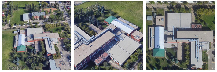 Figure 1
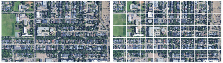 Figure 2
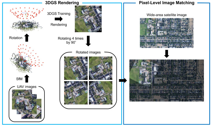 Figure 3
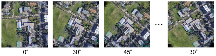 Figure 4
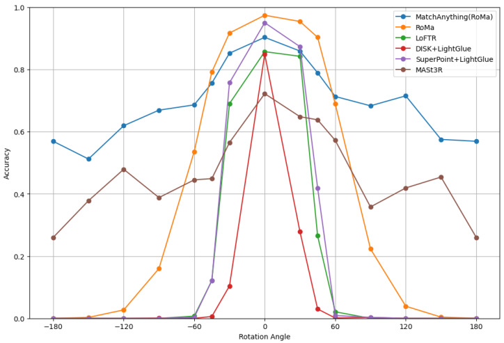 Figure 5
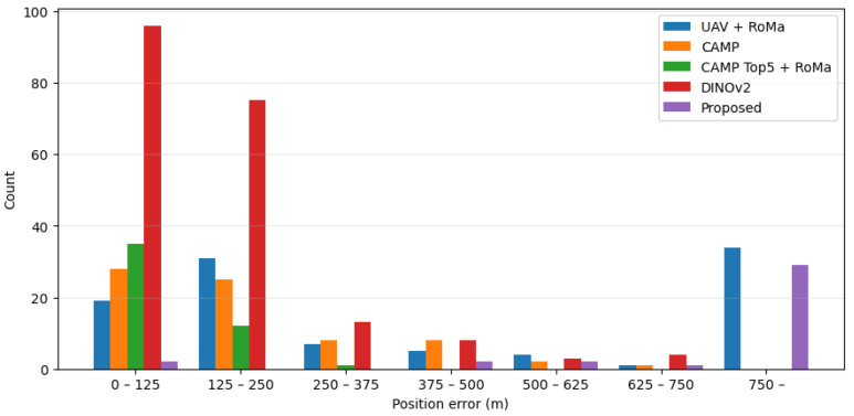 Figure 6
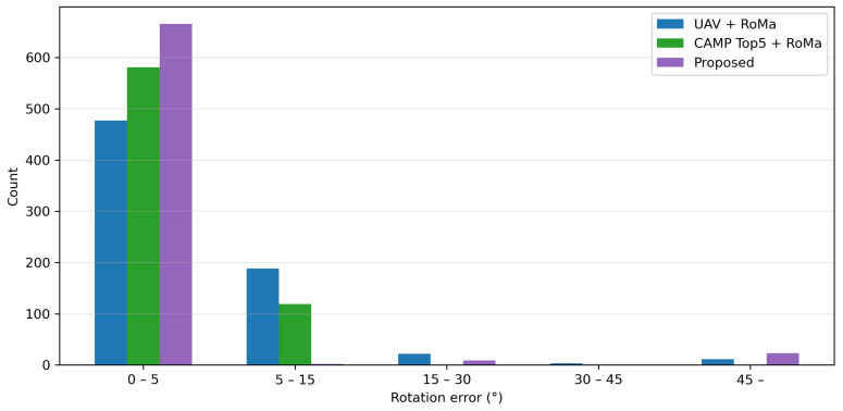 Figure 7
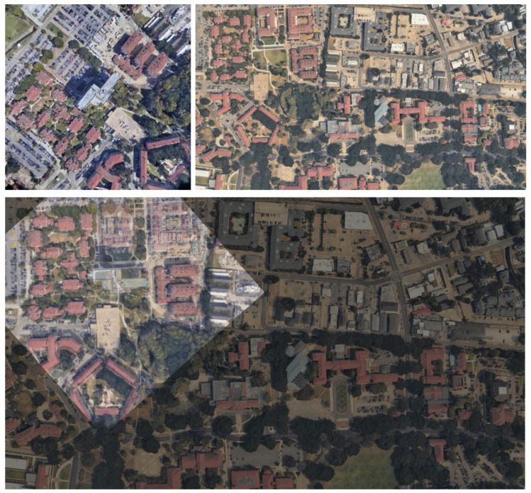 Figure 8
 Figure 9
 Figure 10
 Figure 11
 Figure 12
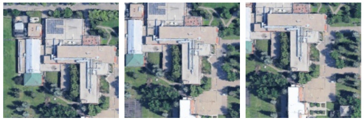 Figure 13
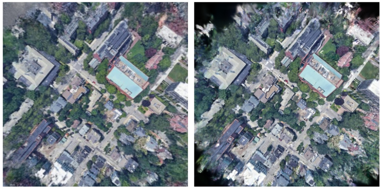 Figure 14
 Figure 15
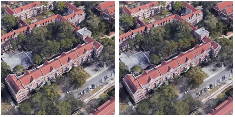 Figure 16
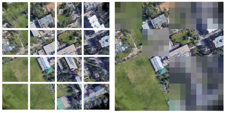 Figure 17
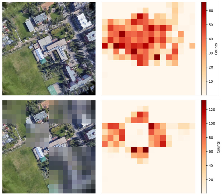 Figure 18
Peer Reviews
No public reviews on file for this paper yet. If you reviewed it on a platform where reviews are public (OpenReview, ICLR, NeurIPS, ICML), you can paste yours below so the community can read it here.
Videos
No videos yet. Explain this paper in a talk, walkthrough, or lecture? Add one.
Taxonomy
TopicsAdvanced Image and Video Retrieval Techniques · UAV Applications and Optimization · Satellite Image Processing and Photogrammetry