Young White Pine Detection Using UAV Imagery and Deep Learning Object Detection Models
Abishek Poudel, Eddie Bevilacqua

TL;DR
This study shows that using drones and deep learning can accurately detect young white pine trees in forests, improving regeneration monitoring.
Contribution
The study introduces a UAV-DL system for efficient and accurate white pine regeneration assessment.
Findings
The Faster R-CNN model achieved an average precision of 0.88 for white pine detection.
Overall accuracy reached 91% and 90% in medium and high-density white pine areas.
UAV-DL systems reduce the need for labor-intensive fieldwork in forest monitoring.
Abstract
This study demonstrates the power of combining unmanned aerial vehicle (UAV) imagery and deep learning (DL) for monitoring forest regeneration, specifically focusing on young white pine (Pinus strobus). Using high-resolution three-band RGB and five-band multispectral orthomosaics derived from UAV flights, 20 DL object-detection models were evaluated within ArcGIS Pro 3.4 software (Esri Inc., Redlands, CA, USA). The models were tested across study sites in St. Lawrence County, NY, to assess performance on three distinct size classes of white pine, each stratified into low, medium, and high density areas. The Faster R-CNN (F-RCNN) model, particularly when trained with image rotation and no augmentation, significantly outperformed others, achieving an average precision of 0.88 across both imagery types. Subsequent confusion matrix analysis yielded 91% and 90% overall accuracy in medium and…
Genes, proteins, chemicals, diseases, species, mutations and cell lines named across the full text — each resolved to its canonical identifier and authoritative record.
Click any figure to enlarge with its caption.
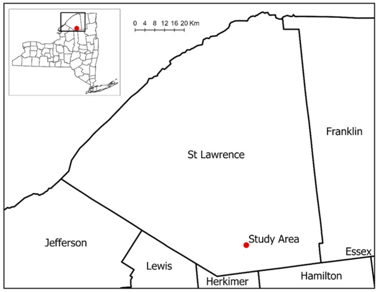 Figure 1
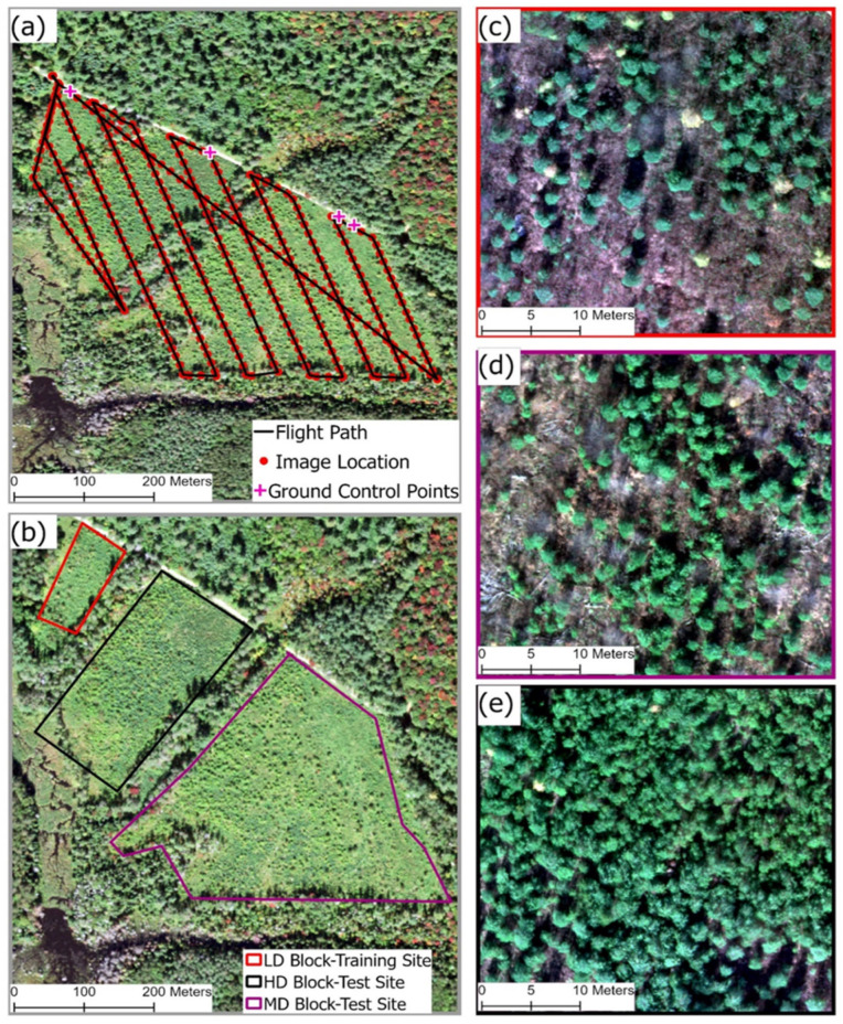 Figure 2
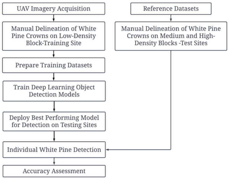 Figure 3
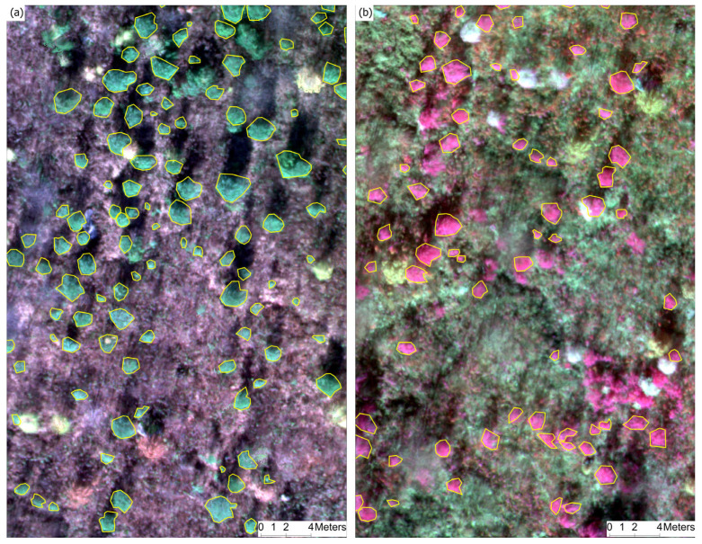 Figure 4
 Figure 5
 Figure 6
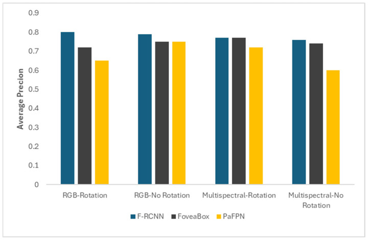 Figure 7
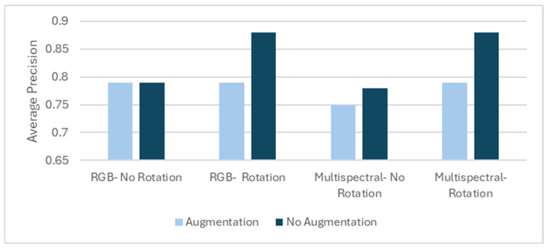 Figure 8
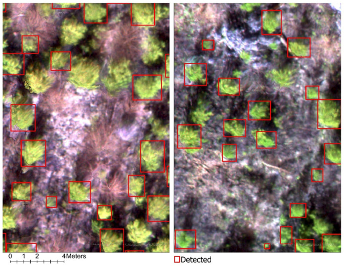 Figure 9
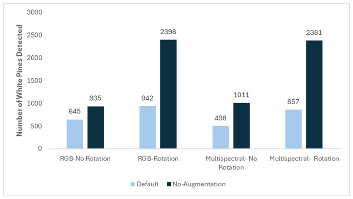 Figure 10
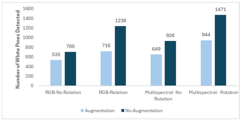 Figure 11
Peer Reviews
No public reviews on file for this paper yet. If you reviewed it on a platform where reviews are public (OpenReview, ICLR, NeurIPS, ICML), you can paste yours below so the community can read it here.
Videos
No videos yet. Explain this paper in a talk, walkthrough, or lecture? Add one.
Taxonomy
TopicsRemote Sensing and LiDAR Applications · Remote Sensing in Agriculture · Remote-Sensing Image Classification