Estimation of Wind Turbine Heights with Shadows Using Gaofen-2 Satellite Imagery
Jiaguo Li, Xinyue Cui, Xingfeng Chen, Hui Gong, Mei Hu, Limin Zhao, Yanping Wang, Kun Liu, Shumin Liu, Yunli Zhang

TL;DR
This paper presents a method to estimate wind turbine heights using satellite imagery and deep learning, which helps monitor turbines after natural disasters.
Contribution
A novel method combining deep learning and spatial geometry for wind turbine height estimation using GF-2 satellite imagery.
Findings
YOLOv5-CBAM and MSASDNet achieved 96% identification accuracy and 82.53% shadow extraction accuracy.
The method achieved an average absolute error of 2.2 m in height estimation.
The technique effectively detects post-disaster status of wind turbines.
Abstract
Using high-resolution remote sensing imagery to obtain the wind turbine height is a fast and effective method for monitoring the status of wind turbines after natural disasters such as earthquakes, landslides, and typhoons. A height estimation method tailored for wind turbines is proposed using high-resolution satellite images. First, deep learning techniques are employed to identify wind turbines and extract their shadow information from GaoFen-2 (GF-2) satellite imagery. Specifically, YOLOv5-CBAM and MSASDNet are used for target recognition and shadow extraction, achieving an identification accuracy of 96% and a shadow extraction accuracy of 82.53%. Next, the line-by-line scanning method is applied to remove blade shadow from the whole wind turbine shadow. By calculating the number of pixels occupied by the shadow length of the wind turbine after removing the blade shadow and…
Genes, proteins, chemicals, diseases, species, mutations and cell lines named across the full text — each resolved to its canonical identifier and authoritative record.
Click any figure to enlarge with its caption.
 Figure 1
 Figure 2
 Figure 3
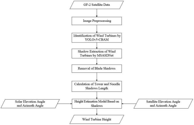 Figure 4
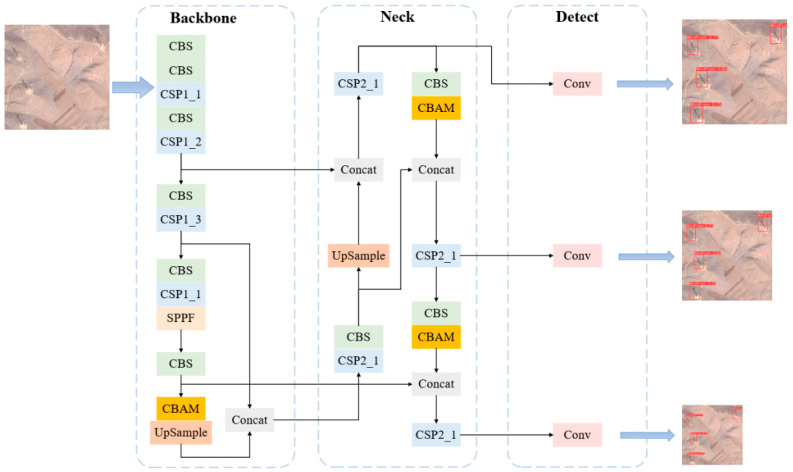 Figure 5
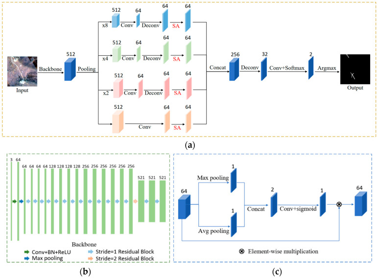 Figure 6
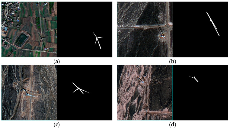 Figure 7
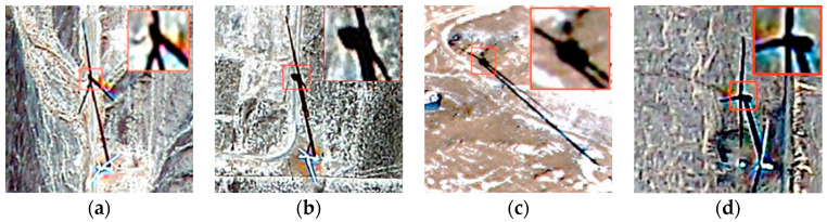 Figure 8
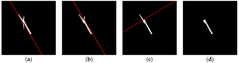 Figure 9
 Figure 10
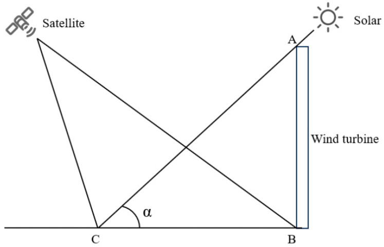 Figure 11
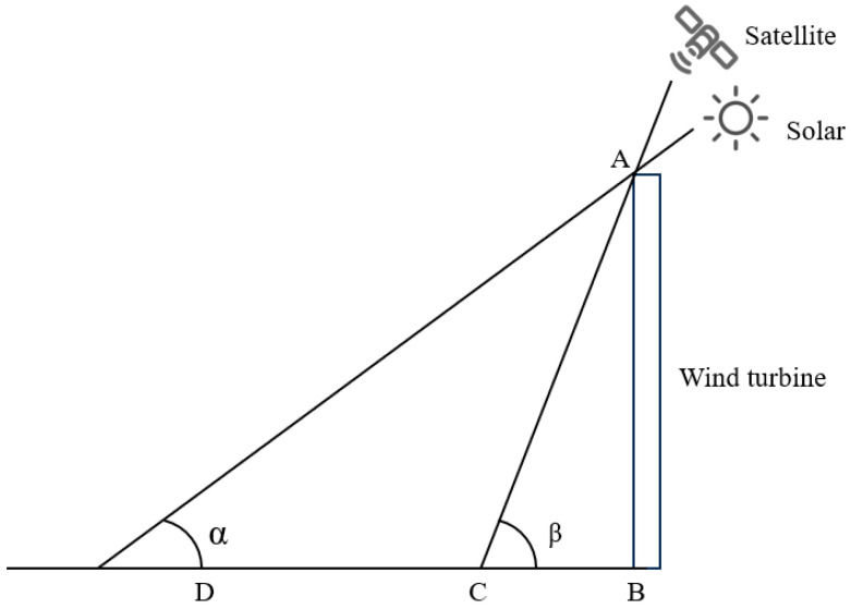 Figure 12
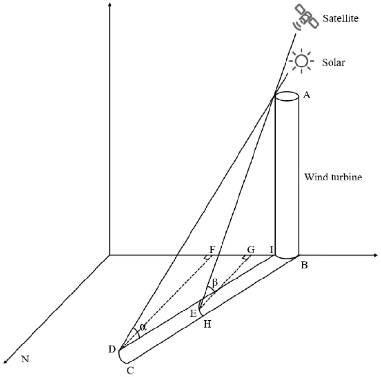 Figure 13
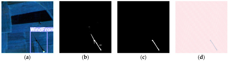 Figure 14
Peer Reviews
No public reviews on file for this paper yet. If you reviewed it on a platform where reviews are public (OpenReview, ICLR, NeurIPS, ICML), you can paste yours below so the community can read it here.
Videos
No videos yet. Explain this paper in a talk, walkthrough, or lecture? Add one.
Taxonomy
TopicsWind Energy Research and Development · Remote Sensing and LiDAR Applications · Synthetic Aperture Radar (SAR) Applications and Techniques