Two Decades of Land Subsidence in Tianjin, China, Measured with Multi-Temporal InSAR Observations
Haolin Zhao, Hongyue Zhou, Dashan Zhou, Chaoying Zhao

TL;DR
This study tracks 20 years of land subsidence in Tianjin, China, using satellite data to show how subsidence patterns shifted over time due to groundwater use and urban development.
Contribution
The study provides a long-term spatiotemporal analysis of land subsidence in Tianjin using multi-source SAR data and a model-based time-series fitting approach.
Findings
Subsidence rates in inland districts like Wuqing and Beichen exceeded 50 mm/yr from 2003–2010.
After 2017, subsidence shifted to localized areas in the Binhai New Area, especially near Dongjiang Port and Fuzhuang.
Subsidence patterns correlate with groundwater use and urban construction phases.
Abstract
Land subsidence poses a persistent challenge to Tianjin, a major coastal city in China, with implications for urban infrastructure and sustainable development. This study examines the spatiotemporal evolution of ground subsidence in Tianjin from 2003 to 2024 using multi-source SAR observations from Envisat ASAR (C-band), ALOS PALSAR (L-band), and Sentinel-1 (C-band). Surface deformation was derived using SBAS-InSAR with atmospheric phase correction. Due to limitations in data availability, SAR observations are temporally discontinuous; therefore, the long-term subsidence evolution was reconstructed by integrating multi-sensor deformation rates through a model-based time-series fitting approach. The results show pronounced subsidence during 2003–2010 in inland districts such as Wuqing, Beichen, Jinnan, and Jinghai, with maximum rates exceeding 50 mm/yr. After 2017, regional subsidence…
Genes, proteins, chemicals, diseases, species, mutations and cell lines named across the full text — each resolved to its canonical identifier and authoritative record.
Click any figure to enlarge with its caption.
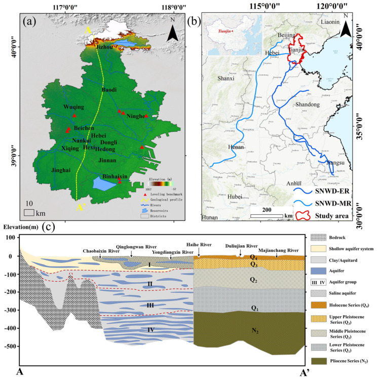 Figure 1
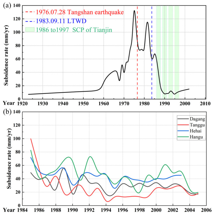 Figure 2
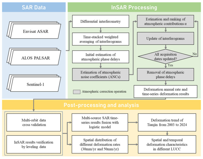 Figure 3
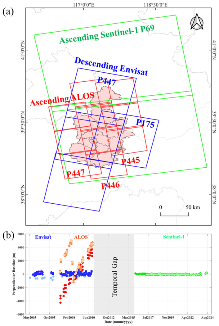 Figure 4
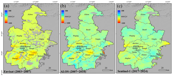 Figure 5
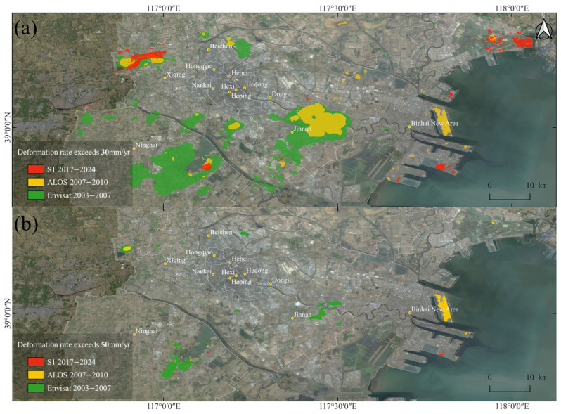 Figure 6
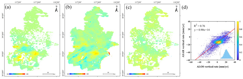 Figure 7
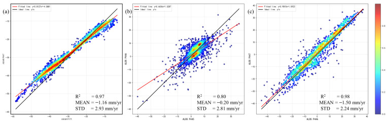 Figure 8
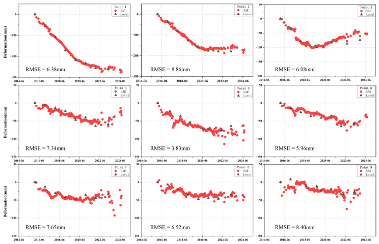 Figure 9
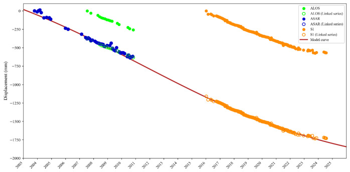 Figure 10
 Figure 11
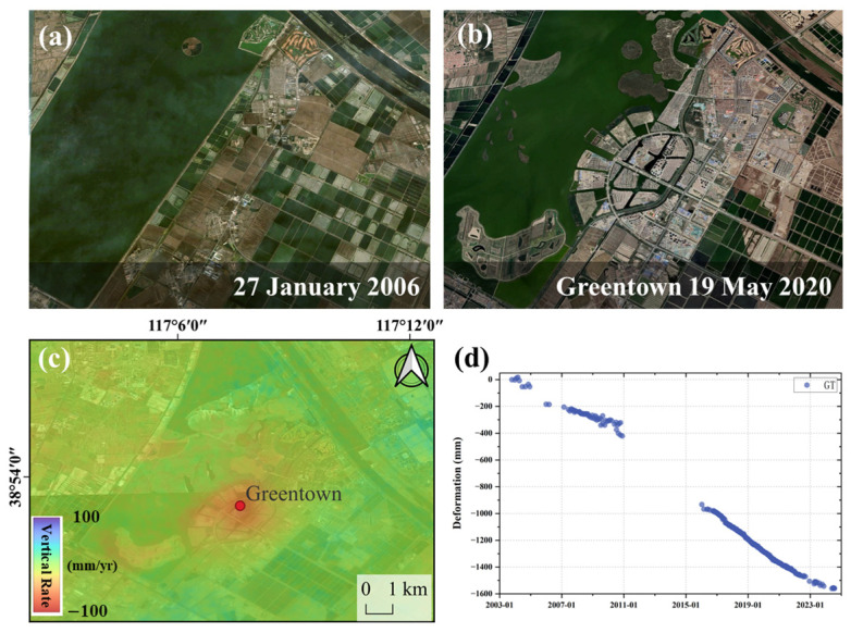 Figure 12
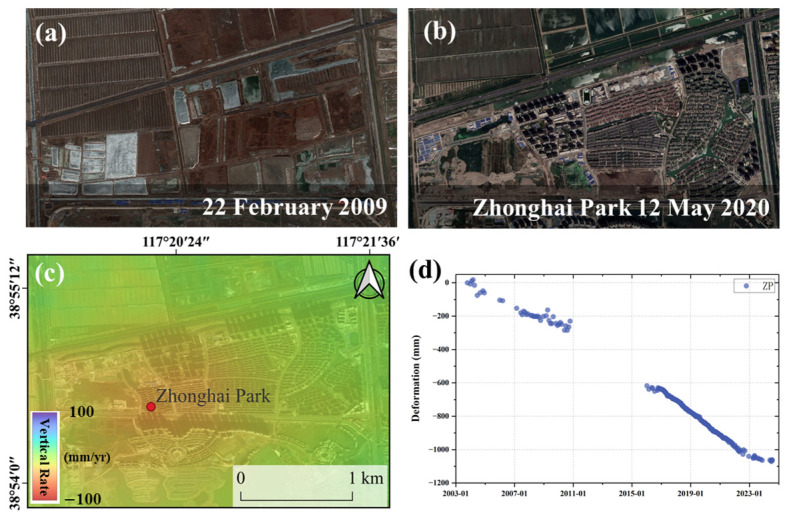 Figure 13
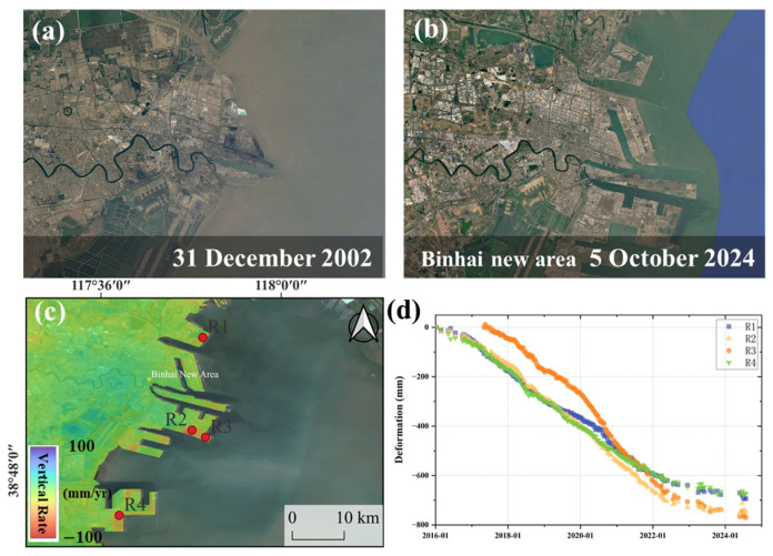 Figure 14
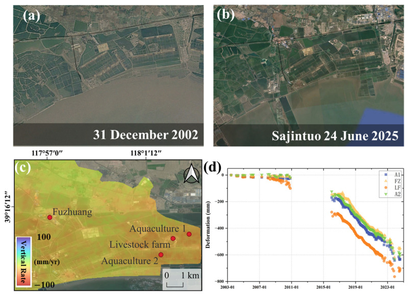 Figure 15
Peer Reviews
No public reviews on file for this paper yet. If you reviewed it on a platform where reviews are public (OpenReview, ICLR, NeurIPS, ICML), you can paste yours below so the community can read it here.
Videos
No videos yet. Explain this paper in a talk, walkthrough, or lecture? Add one.
Taxonomy
TopicsSynthetic Aperture Radar (SAR) Applications and Techniques · Groundwater and Watershed Analysis · Karst Systems and Hydrogeology