Digitalization and Automation of Runway Inspection Using Unmanned Aerial Vehicles
Marios Krestenitis, Alexandros Petropoulos, Ilias Koulalis, Irina Stipanovic, Sandra Skaric Palic, Konstantinos Ioannidis, Stefanos Vrochidis

TL;DR
This paper introduces a system using drones and AI to automatically inspect and assess runway conditions, offering a digital alternative to manual checks.
Contribution
The novel contribution is an end-to-end framework combining UAV imagery, deep learning, and GIS for automated runway inspection.
Findings
The system successfully detects and maps multiple defect types across the full runway.
A georeferenced condition map was produced, supporting maintenance prioritization.
Validation at Zadar Airport demonstrated the system's scalability and practicality.
Abstract
This paper presents an end-to-end framework for automated inspection and condition assessment of airport runway pavement using UAV-acquired imagery. The proposed approach integrates Unmanned Aerial Vehicle (UAV)-based data collection, deep learning-based pixel-level semantic segmentation of surface defects, and Geographic Information System (GIS)-based spatial aggregation to generate a georeferenced digital representation of airfield pavement condition. Multiple safety-critical defect types are detected and localized at pixel resolution, while spatially referenced processing enables a Pavement Condition Index (PCI)-inspired condition assessment based on defect density within predefined sampling units. The framework is validated through a real-world case study at Zadar Airport, where the entire runway was surveyed using high-resolution UAV imagery. The results demonstrate the system’s…
Genes, proteins, chemicals, diseases, species, mutations and cell lines named across the full text — each resolved to its canonical identifier and authoritative record.
Click any figure to enlarge with its caption.
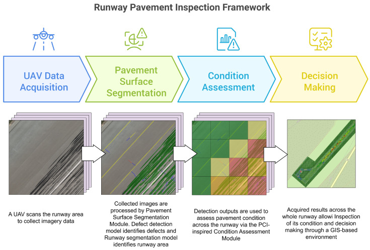 Figure 1
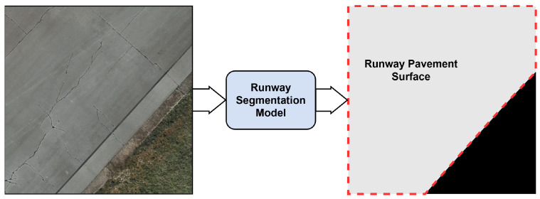 Figure 2
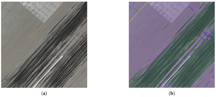 Figure 3
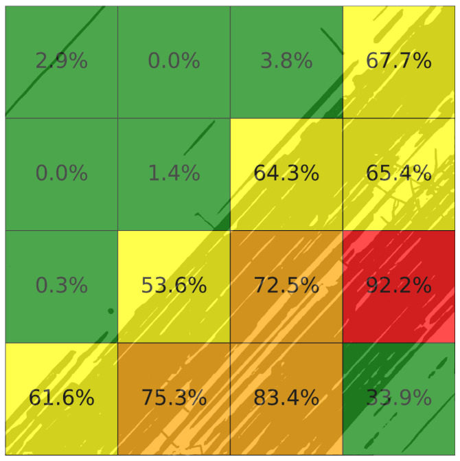 Figure 4
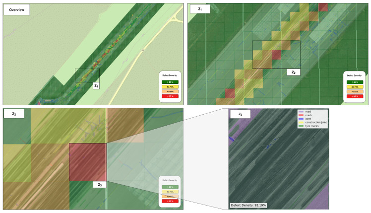 Figure 5
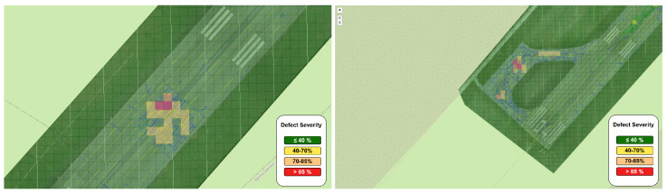 Figure 6
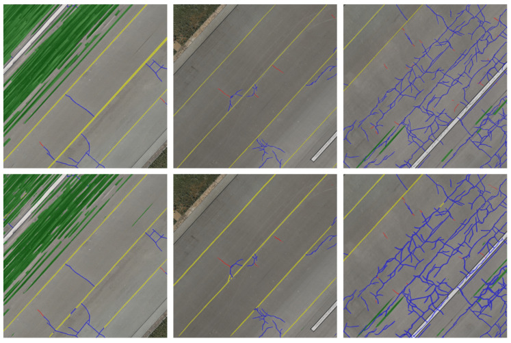 Figure 7
Peer Reviews
No public reviews on file for this paper yet. If you reviewed it on a platform where reviews are public (OpenReview, ICLR, NeurIPS, ICML), you can paste yours below so the community can read it here.
Videos
No videos yet. Explain this paper in a talk, walkthrough, or lecture? Add one.
Taxonomy
TopicsInfrastructure Maintenance and Monitoring · 3D Surveying and Cultural Heritage · Asphalt Pavement Performance Evaluation