Europe-wide maps of biomass density based on satellite remote sensing data for 2017, 2020, 2021 and 2023
Maurizio Santoro, Oliver Cartus, Arnan Araza, Martin Herold, Jukka Miettinen, Ake Rosenqvist, Kazufumi Kobayashi, Takeo Tadono, Frank Martin Seifert

TL;DR
This paper presents detailed maps of forest biomass in Europe using satellite data from 2017 to 2023, providing insights into forest structure and changes over time.
Contribution
The study provides the first Europe-wide annual maps of forest biomass variables using Sentinel-1 and ALOS-2 SAR data with a consistent processing chain.
Findings
Maps of Growing Stock Volume, Aboveground Biomass, and Belowground Biomass were generated at 20 m resolution for multiple years.
Validation showed poor pixel-level accuracy but improved results at larger spatial scales like administrative units.
Inter-annual consistency was affected by the number of satellite observations per year.
Abstract
Spatially explicit information on forest structure and biomass is needed to meet the monitoring and reporting requirements of several European policies. Satellite images enable mapping and monitoring of the Europe’s forest resources through operational observations from the Sentinel-1 Synthetic Aperture Radar (SAR) and the Advanced Land Observing Satellite 2 (ALOS-2) Phased Array l-band SAR 2 (PALSAR-2) instruments. Data acquired in 2017, 2020, 2021 and 2023 were used to generate annual maps of forest biomass variables, namely Growing Stock Volume (GSV), Aboveground Biomass (AGB) and Belowground Biomass (BGB), with a pixel size of 20 m × 20 m. All products are in the geometry of the Sentinel-2 tiling system. A spatially averaged map with a pixel size of 100 m × 100 m (1 hectare) in geographic projection is also supplied, for users who do not require the highest spatial resolution. The…
Genes, proteins, chemicals, diseases, species, mutations and cell lines named across the full text — each resolved to its canonical identifier and authoritative record.
Click any figure to enlarge with its caption.
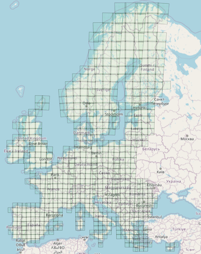 Figure 1
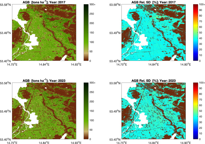 Figure 2
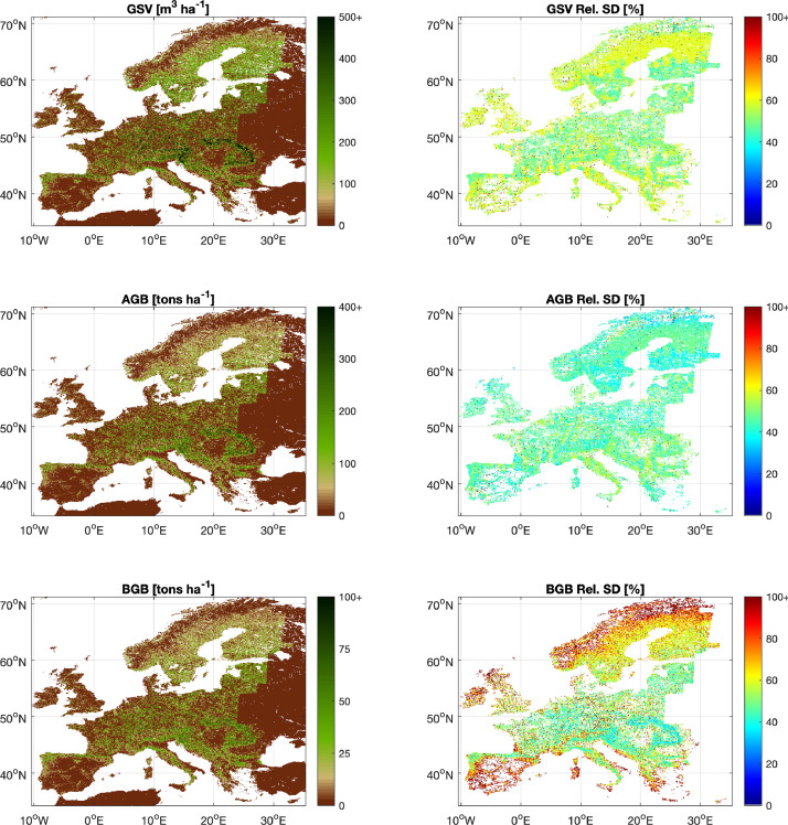 Figure 3
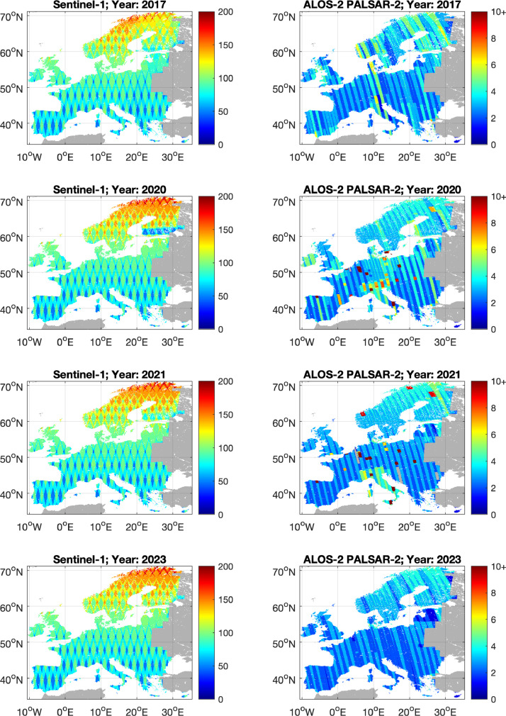 Figure 4
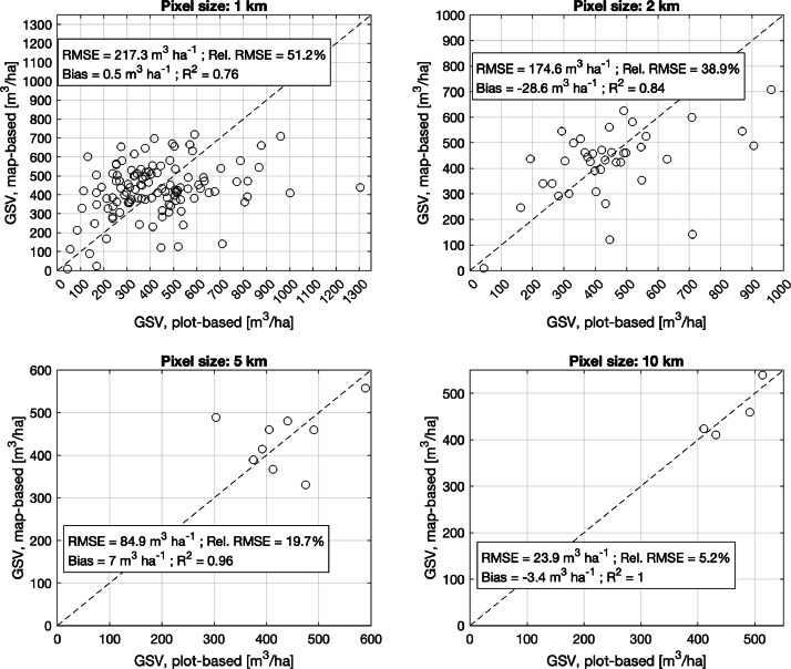 Figure 5
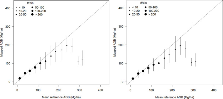 Figure 6
 Figure 7
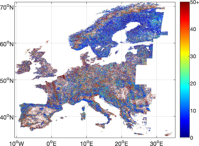 Figure 8
Peer Reviews
No public reviews on file for this paper yet. If you reviewed it on a platform where reviews are public (OpenReview, ICLR, NeurIPS, ICML), you can paste yours below so the community can read it here.
Videos
No videos yet. Explain this paper in a talk, walkthrough, or lecture? Add one.
Taxonomy
TopicsRemote Sensing in Agriculture · Synthetic Aperture Radar (SAR) Applications and Techniques · Remote Sensing and LiDAR Applications