Vulcano island: the new high resolution digital surface model post 2021-2022 volcanic unrest
Marina Bisson, Roberto Gianardi, Francesca Iacono, Paolo Madonia, Gianfilippo De Astis, Claudia Spinetti

TL;DR
A high-resolution 3D model of Vulcano island was created using Airborne Lidar to study changes after a volcanic crisis.
Contribution
A new high-resolution digital surface model of Vulcano island with 50 cm spatial resolution and 8 cm vertical accuracy is presented.
Findings
An Airborne Lidar survey produced over 200 million 3D points for the island's digital surface model.
The model achieved a vertical accuracy of 8 cm and spatial resolution of 50 cm.
The model supports detailed geomorphological studies and natural hazard assessments.
Abstract
During the years 2021-2022 Vulcano island was affected by a volcanic crisis characterized by a remarkable increase in fumarolic activity, intensified seismicity and ground deformations. With the aim of reproducing with high detail the island surface after this crisis, an Airborne Lidar survey was carried out on 4th August 2023. More than 200 × 106 3D Lidar points were processed to create a new Digital Surface Model at a very high spatial resolution (50 cm). This model reproduces the elevation surface of all natural and anthropic elements constituting the island. The model was validated through a set of Ground Control Points and a vertical accuracy of 8 cm was obtained. This level of accuracy, combined with the spatial resolution of 50 cm, makes the model particularly suitable for detailed geomorphological investigations. In addition, associated with the derived coastline, it provides…
Genes, proteins, chemicals, diseases, species, mutations and cell lines named across the full text — each resolved to its canonical identifier and authoritative record.
Click any figure to enlarge with its caption.
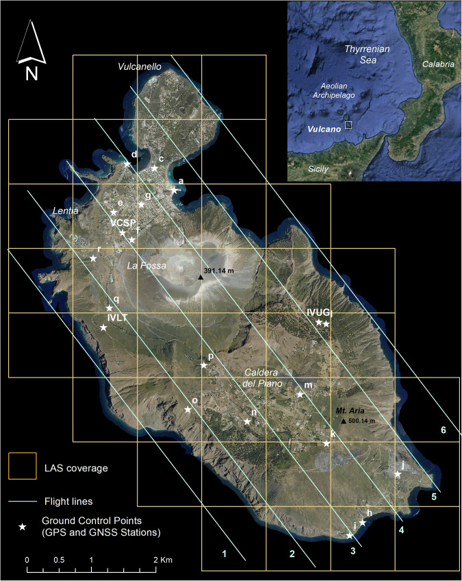 Figure 1
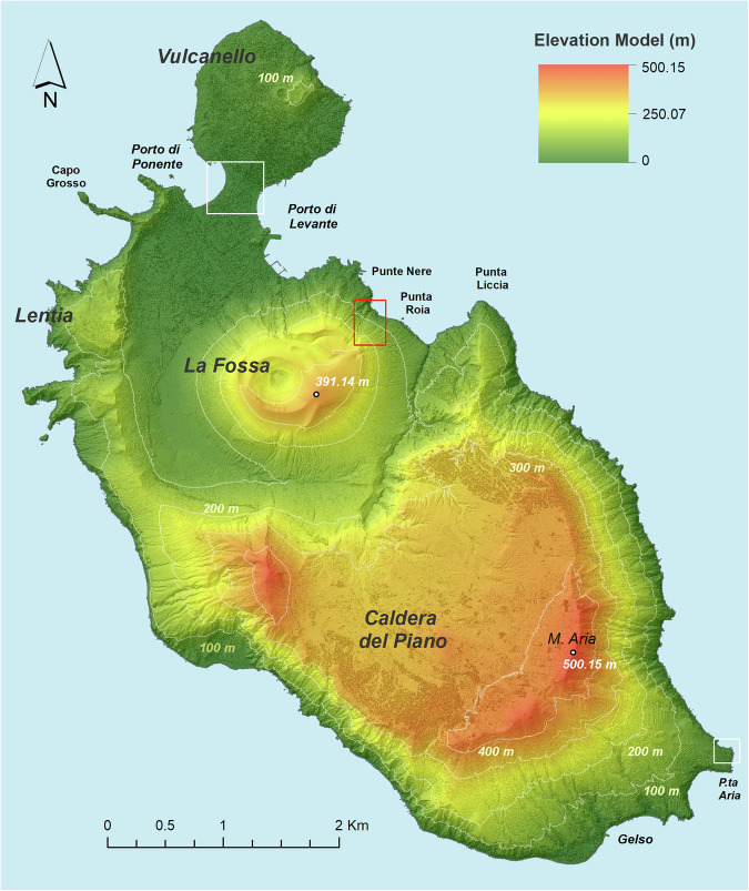 Figure 2
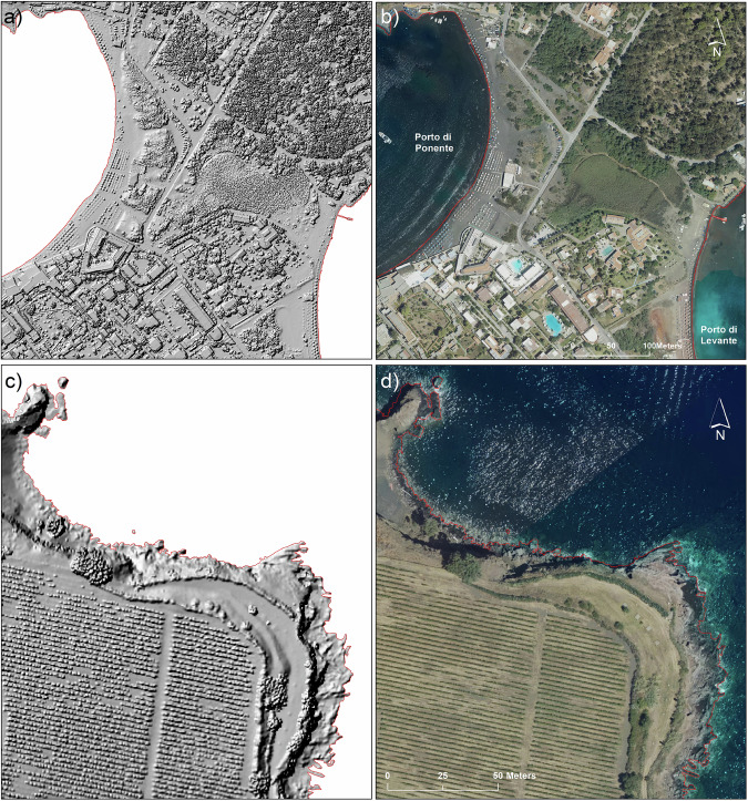 Figure 3
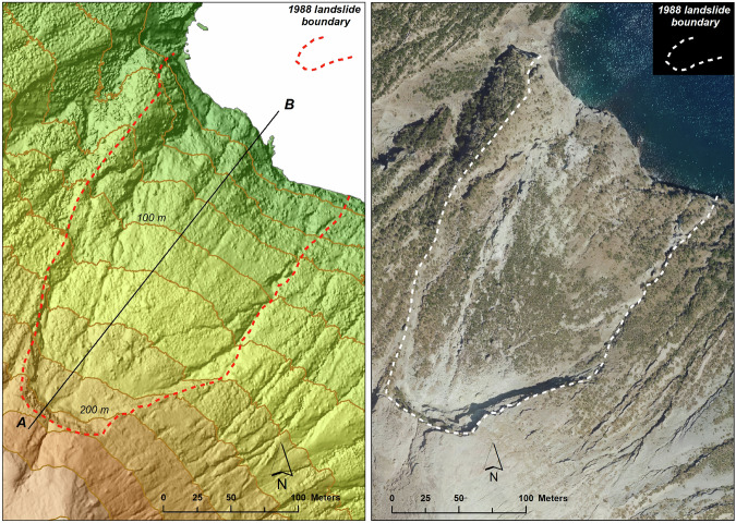 Figure 4
 Figure 5
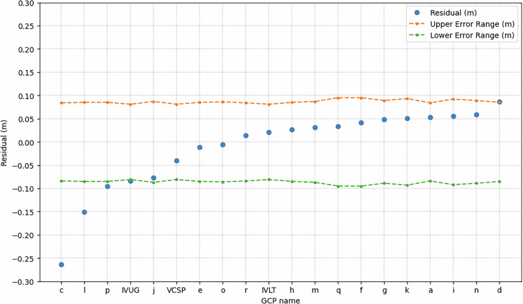 Figure 6
Peer Reviews
No public reviews on file for this paper yet. If you reviewed it on a platform where reviews are public (OpenReview, ICLR, NeurIPS, ICML), you can paste yours below so the community can read it here.
Videos
No videos yet. Explain this paper in a talk, walkthrough, or lecture? Add one.
Taxonomy
TopicsSynthetic Aperture Radar (SAR) Applications and Techniques · Remote Sensing and LiDAR Applications · 3D Surveying and Cultural Heritage