A systematic map of methods for assessing societal benefits of Earth science information
Casey C. O’Hara, Mabel Baez-Schon, Rebecca Chaplin-Kramer, Samantha H. Cheng, Alejandra Echeverri, Gillian L. Galford, Rachelle K. Gould, Cristina L. Mancilla, Maura C. Muldoon, Gerald G. Singh, Priscilla Baltezar, Yusuke Kuwayama, Stephen Polasky, Amanda D. Rodewald

TL;DR
This paper maps methods used to assess how Earth science information benefits society, highlighting diverse approaches and the need for better quantification of these benefits.
Contribution
A systematic mapping of valuation methods for Earth science information's societal benefits, revealing methodological diversity and gaps.
Findings
Most studies use decision analysis methods to assess quantitative instrumental values like profit and crop yield.
Fewer studies capture qualitative and relational values like empowerment and justice through preference elicitation.
Many studies focus on agriculture, and there is a need for more systematic valuation approaches to align science with societal goals.
Abstract
Earth science information (ESI) from satellites and other remote sensing technologies is critical for managing climate, agriculture, disasters, and more. Yet the societal value of ESI, how it improves real-world decisions and outcomes, remains poorly understood. We systematically map studies that quantify this value, revealing how different methods capture diverse benefits, from economic efficiency and lives saved to empowerment and justice. Our findings demonstrate that a rich array of methods exists to assess societal benefits of ESI across many decision contexts, identifying benefits in terms of instrumental and relational values. This synthesis expands the evidence base for why ESI matters and how it can help guide future investments, promote public support, and align Earth science with societal goals. Remotely sensed Earth science information (ESI) has become increasingly central…
Genes, proteins, chemicals, diseases, species, mutations and cell lines named across the full text — each resolved to its canonical identifier and authoritative record.
Click any figure to enlarge with its caption.
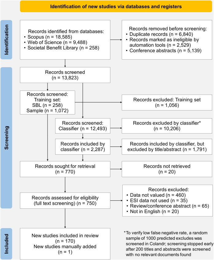 Figure 1
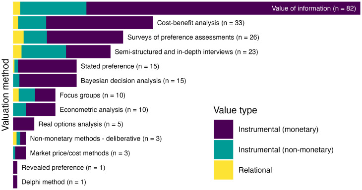 Figure 2
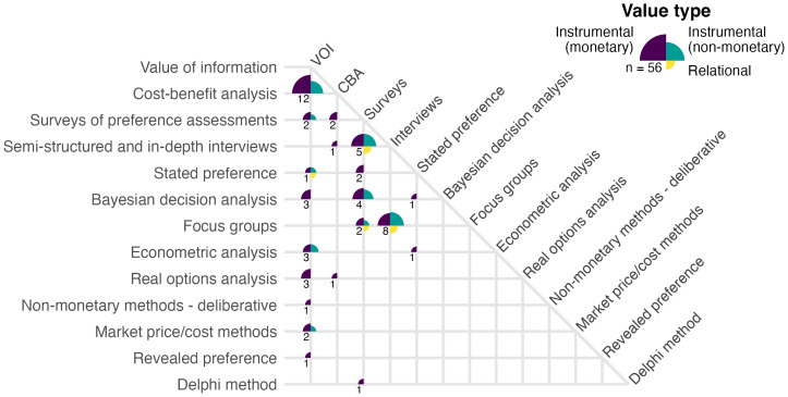 Figure 3
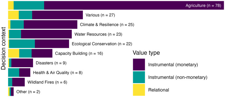 Figure 4
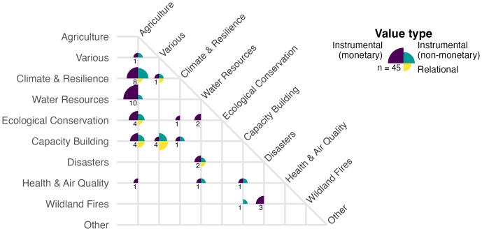 Figure 5
Peer Reviews
No public reviews on file for this paper yet. If you reviewed it on a platform where reviews are public (OpenReview, ICLR, NeurIPS, ICML), you can paste yours below so the community can read it here.
Videos
No videos yet. Explain this paper in a talk, walkthrough, or lecture? Add one.
Taxonomy
TopicsCoastal and Marine Management · Geographic Information Systems Studies · Space Science and Extraterrestrial Life