The African Transport Systems Database - a geospatial database of multi-modal connected networks
Silvia Colombo, Raghav Pant, Marcus Young, Fred Thomas, Tom Russell, Jasper Verschuur, Jim W. Hall

TL;DR
The paper introduces a detailed geospatial transport database for Africa covering roads, railways, airports, ports, and waterways.
Contribution
The novel contribution is the first continent-wide standardized multi-modal transport database for Africa.
Findings
The database includes 234 airports, 179 maritime ports, and extensive road and rail networks.
AfTS-Db supports transport planning and resilience assessments across Africa.
The data is expected to aid environmental and economic studies.
Abstract
We present the first comprehensive geolocated multi-modal transport database for the whole continent of Africa, the African Transport Systems Database (AfTS-Db), including road, rail, aviation, maritime and inland waterway networks. To do so, we created and standardized asset and network data across all transport modes, including inter-modal connections, attributes of road and rail corridors and estimated annual statistics for airports and ports. The African Transport Systems Database includes 234 airports including their airline routes, 179 maritime ports and their connections with each other, 132 inland ports and docking sites with river and lake connections, 4,412 railway stations connected across 99,373 kilometers of rail lines, and 1,004,512 kilometers of roads mainly comprised of all motorways, trunk roads, primary and secondary routes across Africa and some local roads that…
Genes, proteins, chemicals, diseases, species, mutations and cell lines named across the full text — each resolved to its canonical identifier and authoritative record.
Click any figure to enlarge with its caption.
 Figure 10
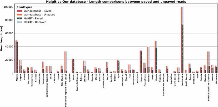 Figure 11
 Figure 1
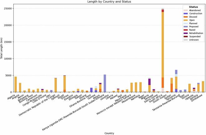 Figure 2
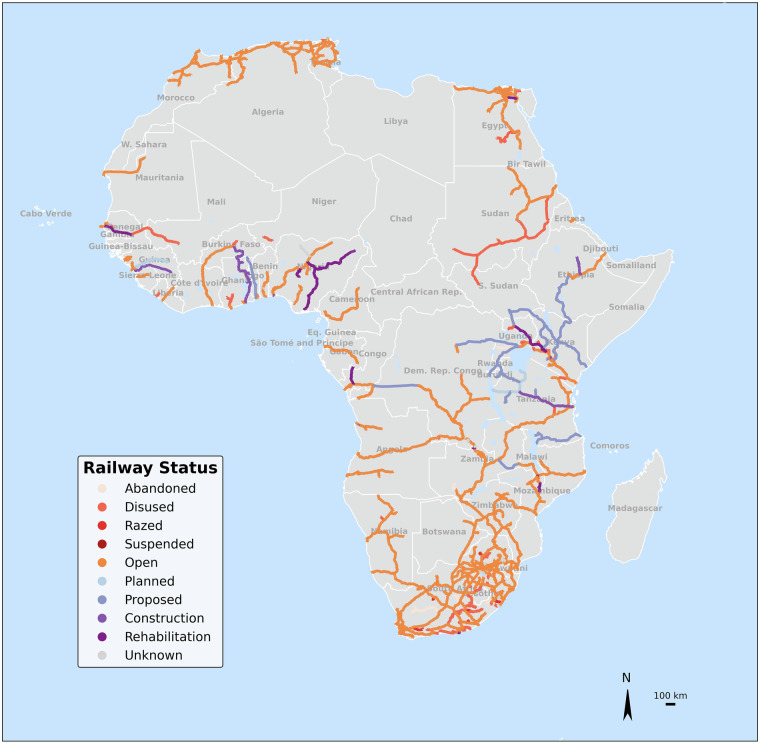 Figure 3
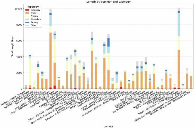 Figure 4
 Figure 5
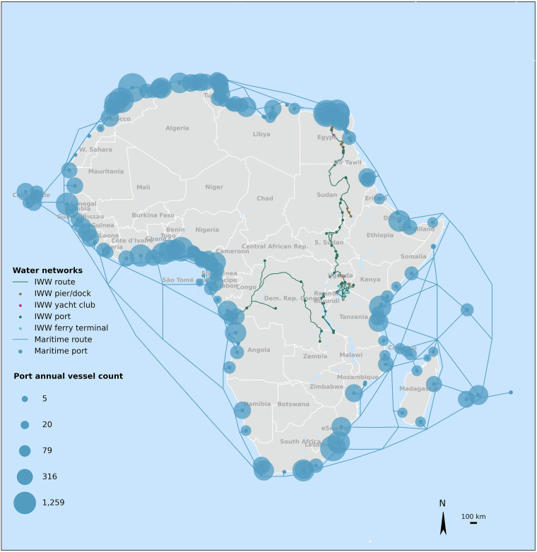 Figure 6
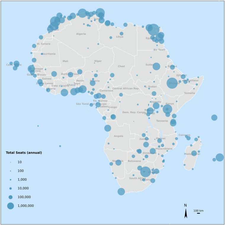 Figure 7
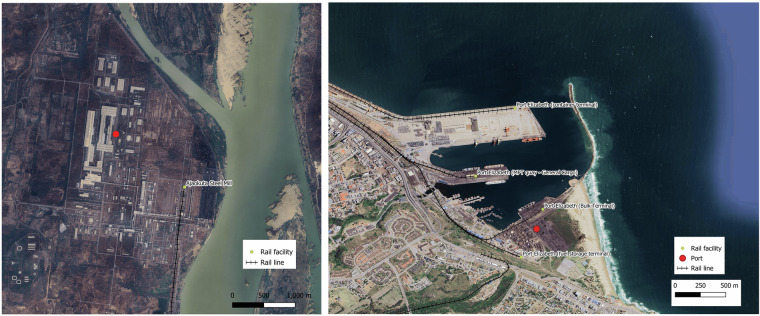 Figure 8
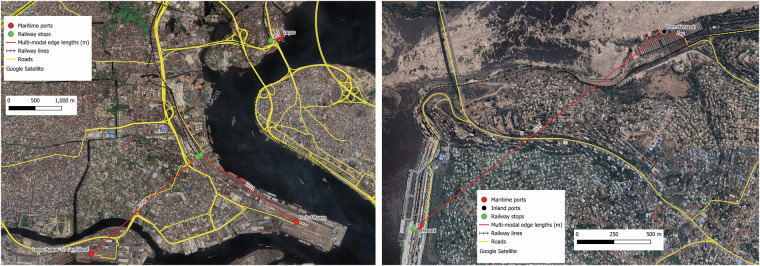 Figure 9
Peer Reviews
No public reviews on file for this paper yet. If you reviewed it on a platform where reviews are public (OpenReview, ICLR, NeurIPS, ICML), you can paste yours below so the community can read it here.
Videos
No videos yet. Explain this paper in a talk, walkthrough, or lecture? Add one.
Taxonomy
TopicsInfrastructure Resilience and Vulnerability Analysis · Urban Transport and Accessibility · Human Mobility and Location-Based Analysis