GNSS evaluation of GRACE-assimilated water storage models over 89 river basins worldwide
Majid Abbaszadeh, Tonie van Dam

TL;DR
This study compares two water storage models using GNSS data to evaluate their accuracy in predicting water storage changes across 89 river basins worldwide.
Contribution
The paper introduces a novel evaluation method using GNSS data to assess GRACE-assimilated hydrological models globally.
Findings
CLSM-DA shows better agreement with GNSS data in regions like Africa and Southeast Asia.
Both models struggle during extreme events like droughts, highlighting their limitations.
Phase delays in CLSM-DA improve alignment with GNSS in some regions.
Abstract
The gravity recovery and climate experiment (GRACE) and GRACE follow-on (GFO) gravity observations have significantly improved our understanding of the terrestrial water cycle. However, GRACE-assimilated (GA) hydrological models still differ significantly. This paper uses global navigation satellite system (GNSS) data to assess two global GA datasets: Global land water storage release 2 (GLWS2.0) and catchment land surface model GRACE data assimilation (CLSM-DA). From 2004 to 2019, the mean annual amplitude of equivalent water thickness (EWT) of these datasets differs by more than 25 mm over 40% of the modeled land area, and the timing of peak water storage diverges by as much as 30-days across 50% of their domain. We compare the modeled hydrological loading vertical displacement predicted from these models with GNSS uplift data to compare and contrast the model quality. Using river…
Genes, proteins, chemicals, diseases, species, mutations and cell lines named across the full text — each resolved to its canonical identifier and authoritative record.
Click any figure to enlarge with its caption.
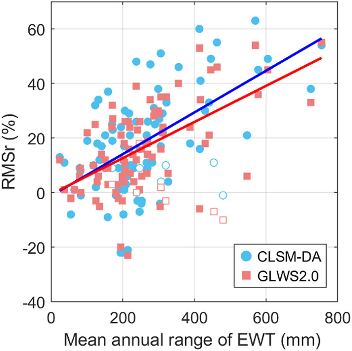 Figure 10
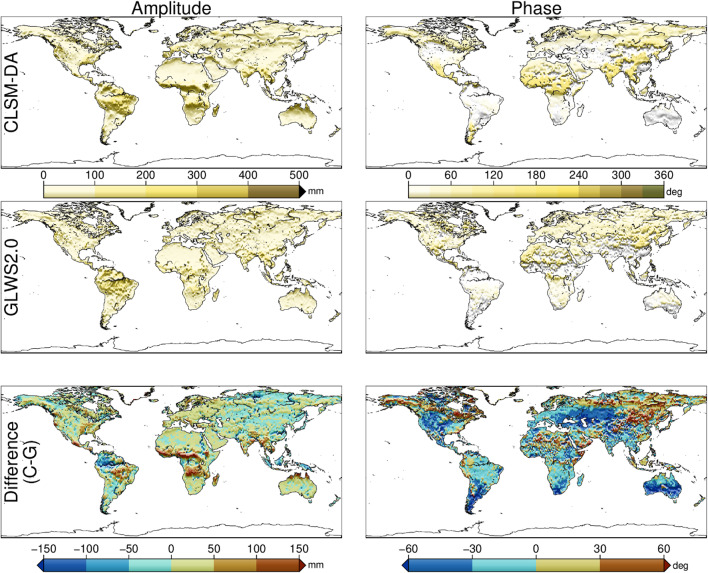 Figure 1
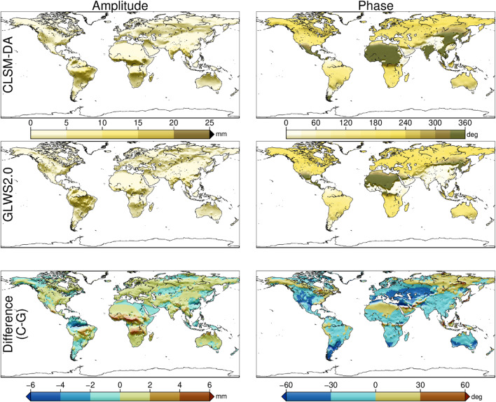 Figure 2
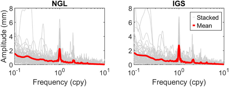 Figure 3
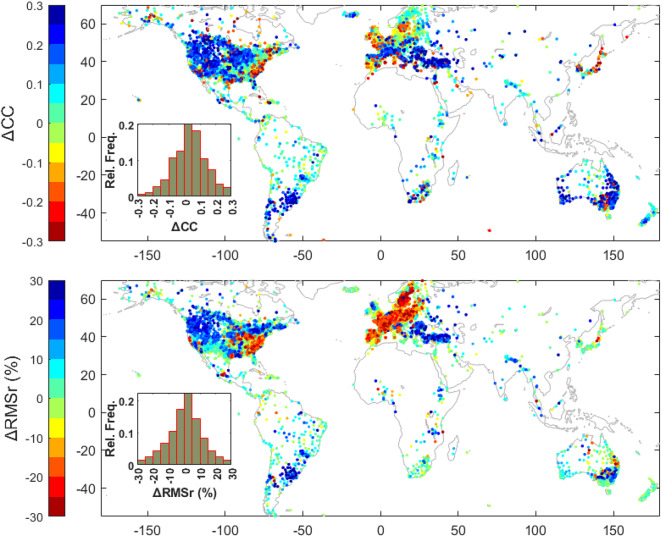 Figure 4
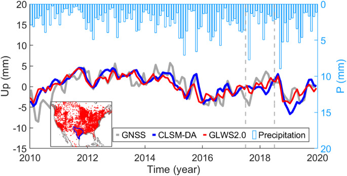 Figure 5
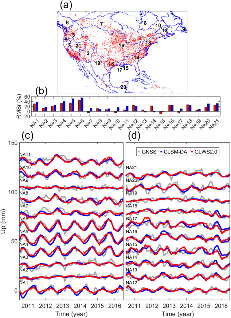 Figure 6
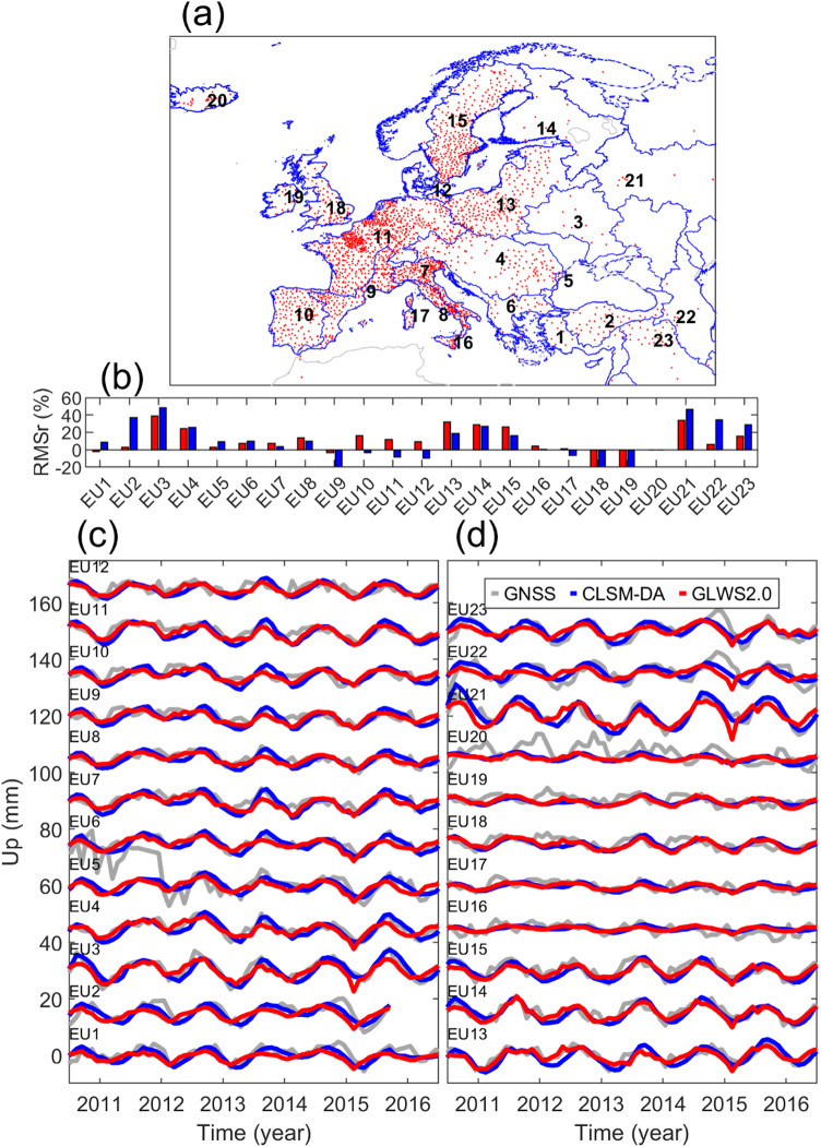 Figure 7
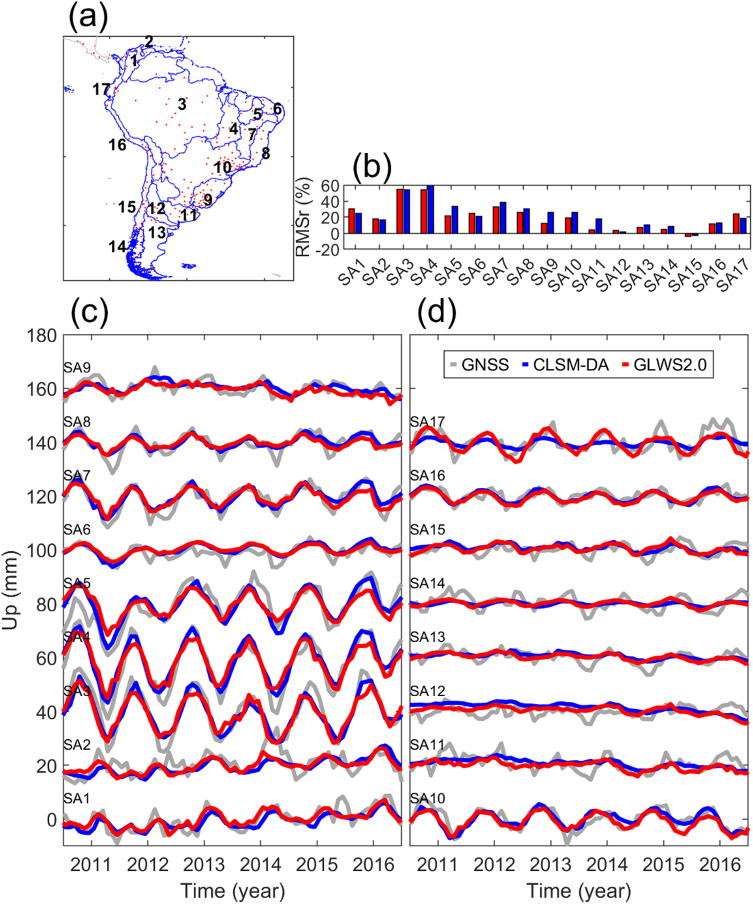 Figure 8
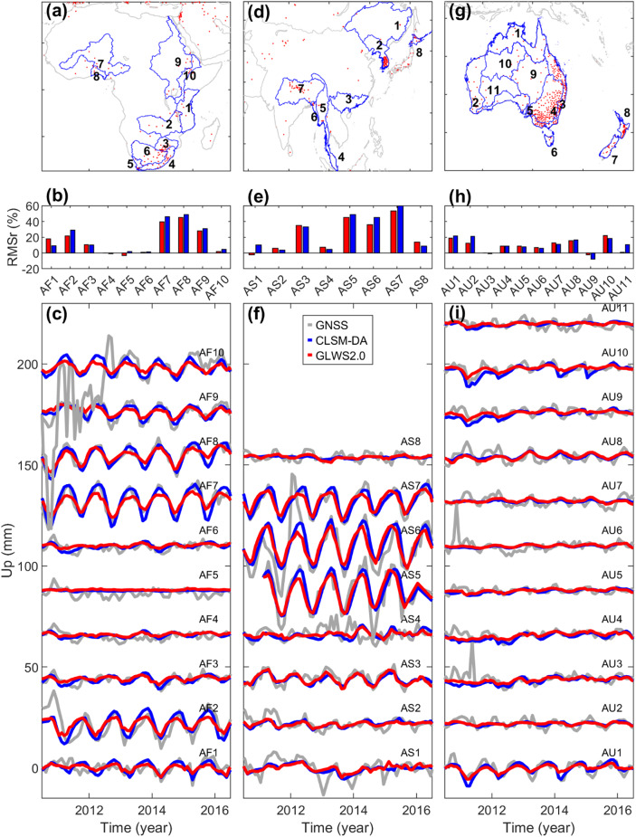 Figure 9
Peer Reviews
No public reviews on file for this paper yet. If you reviewed it on a platform where reviews are public (OpenReview, ICLR, NeurIPS, ICML), you can paste yours below so the community can read it here.
Videos
No videos yet. Explain this paper in a talk, walkthrough, or lecture? Add one.
Taxonomy
TopicsGeophysics and Gravity Measurements · GNSS positioning and interference · Synthetic Aperture Radar (SAR) Applications and Techniques