Integrated GIS-machine learning approach to irrigation water quality assessment in coastal aquifers
Loubna Nefla, Amira Bergal, Warda Boumaraf, Samira Gheid, Chahrazed Bouksiba, Hichem Khammar, Fulvio Celico, Hichem Nasri, Aissam Gaagai, Salah Elsayed, Mohamed S. Abd El-baki, Abdullah M. Attiah, András Székács, Omar Saeed, Mohamed Gad

TL;DR
This study uses machine learning and GIS to assess irrigation water quality in a coastal aquifer in Algeria, showing how seasonal changes and geochemical processes affect water suitability.
Contribution
The paper introduces a novel integration of machine learning algorithms with GIS-based hydrogeochemical analysis for irrigation water quality assessment in semi-arid regions.
Findings
Random Forest (RF) outperformed other machine learning models in predicting water quality indices with high accuracy (R² > 0.95).
Summer groundwater samples showed slightly poorer quality than winter samples due to evaporative concentration of solutes.
The study identified Mg-Ca-SO₄ and Na-Cl as dominant hydrochemical facies, influenced by rock-water interactions and mineral dissolution.
Abstract
Groundwater has become a vital and increasingly relied-upon resource, especially in semi-arid and arid regions. Thus, to ensure groundwater complies with standards before use, continuous monitoring and comprehensive quality assessment are essential. This study was conducted to assess the quality of groundwater (GW) in the Skikda aquifer, northeastern Algeria, for irrigation using irrigation water quality indices (IWQIs), multivariate statistical analysis, and machine learning algorithms (MLAs): Random Forest regression (RF), Extreme Gradient Boosting regression (XGBR), and Adaptive Boosting Regression (ABR), integrated with SHAP analysis. Forty-four groundwater samples were collected from the study area during summer and winter seasons and analysed for temperature, pH (6.25–9.29; mean 7.24), electrical conductivity (EC: 532–5830 µS/cm; mean 1798.22 µS/cm), turbidity, total dissolved…
Genes, proteins, chemicals, diseases, species, mutations and cell lines named across the full text — each resolved to its canonical identifier and authoritative record.
Click any figure to enlarge with its caption.
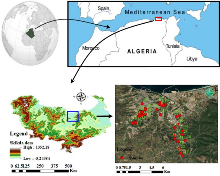 Figure 1
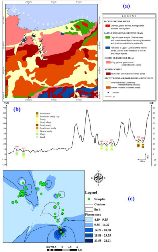 Figure 2
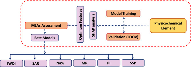 Figure 3
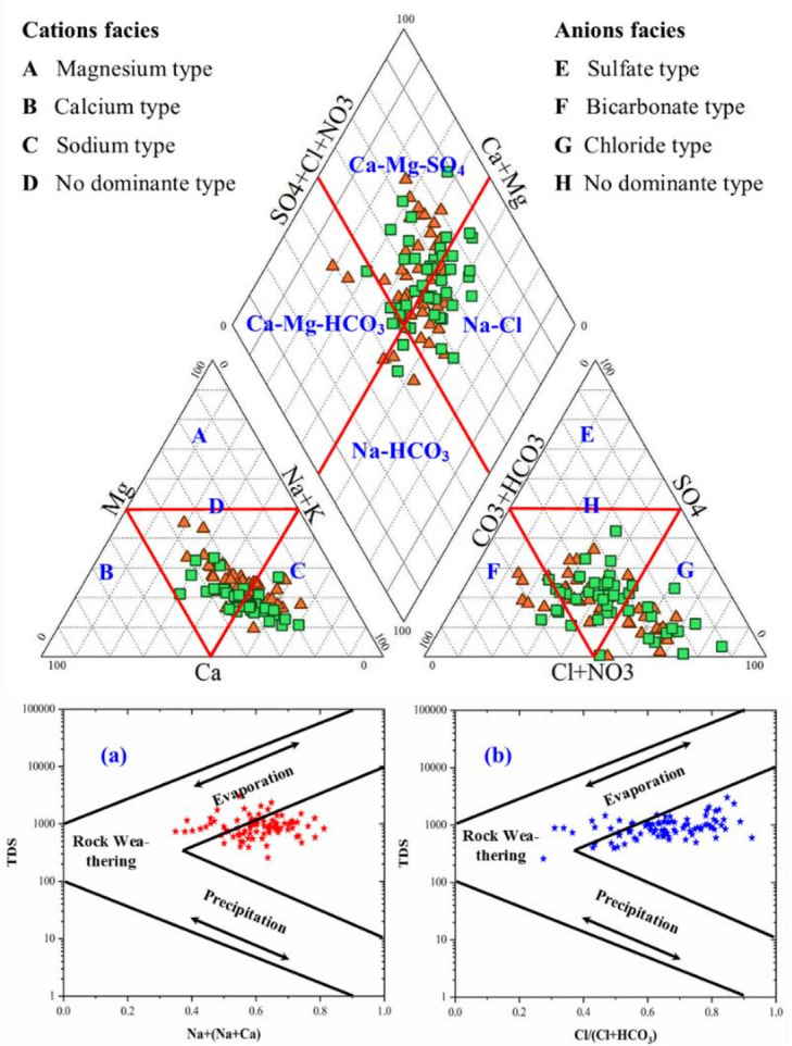 Figure 4
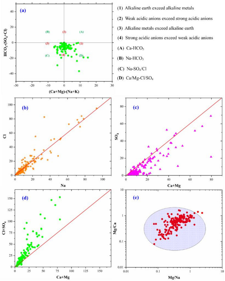 Figure 5
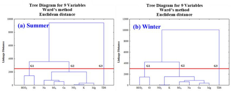 Figure 6
 Figure 7
 Figure 8
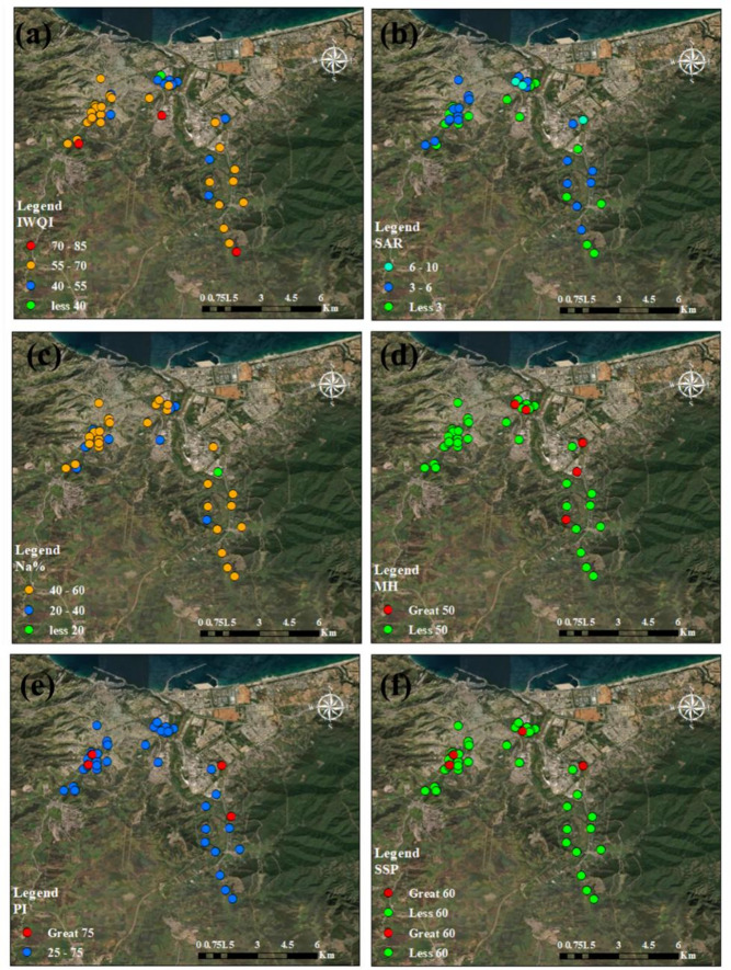 Figure 9
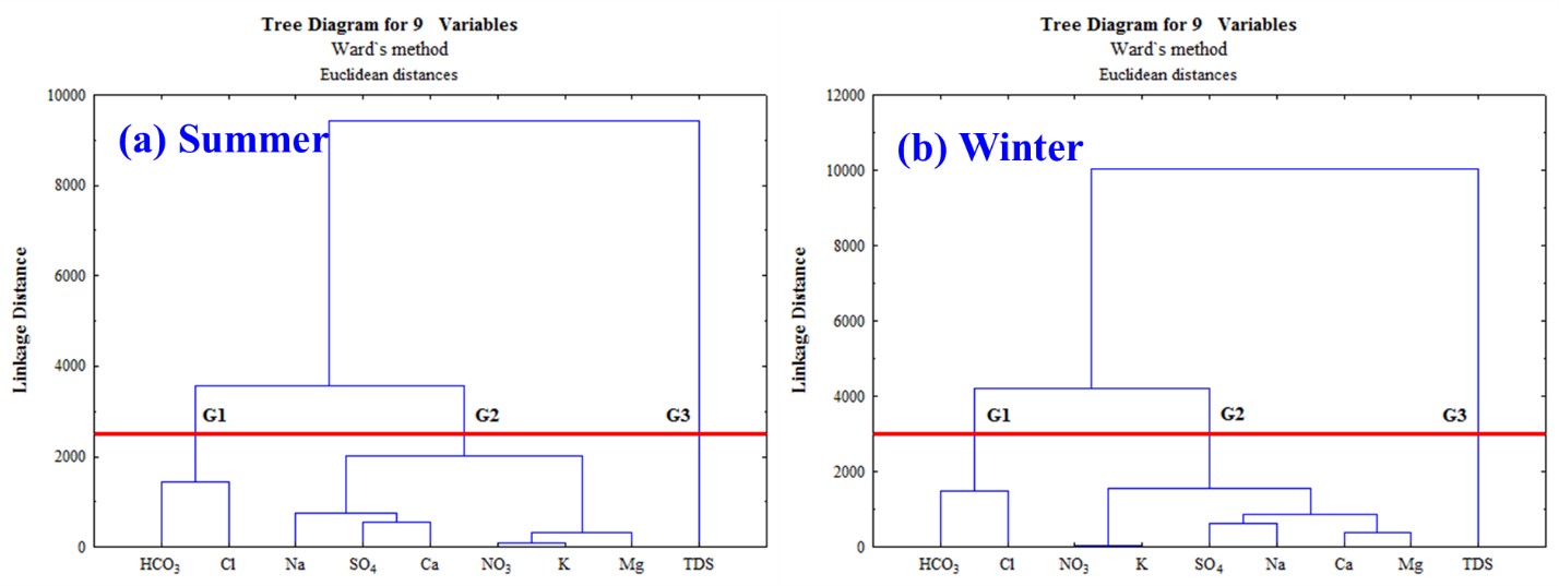 Figure 10
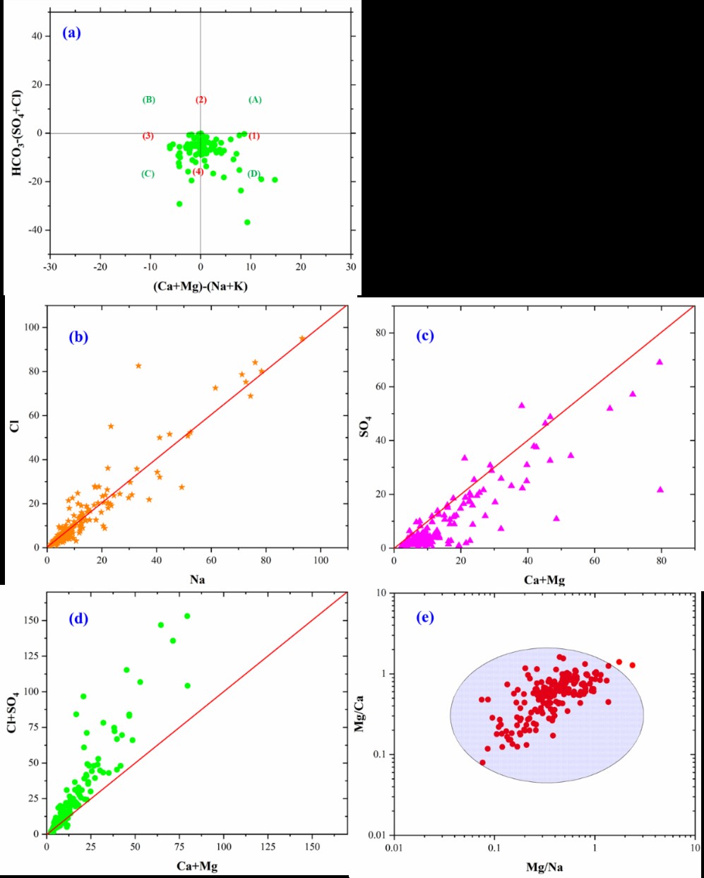 Figure 11
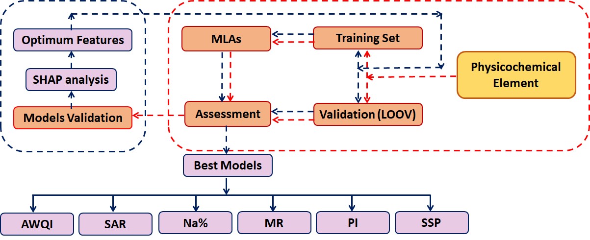 Figure 12
 Figure 13
 Figure 14
 Figure 15
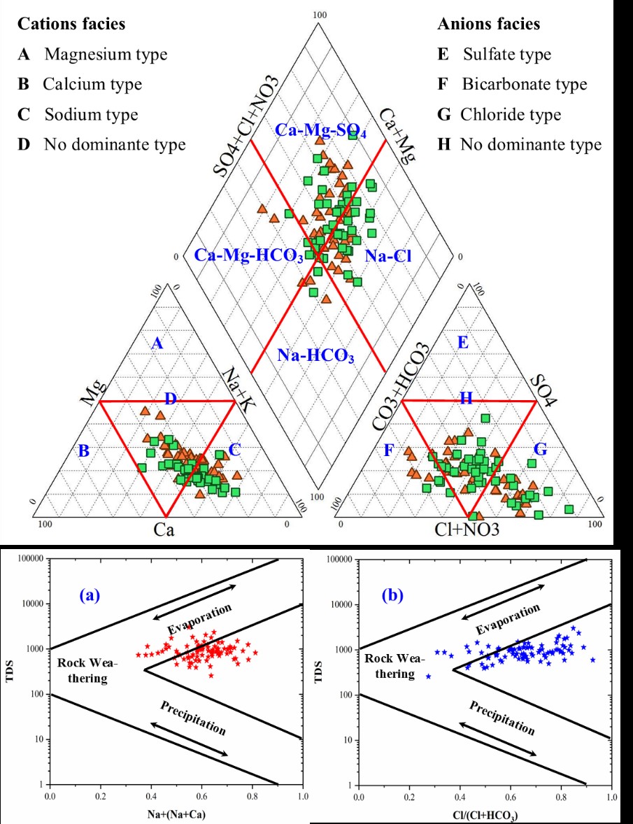 Figure 16
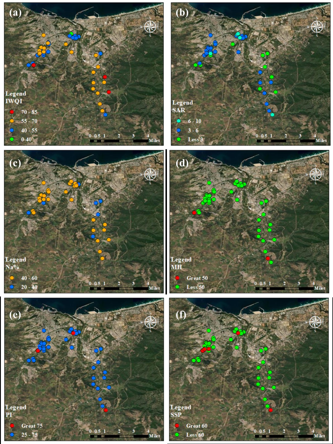 Figure 17
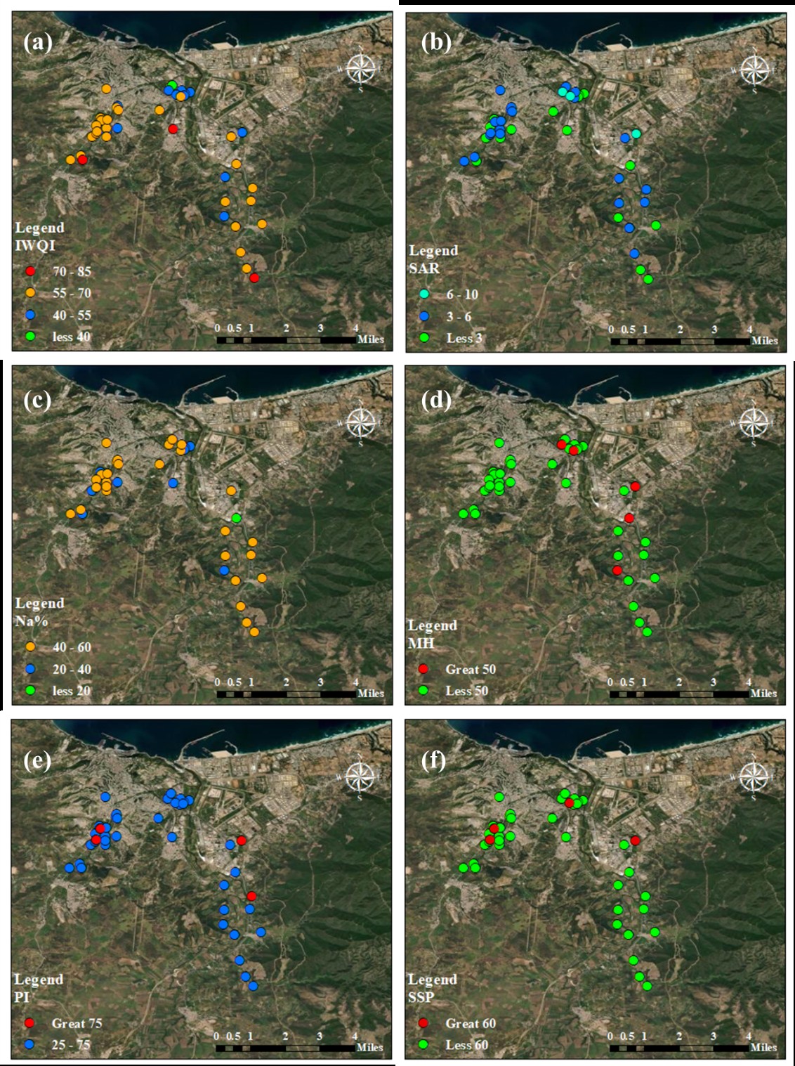 Figure 18
Peer Reviews
No public reviews on file for this paper yet. If you reviewed it on a platform where reviews are public (OpenReview, ICLR, NeurIPS, ICML), you can paste yours below so the community can read it here.
Videos
No videos yet. Explain this paper in a talk, walkthrough, or lecture? Add one.
Taxonomy
TopicsGroundwater and Isotope Geochemistry · Groundwater and Watershed Analysis · Water Quality and Pollution Assessment