Snow cover mapping with Meteosat third generation FCI: initial evaluation of the European Organisation for the Exploitation of Meteorological Satellites H SAF H43 snow mask product
Semih Kuter, Cagri Hasan Karaman, Mustafa Berkay Akpinar, Zuhal Akyurek

TL;DR
This study evaluates a new satellite-based snow cover product from EUMETSAT, showing it improves snow detection accuracy in mountainous regions compared to an older product.
Contribution
The paper introduces and validates the first operational snow cover product from the Meteosat Third Generation FCI sensor.
Findings
H43 shows up to 40% reduction in miss rates above 2,000 m elevation compared to H34.
False Alarm Ratio remains below 30% across all land-cover types with H43.
Improved cloud detection and 10-min temporal resolution enhance snow monitoring capabilities.
Abstract
This study presents the results of the initial validation of the EUMETSAT H SAF H43 snow cover product, the first operational snow product derived from the Flexible Combined Imager (FCI) onboard Meteosat Third Generation (MTG). The evaluation, covering the period from December 2024 to February 2025, includes a direct comparison with the earlier H34 product, generated from SEVIRI observations onboard Meteosat Second Generation (MSG). Analyses were conducted over three mountainous regions—the Alps, Turkey, and Georgia—using MODIS-based reference snow cover maps and in-situ snow-depth measurements from WMO synoptic stations. As snow cover in mountainous terrain plays a critical role in hydrology and water resources management, special attention was given to high-elevation zones (above 1,000 m), where snow is seasonally persistent and detection accuracy most relevant. The evaluation…
Genes, proteins, chemicals, diseases, species, mutations and cell lines named across the full text — each resolved to its canonical identifier and authoritative record.
Click any figure to enlarge with its caption.
 Figure 1
 Figure 2
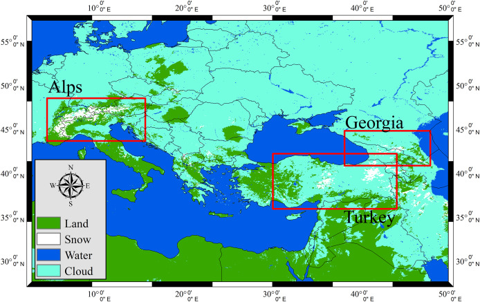 Figure 3
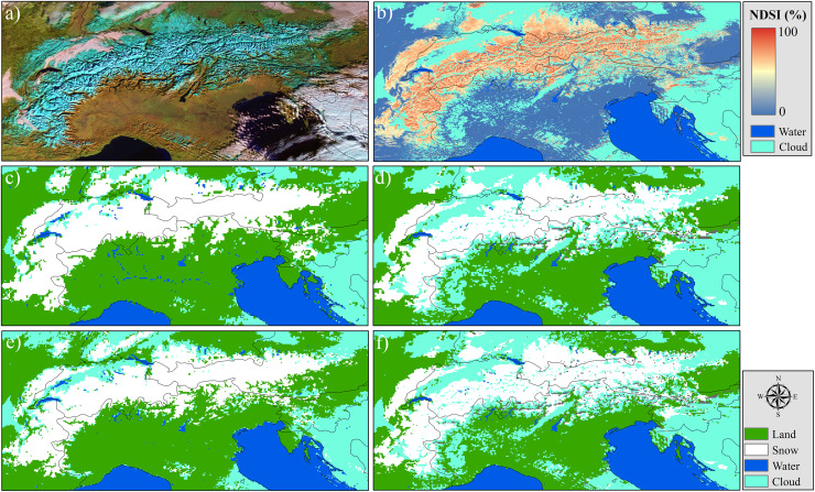 Figure 4
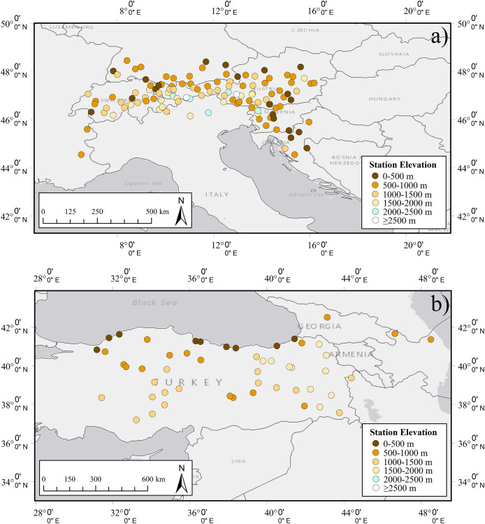 Figure 5
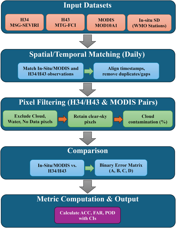 Figure 6
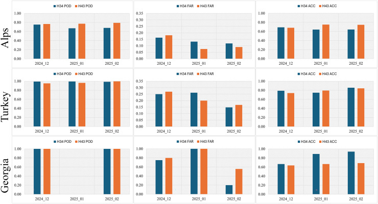 Figure 7
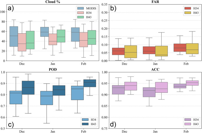 Figure 8
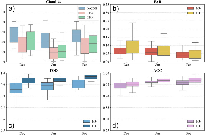 Figure 9
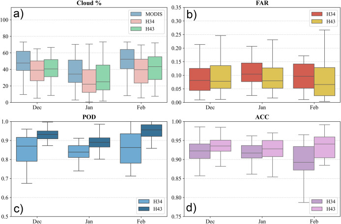 Figure 10
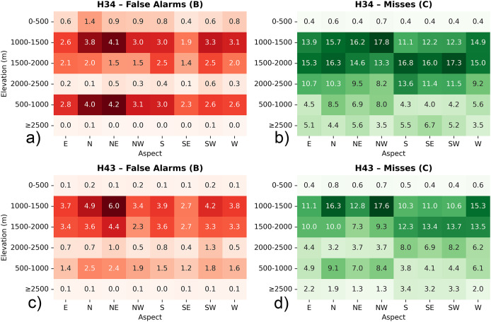 Figure 11
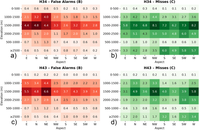 Figure 12
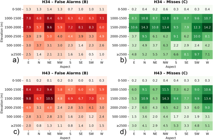 Figure 13
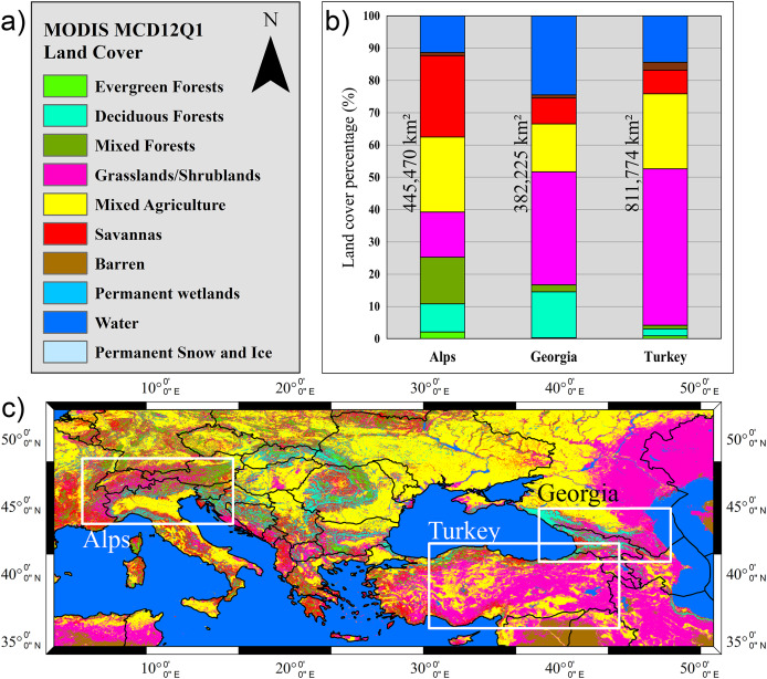 Figure 14
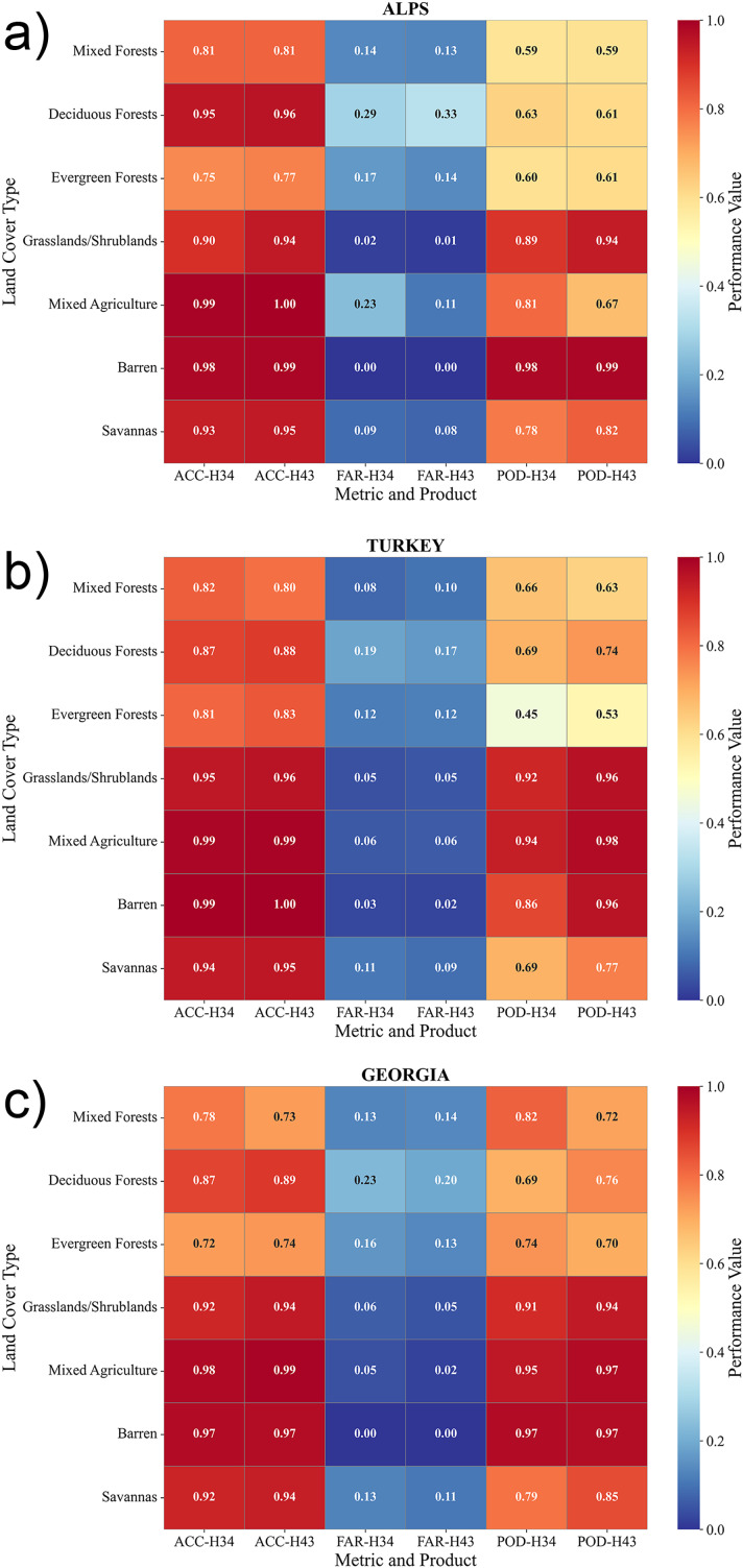 Figure 15
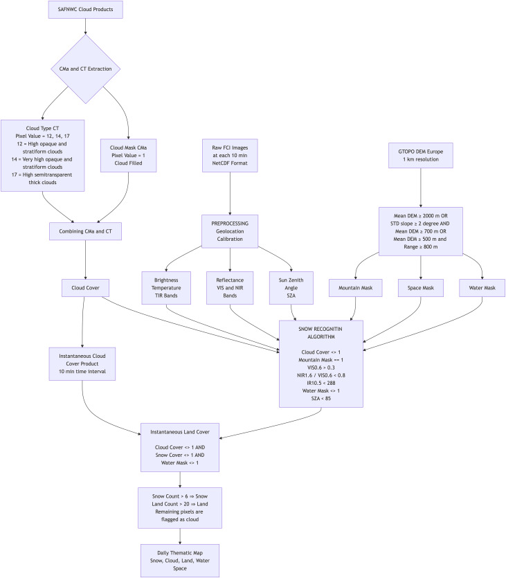 Figure 16
 Figure 17
 Figure 18
 Figure 19
 Figure 20
 Figure 21
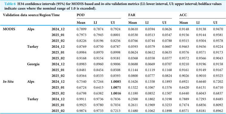 Figure 22
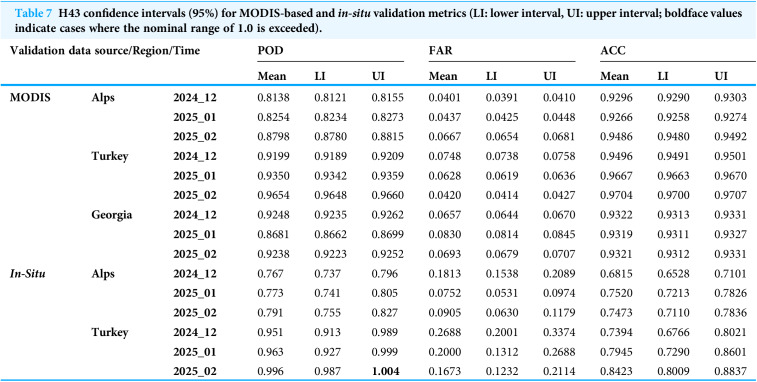 Figure 23
Peer Reviews
No public reviews on file for this paper yet. If you reviewed it on a platform where reviews are public (OpenReview, ICLR, NeurIPS, ICML), you can paste yours below so the community can read it here.
Videos
No videos yet. Explain this paper in a talk, walkthrough, or lecture? Add one.
Taxonomy
TopicsCryospheric studies and observations · Synthetic Aperture Radar (SAR) Applications and Techniques · Remote Sensing in Agriculture