From Film to Data: Automating Meta-Feature Extraction in Historical Aerial Imagery
Felix Dahle, Yushan Liu, Roderik Lindenbergh, Bert Wouters

TL;DR
This paper introduces an automated method to extract key features from historical aerial images, improving 3D reconstruction accuracy and reducing manual labor.
Contribution
A novel automated workflow combining computer vision and machine learning for extracting meta-features from poor-quality historical aerial imagery.
Findings
The workflow successfully detected fiducial marks and textual annotations in over 7000 historical images.
Approximately 70% of images provided usable focal length data, while altitude extraction had a success rate of only 15%.
The method effectively estimated missing parameters, enabling robust image reconstruction across multiple flight paths.
Abstract
Historical aerial imagery provides valuable data from regions and periods with limited geospatial information. A common method to utilize this data is through the generation of ortho-photos and 3D models using Structure-from-Motion (SfM) techniques. However, many of these images were scanned decades after their acquisition and require geometric calibration, along with internal and external camera parameter estimation, for accurate reconstruction. Manual identification of key features, such as fiducial marks and text annotations, is labour-intensive, while existing automated methods struggle with poor-quality datasets. This paper presents an automated workflow that combines computer vision and machine learning techniques to detect and extract these key features from historical aerial images. To address challenges related to image quality, we also introduce estimation protocols that…
Genes, proteins, chemicals, diseases, species, mutations and cell lines named across the full text — each resolved to its canonical identifier and authoritative record.
Click any figure to enlarge with its caption.
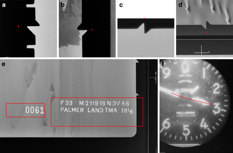 Figure 10
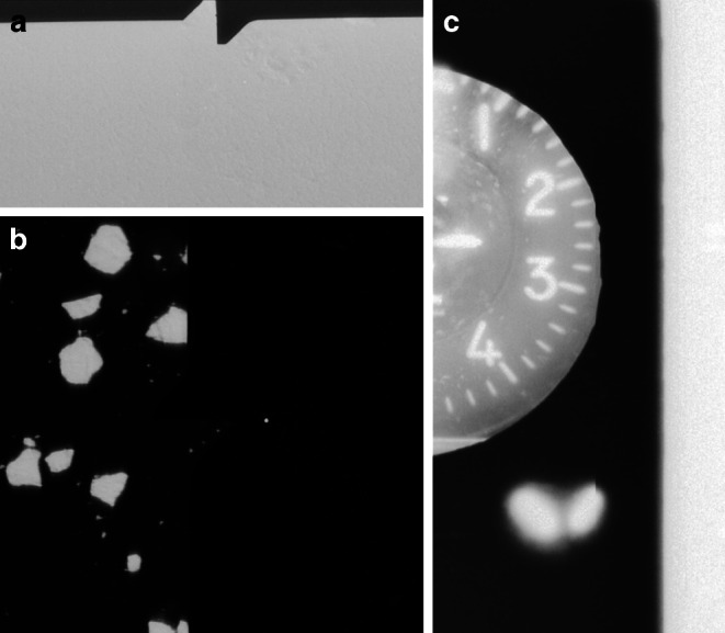 Figure 11
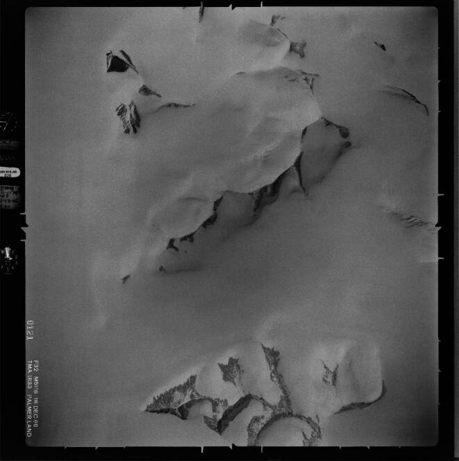 Figure 1
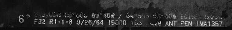 Figure 2
 Figure 3
 Figure 4
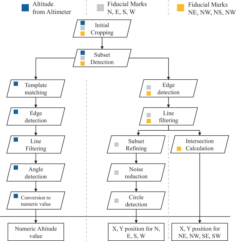 Figure 5
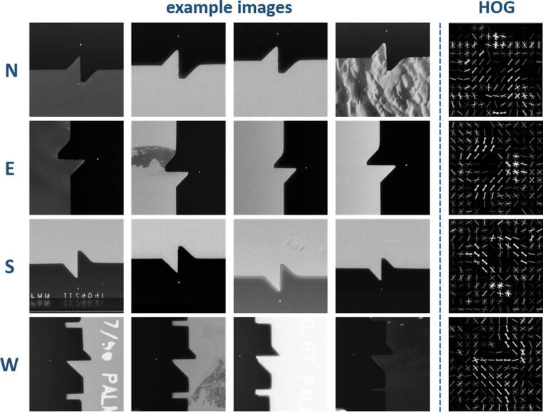 Figure 6
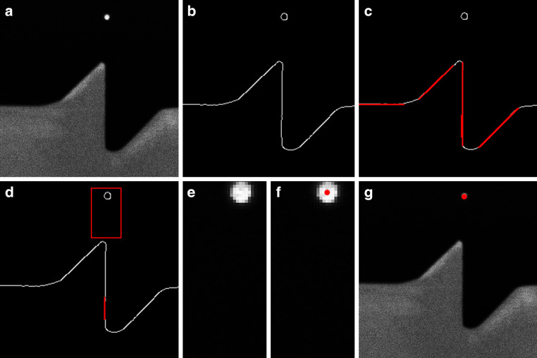 Figure 7
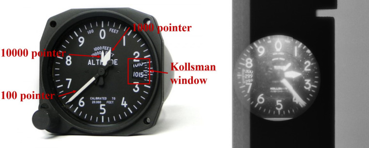 Figure 8
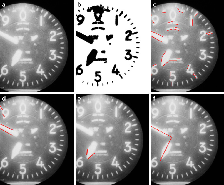 Figure 9
Peer Reviews
No public reviews on file for this paper yet. If you reviewed it on a platform where reviews are public (OpenReview, ICLR, NeurIPS, ICML), you can paste yours below so the community can read it here.
Videos
No videos yet. Explain this paper in a talk, walkthrough, or lecture? Add one.
Taxonomy
TopicsAdvanced Image and Video Retrieval Techniques · 3D Surveying and Cultural Heritage · Remote Sensing and LiDAR Applications