Uncertainty of Object Points Monoplotted from Terrestrial Images
Sebastian Mikolka-Flöry, Camillo Ressl, Norbert Pfeifer

TL;DR
This paper introduces methods to estimate the uncertainty of 3D points reconstructed from single images, which is important for analyzing historical glacier changes.
Contribution
The paper proposes three methods to estimate monoplotting uncertainty and evaluates their accuracy and speed for different use cases.
Findings
The unscented transform provides more accurate uncertainty estimates than variance propagation for manually selected points.
Monte Carlo simulation is recommended for accuracy despite slower performance.
Variance propagation is suitable for fast uncertainty estimation across entire images.
Abstract
With monoplotting, object points can be reconstructed from a single oriented image if a reference surface of the captured scene is available. While used extensively in environmental sciences, prior approaches fall short of describing the uncertainty of the reconstructed points. In this paper, we estimate this monoplotting uncertainty using three different methods: i) Monte Carlo simulation, ii) unscented transform and iii) classical variance propagation with tangential approximation of the terrain. Our investigations are guided by two different use cases: i) For manually selected image points, the estimated uncertainty determines whether these monoplotted points are accurate enough for a subsequent research question (e.g. deriving glacier changes from historical terrestrial images). ii) Estimating the monoplotting uncertainty for each pixel of the whole image to get an overview of the…
Genes, proteins, chemicals, diseases, species, mutations and cell lines named across the full text — each resolved to its canonical identifier and authoritative record.
Click any figure to enlarge with its caption.
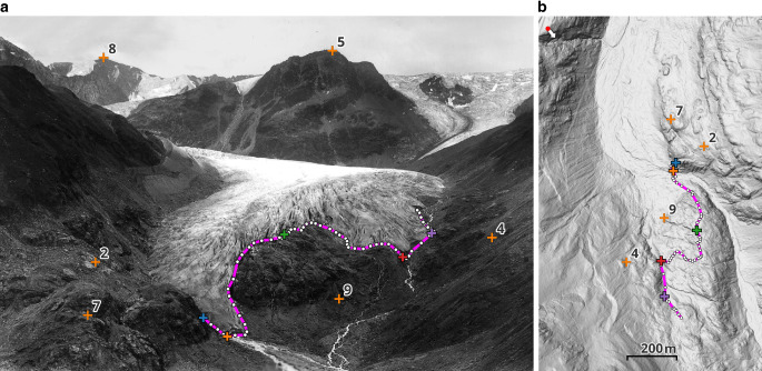 Figure 1
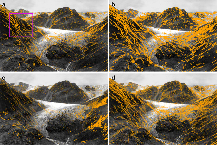 Figure 2
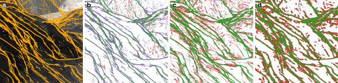 Figure 3
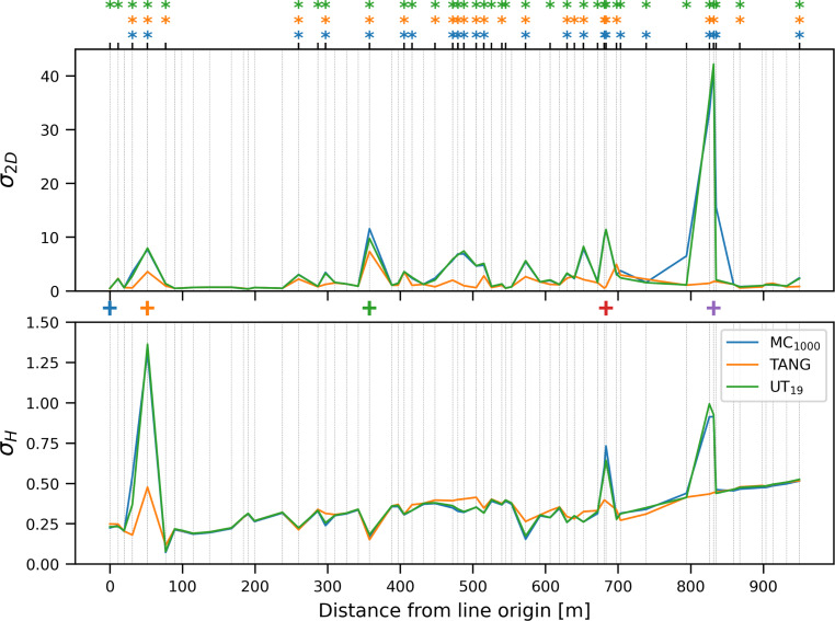 Figure 4
 Figure 5
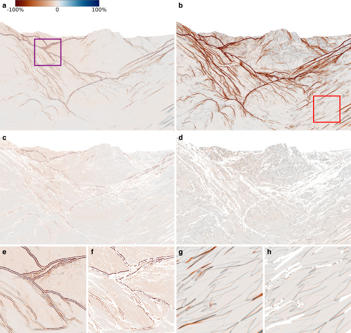 Figure 6
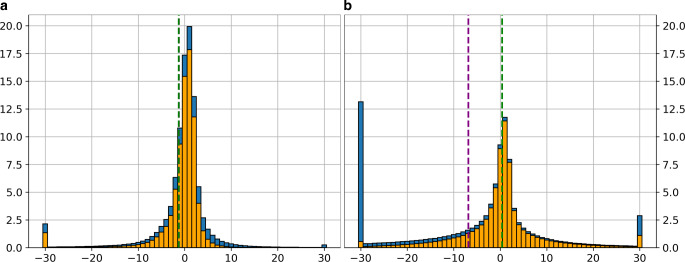 Figure 7
Peer Reviews
No public reviews on file for this paper yet. If you reviewed it on a platform where reviews are public (OpenReview, ICLR, NeurIPS, ICML), you can paste yours below so the community can read it here.
Videos
No videos yet. Explain this paper in a talk, walkthrough, or lecture? Add one.
Taxonomy
TopicsRemote Sensing and LiDAR Applications · Remote Sensing in Agriculture · Soil Geostatistics and Mapping