Using Sentinel 2A and Landsat 8 imagery to assess changes in forest carbon storage
Bingjie Li, Shanghua Liu, Dongwei Liu, Zhitao Fan, Zhicheng Qu, Shunyu Yao, Xiashu Su, Lixin Wang

TL;DR
This study uses satellite imagery to estimate forest carbon storage and finds that higher-resolution Sentinel 2A data improves accuracy compared to lower-resolution Landsat 8.
Contribution
A novel approach using Sentinel 2A imagery and machine learning improves carbon storage estimation accuracy for dominant forest species and types.
Findings
Approach 2 using Sentinel 2A data provided more accurate carbon storage estimates for species like Populus, Salix, and Pinus tabuliformis.
Machine learning models effectively estimated carbon storage using Sentinel 2A imagery and dominant species classification.
The Ordos Forest carbon storage increased by 27 Mt (89%) from 2013 to 2023, showing the feasibility of long-term monitoring with lower-resolution imagery.
Abstract
Estimating carbon storage using high-resolution imagery of dominant species and types is often constrained by the availability of data. Herein, we developed a carbon storage estimation model for dominant species and types using high-resolution Sentinel 2A imagery and compared the two approaches using lower-resolution Landsat 8 imagery for whole-forest estimation. Approach 1 employs a traditional method using in-situ carbon storage measurements with Landsat 8 vegetation indices, whereas Approach 2 uses Sentinel 2A carbon storage estimates as a reference. Using Random Forest, Decision Tree, and Multiple Linear Regression models, we compared both approaches and found that Approach 2 estimates matched the Sentinel 2A results for different species and types more accurately, including Populus, Salix, Pinus tabuliformis, and shrub types. At the same time, our research results show that machine…
Genes, proteins, chemicals, diseases, species, mutations and cell lines named across the full text — each resolved to its canonical identifier and authoritative record.
Click any figure to enlarge with its caption.
 Figure 1
 Figure 2
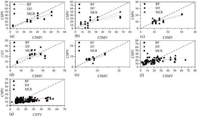 Figure 3
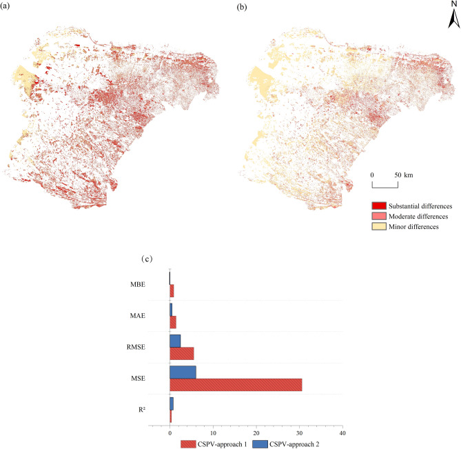 Figure 4
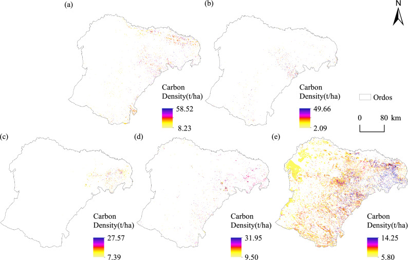 Figure 5
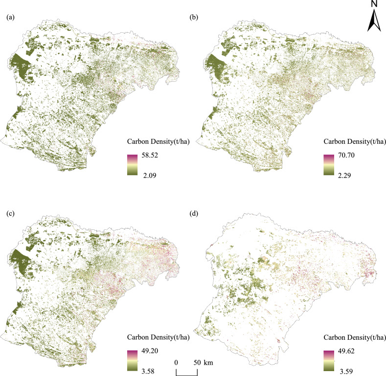 Figure 6
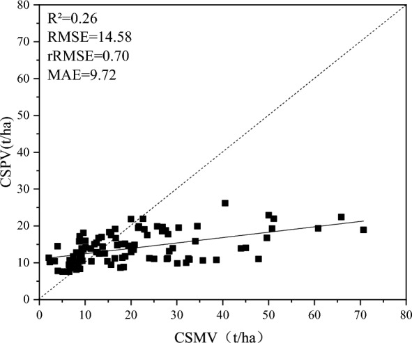 Figure 7
 Figure 8
Peer Reviews
No public reviews on file for this paper yet. If you reviewed it on a platform where reviews are public (OpenReview, ICLR, NeurIPS, ICML), you can paste yours below so the community can read it here.
Videos
No videos yet. Explain this paper in a talk, walkthrough, or lecture? Add one.
Taxonomy
TopicsRemote Sensing and LiDAR Applications · Remote Sensing in Agriculture · Forest ecology and management