Estimation of above-ground carbon stock of Dendrocalamus giganteus using ANUSPLIN-interpolated GEDI and ICESat-2/ATLAS parameters
Huanfen Yang, Zhen Qin, Shengjiao Li, Qingtai Shu, Mingxing Wang, Yiran Zhang, Zeyu Li

TL;DR
This study improves the estimation of carbon storage in giant bamboo forests using advanced interpolation and machine learning techniques with satellite data.
Contribution
The study introduces ANUSPLIN interpolation and XGBoost for more accurate regional carbon stock estimation using GEDI and ICESat-2/ATLAS data.
Findings
ANUSPLIN interpolation with specific spline degrees achieved highest accuracy for GEDI and ICESat-2/ATLAS parameters.
XGBoost outperformed LightGBM and RFR in estimating above-ground carbon stock with higher precision and lower error.
ANUSPLIN interpolation outperformed co-kriging in spatial interpolation performance.
Abstract
GEDI and ICESat-2/ATLAS have significant limitations in estimating forest structure parameters. This study aims to enhance the estimation accuracy of above-ground carbon storage (AGC) of Dendrocalamus giganteus by applying the ANUSPLIN interpolation technique for spatial expansion. The results indicate that: (1) When the spline degree of ANUSPLIN interpolation was set to 4 for GEDI parameters (cover, pai, sensitivity) and ICESat-2/ATLAS parameters (toc_roughness, h_median_canopy_abs, h_canopy_abs, h_max_canopy_abs), the model’s accuracy was highest. The spline degree 2 for the digital_elevation_model parameter (GEDI) and the asr parameter (ICESat-2/ATLAS) yielded optimal results. (2) The interpolation accuracy and performance of ANUSPLIN outperformed that of co-kriging (CK). (3) The Extreme Gradient Boosting (XGBoost) model (Coefficient of Determination, R2 = 0.93; Root Mean Square…
Genes, proteins, chemicals, diseases, species, mutations and cell lines named across the full text — each resolved to its canonical identifier and authoritative record.
Click any figure to enlarge with its caption.
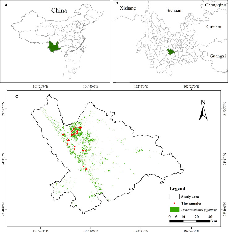 Figure 1
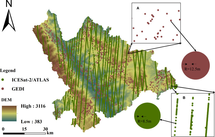 Figure 2
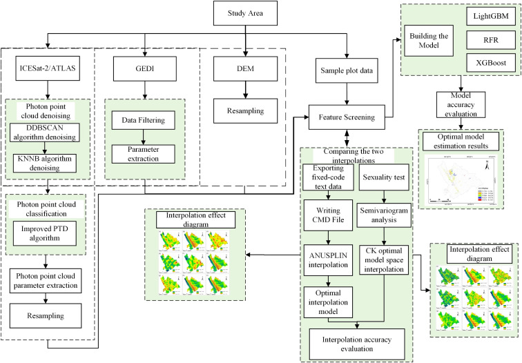 Figure 3
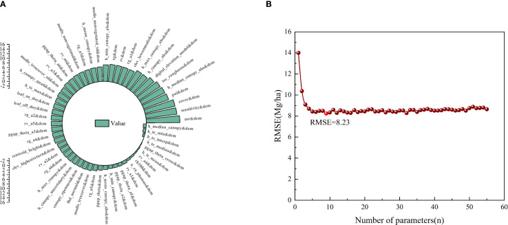 Figure 4
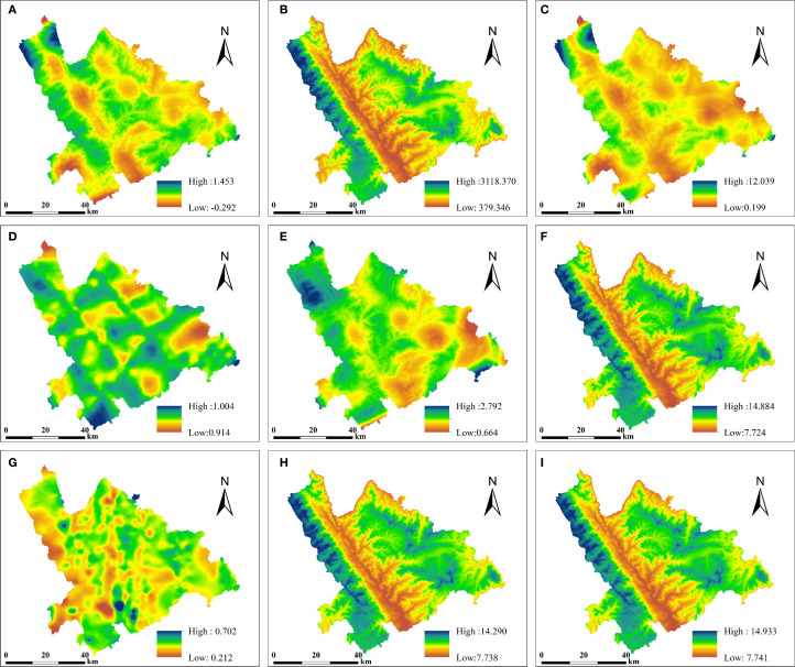 Figure 5
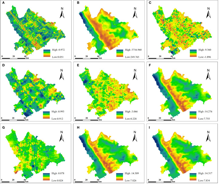 Figure 6
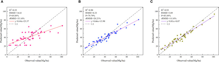 Figure 7
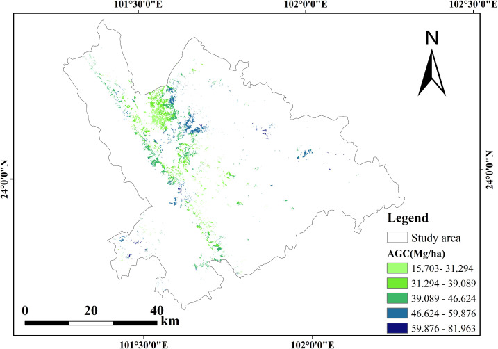 Figure 8
Peer Reviews
No public reviews on file for this paper yet. If you reviewed it on a platform where reviews are public (OpenReview, ICLR, NeurIPS, ICML), you can paste yours below so the community can read it here.
Videos
No videos yet. Explain this paper in a talk, walkthrough, or lecture? Add one.
Taxonomy
TopicsSoil Geostatistics and Mapping · Synthetic Aperture Radar (SAR) Applications and Techniques · Remote Sensing and LiDAR Applications