Angles-Only Navigation via Optical Satellite Measurement with Prior Altitude Constrained
Dongkai Dai, Yuanman Ni, Ying Yu, Jiaxuan Li, Shiqiao Qin

TL;DR
This paper introduces a low-cost navigation method using satellite angles and altitude data to enable precise location tracking without GPS.
Contribution
A novel angles-only navigation method using optical satellite measurements and prior altitude constraints for GNSS-denied environments.
Findings
Geolocation error is mainly influenced by the perpendicular projection of orbital error relative to the line-of-sight.
Geolocation accuracy within 250 m (RMS) was achieved using Globalstar satellites in ground-based experiments.
Altitude errors significantly impact accuracy at low elevation angles.
Abstract
This paper presents an angles-only navigation (AON) method utilizing optical observations of a single satellite with known ephemeris and prior altitude constraints given by an altimeter or known topography, which can enable near-ground platforms to achieve autonomous navigation in GNSS-denied environments. By leveraging a star tracker to measure the line-of-sight (LOS) direction of a satellite against a star background, the observer’s location is resolved via triangulation under geometric constraints. Theoretical error models are derived to analyze the influence of satellite position errors, LOS direction errors, and altitude uncertainties on geolocation accuracy. Numerical simulations validate the error propagation mechanisms, demonstrating that geolocation error is primarily determined by the perpendicular projection of orbital error relative to the LOS, increases linearly with LOS…
Genes, proteins, chemicals, diseases, species, mutations and cell lines named across the full text — each resolved to its canonical identifier and authoritative record.
Click any figure to enlarge with its caption.
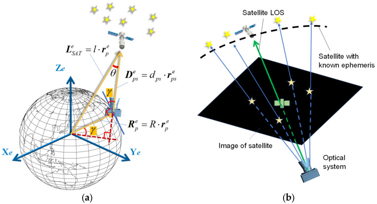 Figure 1
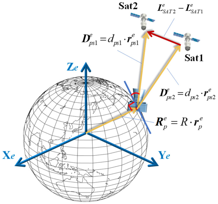 Figure 2
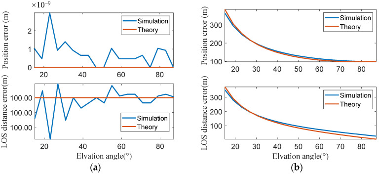 Figure 3
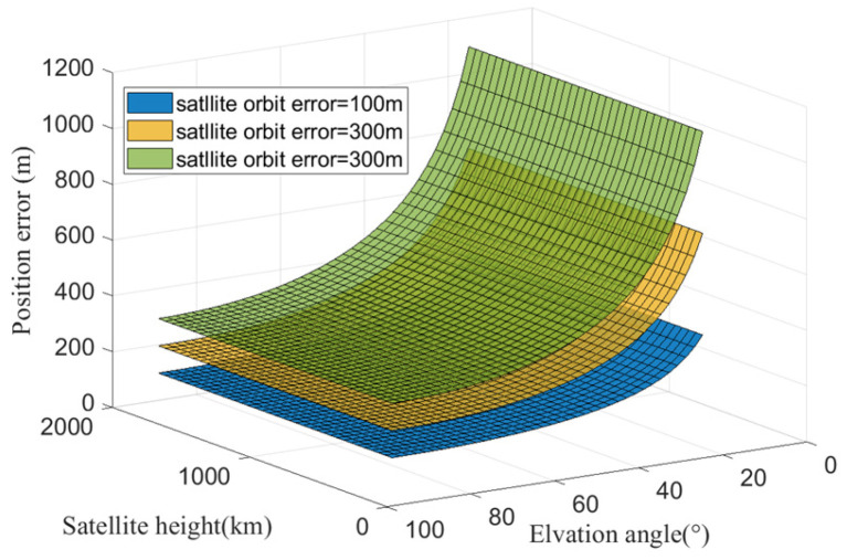 Figure 4
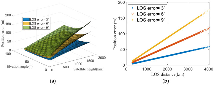 Figure 5
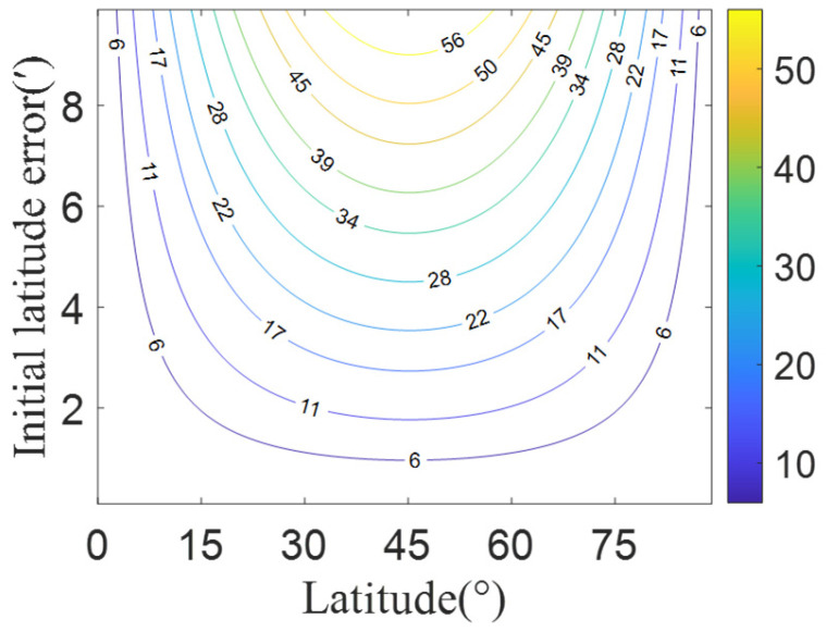 Figure 6
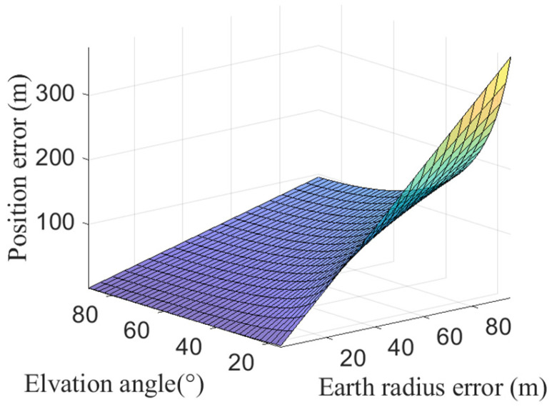 Figure 7
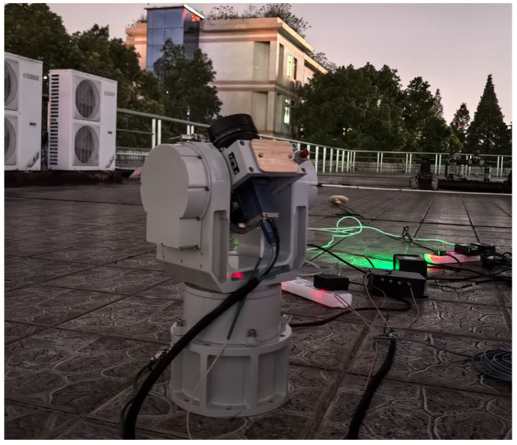 Figure 8
 Figure 9
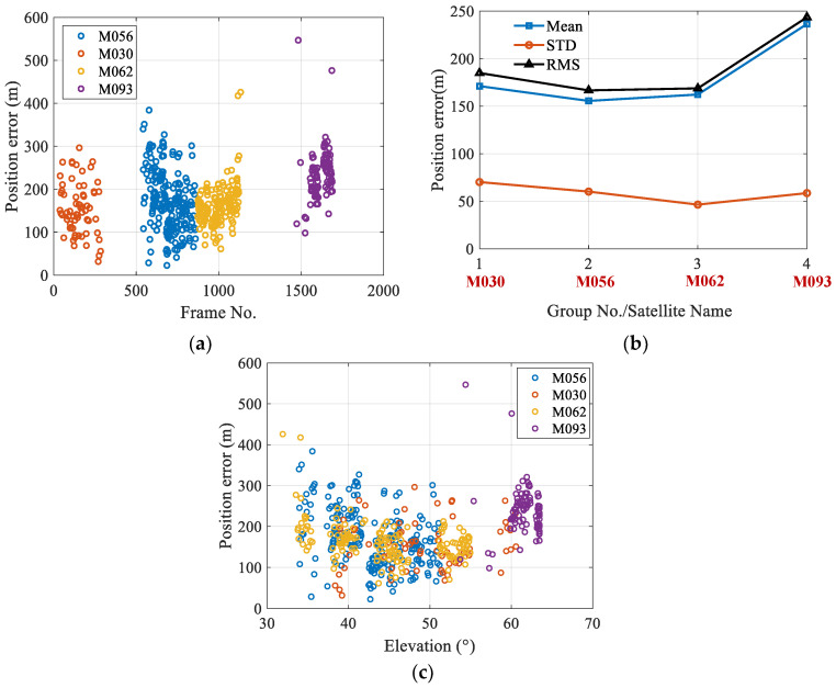 Figure 10
 Figure 11
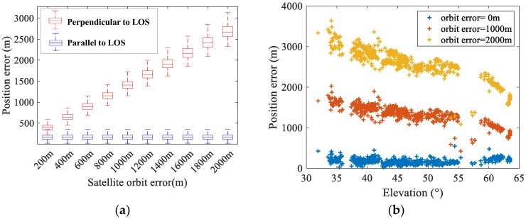 Figure 12
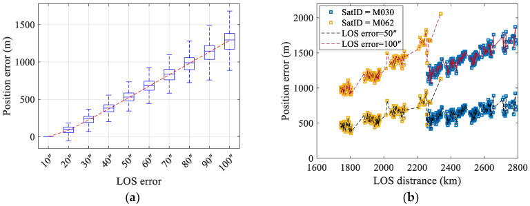 Figure 13
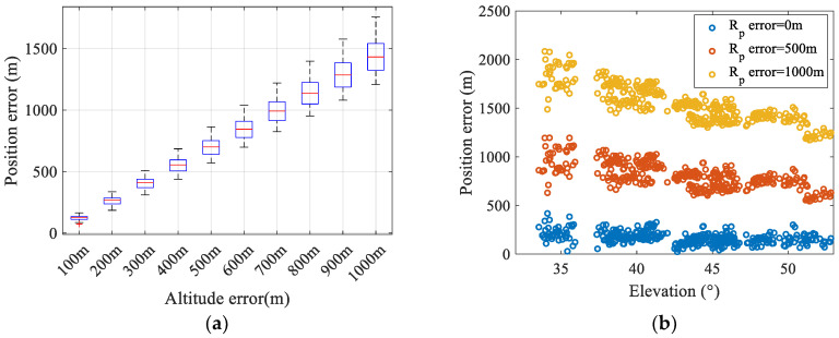 Figure 14
Peer Reviews
No public reviews on file for this paper yet. If you reviewed it on a platform where reviews are public (OpenReview, ICLR, NeurIPS, ICML), you can paste yours below so the community can read it here.
Videos
No videos yet. Explain this paper in a talk, walkthrough, or lecture? Add one.
Taxonomy
TopicsInertial Sensor and Navigation · GNSS positioning and interference · Space Satellite Systems and Control