Integration of Physical Features and Machine Learning: CSF-RF Framework for Optimizing Ground Point Filtering in Vegetated Regions
Sisi Zhang, Chenyao Qu, Zhimin Wu, Wei Wang

TL;DR
A new algorithm called CSF-RF improves ground point filtering in vegetated areas by combining physical simulation and machine learning, leading to more accurate elevation models.
Contribution
The novel CSF-RF framework integrates physical features and machine learning to enhance ground point filtering accuracy in complex vegetated terrains.
Findings
The CSF-RF algorithm reduces total error to 0.03% with both type I and type II errors below 0.05%.
In dense vegetation areas, CSF-RF achieves a 79.6% reduction in total error compared to the CSF algorithm.
The algorithm effectively reduces vegetation interference and improves DEM accuracy in complex terrain.
Abstract
Complex terrain conditions and dense vegetation cover in a vegetation area present significant challenges for point cloud data processing and the accurate extraction of ground points. This work integrates the physical characteristics between ground and non-ground points from the traditional Cloth Simulation Filter (CSF) algorithm and the strong learning capability of the machine learning Random Forest (RF) framework, developing the CSF-RF fusion algorithm for filtering ground points in vegetated areas, which can improve the accuracy of point cloud filtering in complex terrain environments. Both type I and type II errors do not exceed 0.05%, and the total error is maintained within 0.03%. Particularly in areas with dense vegetation and severe terrain undulations, the advantages are evident: the CSF-RF algorithm achieves a total error of only 0.19%, representing a 79.6% relative reduction…
Genes, proteins, chemicals, diseases, species, mutations and cell lines named across the full text — each resolved to its canonical identifier and authoritative record.
Click any figure to enlarge with its caption.
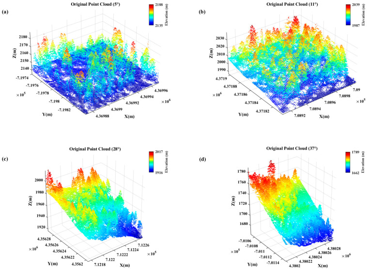 Figure 1
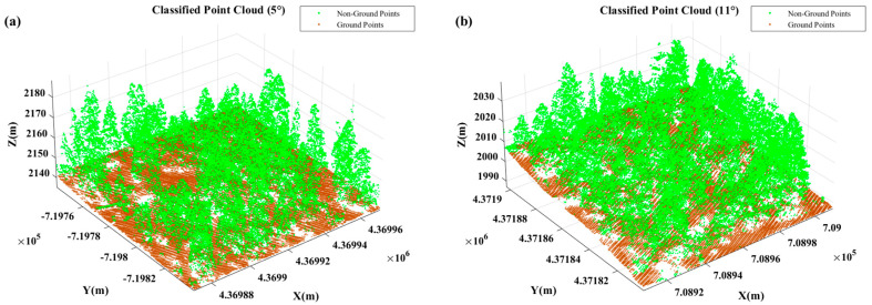 Figure 2
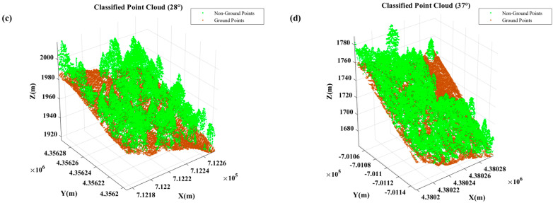 Figure 3
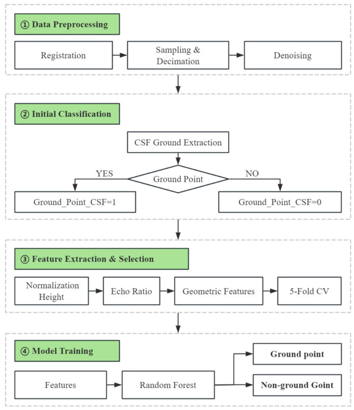 Figure 4
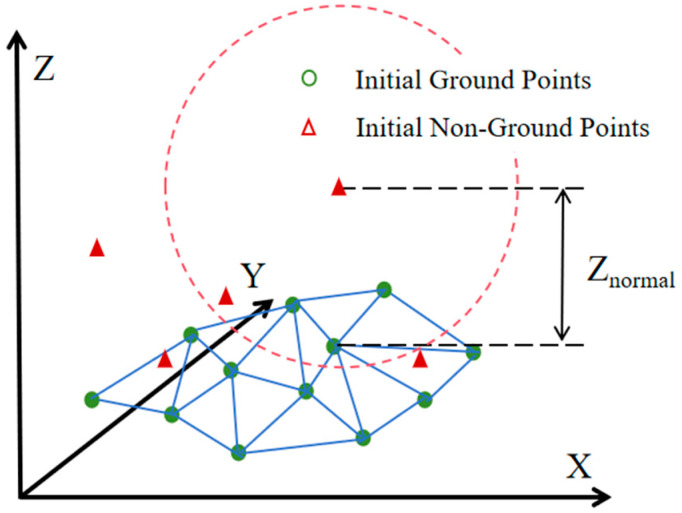 Figure 5
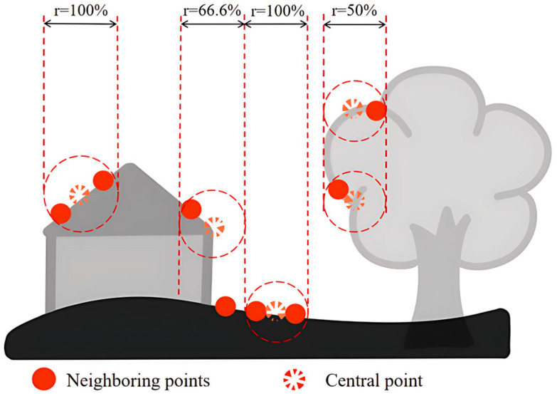 Figure 6
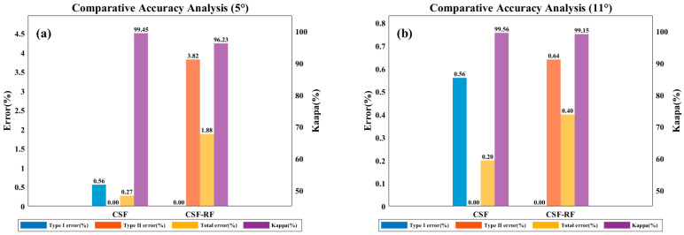 Figure 7
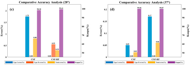 Figure 8
 Figure 9
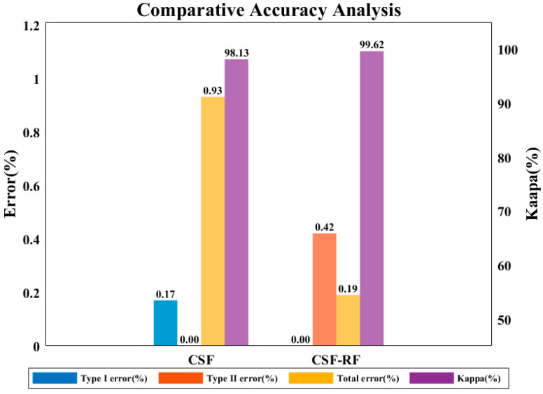 Figure 10
 Figure 11
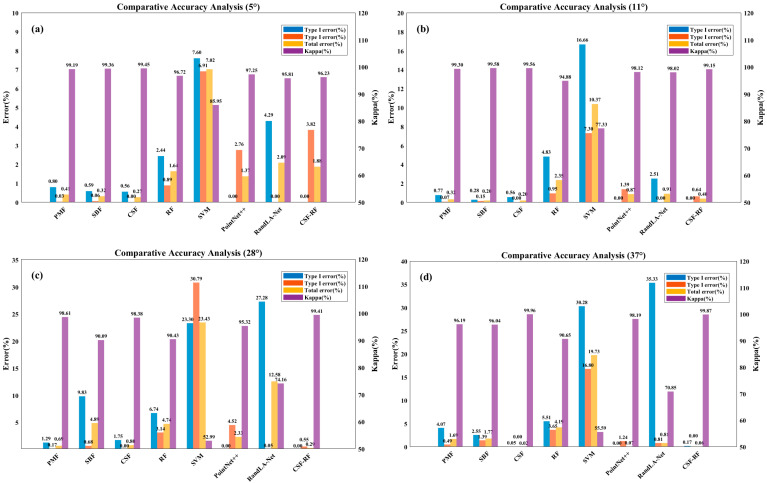 Figure 12
Peer Reviews
No public reviews on file for this paper yet. If you reviewed it on a platform where reviews are public (OpenReview, ICLR, NeurIPS, ICML), you can paste yours below so the community can read it here.
Videos
No videos yet. Explain this paper in a talk, walkthrough, or lecture? Add one.
Taxonomy
TopicsRemote Sensing and LiDAR Applications · Forest ecology and management · 3D Surveying and Cultural Heritage