Influence of Renders Surface Structure and Color Properties in the Context of the TLS Accuracy
Andrzej Kwinta, Agnieszka Malec, Izabela Piech, Robert Gradka

TL;DR
This paper investigates how the surface structure and color of renders affect the accuracy of terrestrial laser scanning measurements.
Contribution
The study reveals that render type and brightness influence TLS measurement accuracy and dispersion.
Findings
Scratched-type render causes a greater standard deviation in TLS measurements than Roughcast-type render.
Measurement dispersion increases as render brightness decreases.
Abstract
This paper presents the results of laboratory studies on the impact of the type, color, and brightness of render on the accuracy of measurements performed using the terrestrial laser scanning (TLS). Analyses were conducted for decorative renders of the “Roughcast” and “Scratched” types, with average brightness ranging from 143 to 243. It was found that the standard deviation of the mean distance for “Scratched” renders is approximately 26% higher than for “Roughcast” renders. The results indicate increased dispersion of measurement results as render brightness decreases. Within the analyzed range, it was observed that the blue color has the least impact on the TLS measurement results. What are the main findings? Scratched-type render causes a greater standard deviation in TLS measurements than the Roughcast-type one.As the brightness of the renders decreases, the dispersion of the…
Genes, proteins, chemicals, diseases, species, mutations and cell lines named across the full text — each resolved to its canonical identifier and authoritative record.
Click any figure to enlarge with its caption.
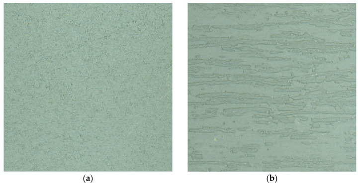 Figure 1
 Figure 2
 Figure 3
 Figure 4
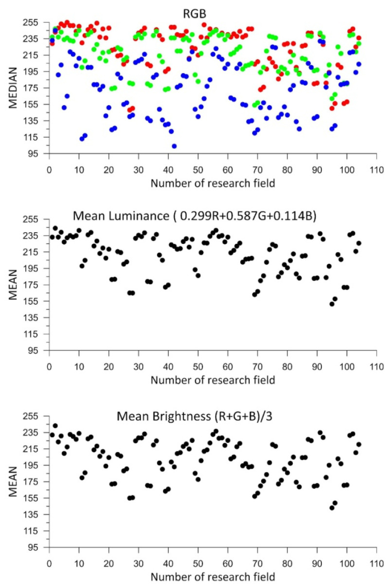 Figure 5
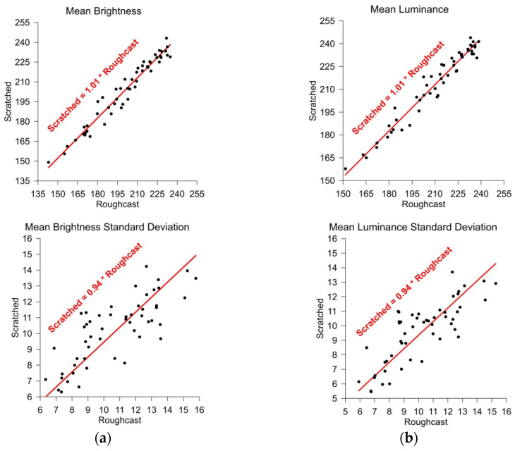 Figure 6
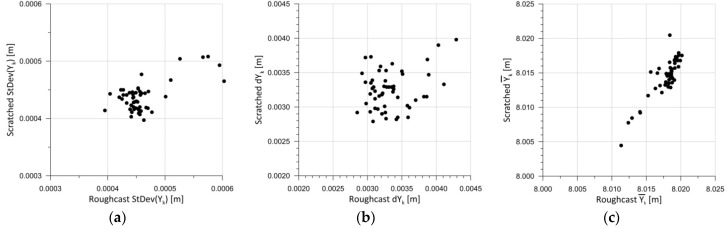 Figure 7
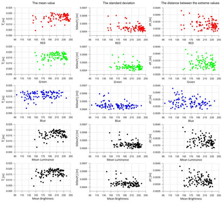 Figure 8
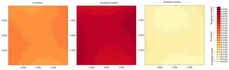 Figure 9
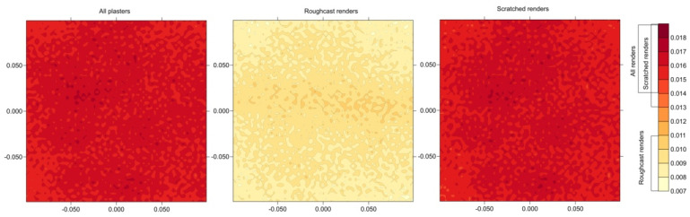 Figure 10
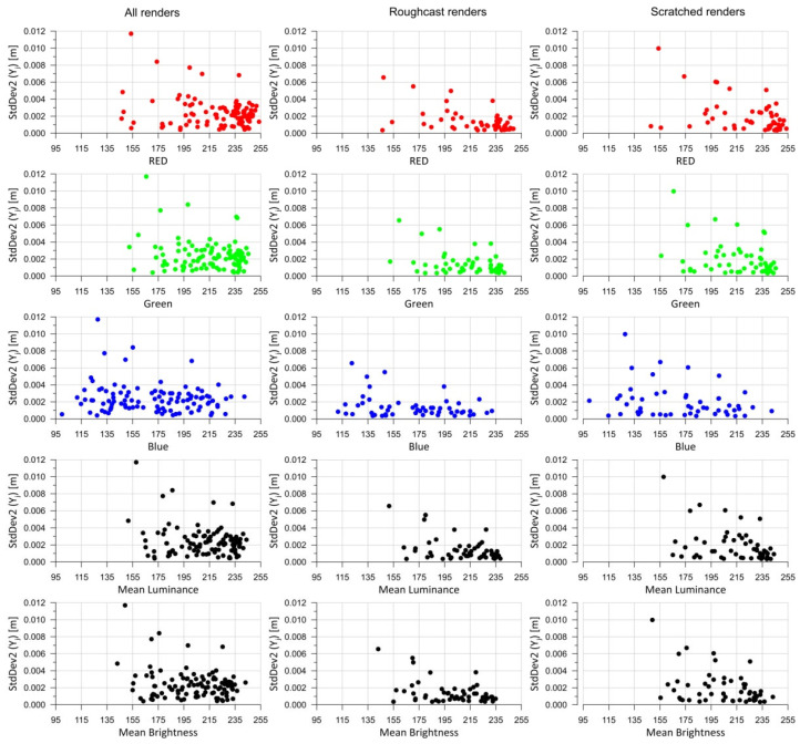 Figure 11
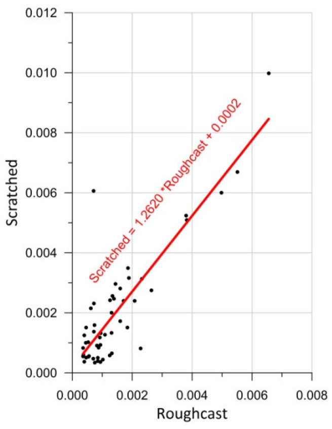 Figure 12
Peer Reviews
No public reviews on file for this paper yet. If you reviewed it on a platform where reviews are public (OpenReview, ICLR, NeurIPS, ICML), you can paste yours below so the community can read it here.
Videos
No videos yet. Explain this paper in a talk, walkthrough, or lecture? Add one.
Taxonomy
Topics3D Surveying and Cultural Heritage · Remote Sensing and LiDAR Applications · 3D Modeling in Geospatial Applications