Automated Detection of Tailing Impoundments in Multi-Sensor High-Resolution Satellite Images Through Advanced Deep Learning Architectures
Lin Qin, Wenyue Song

TL;DR
This paper introduces a deep learning framework using multi-sensor satellite images to accurately detect tailing impoundments, improving environmental monitoring in mining areas.
Contribution
A novel YOLO-based deep learning model with multi-scale feature aggregation and fusion for improved detection of tailing impoundments.
Findings
The proposed model outperforms existing methods in precision and computational efficiency.
Multi-source data integration enhances detection accuracy in complex environments.
Affine transformations and adversarial synthesis improve dataset robustness.
Abstract
Accurate spatial mapping of Tailing Impoundments (TIs) is vital for environmental sustainability in mining ecosystems. While remote sensing enables large-scale monitoring, conventional methods relying on single-sensor data and traditional machine learning-based algorithm suffer from reduced accuracy in cluttered environments. This research proposes a deep learning framework leveraging multi-source high-resolution imagery to address these limitations. An upgraded You Only Look Once (YOLO) model is introduced, integrating three key innovations: a multi-scale feature aggregation layer, a lightweight hierarchical fusion mechanism, and a modified loss metric. These components enhance the model’s ability to capture spatial dependencies, optimize inference speed, and ensure stable training dynamics. A comprehensive dataset of TIs across varied terrains was constructed, expanded through affine…
Genes, proteins, chemicals, diseases, species, mutations and cell lines named across the full text — each resolved to its canonical identifier and authoritative record.
Click any figure to enlarge with its caption.
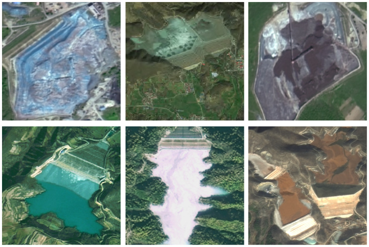 Figure 1
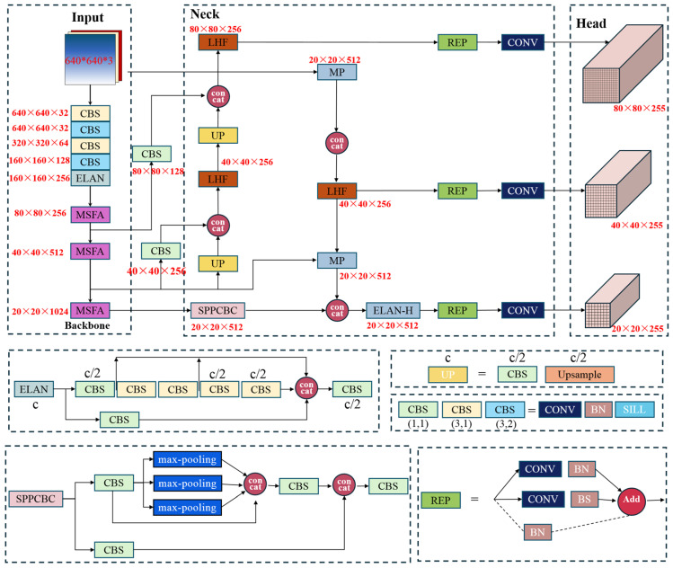 Figure 2
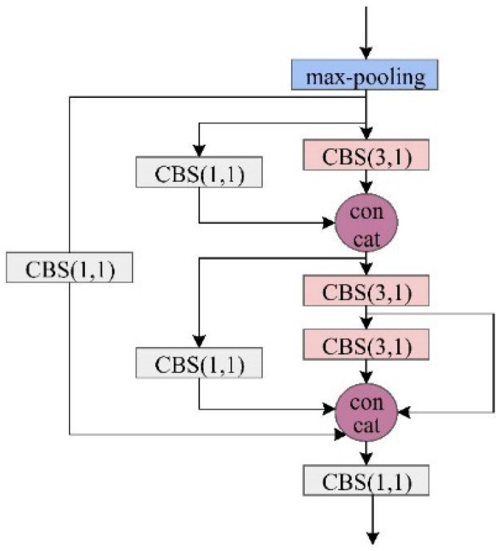 Figure 3
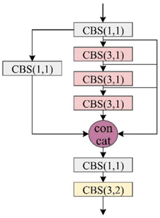 Figure 4
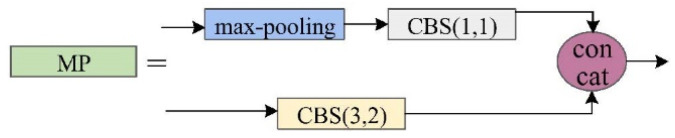 Figure 5
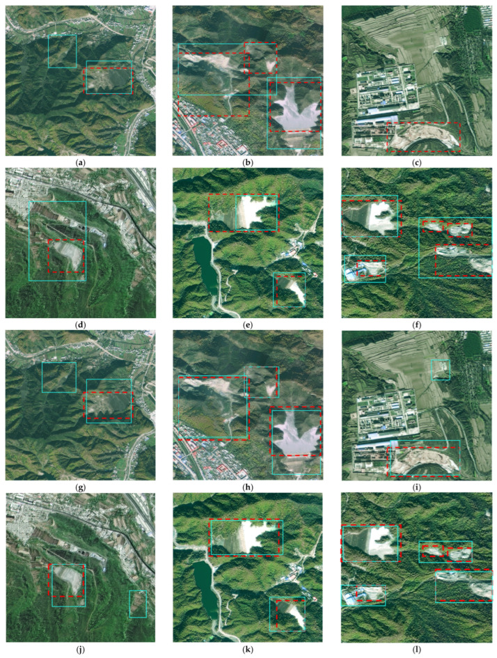 Figure 6
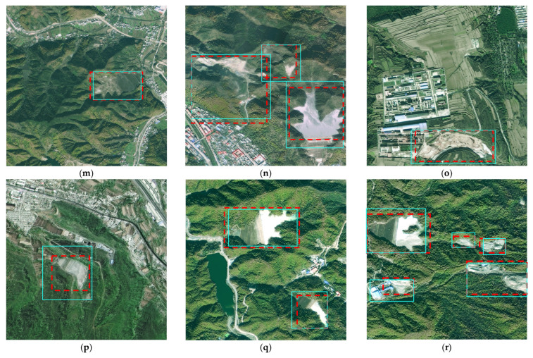 Figure 7
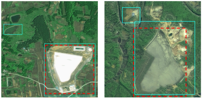 Figure 8
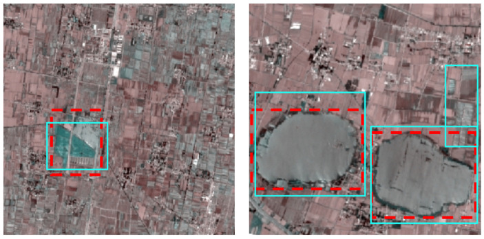 Figure 9
Peer Reviews
No public reviews on file for this paper yet. If you reviewed it on a platform where reviews are public (OpenReview, ICLR, NeurIPS, ICML), you can paste yours below so the community can read it here.
Videos
No videos yet. Explain this paper in a talk, walkthrough, or lecture? Add one.
Taxonomy
TopicsGeochemistry and Geologic Mapping · Mineral Processing and Grinding · Remote-Sensing Image Classification