Applicability of Multi-Sensor and Multi-Geometry SAR Data for Landslide Detection in Southwestern China: A Case Study of Qijiang, Chongqing
Haiyan Wang, Xiaoting Liu, Guangcai Feng, Pengfei Liu, Wei Li, Shangwei Liu, Weiming Liao

TL;DR
This study evaluates how different satellite radar data can detect landslides in mountainous southwest China, finding that L-band radar and combined satellite data improve accuracy.
Contribution
The study introduces a novel evaluation of multi-sensor and multi-geometry SAR data for landslide detection in complex geological regions.
Findings
L-band SAR data provides better monitoring precision than C-band in the SMRC.
Combining LUTAN-1 ascending and descending orbits improves spatial accuracy in complex landscapes.
Multi-source data fusion enhances detection of small- to medium-scale landslides.
Abstract
The southwestern mountainous region of China (SMRC), characterized by complex geological environments, experiences frequent landslide disasters that pose significant threats to local residents. This study focuses on the Qijiang District of Chongqing, where we conduct a systematic evaluation of wavelength and observation geometry effects on InSAR-based landslide monitoring. Utilizing multi-sensor SAR imagery (Sentinel-1 C-band, ALOS-2 L-band, and LUTAN-1 L-band) acquired between 2018 and 2025, we integrate time-series InSAR analysis with geological records, high-resolution topographic data, and field investigation findings to assess representative landslide-susceptible zones in the Qijiang District. The results indicate the following: (1) L-band SAR data demonstrates superior monitoring precision compared to C-band SAR data in the SMRC; (2) the combined use of LUTAN-1…
Genes, proteins, chemicals, diseases, species, mutations and cell lines named across the full text — each resolved to its canonical identifier and authoritative record.
Click any figure to enlarge with its caption.
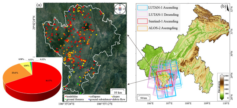 Figure 1
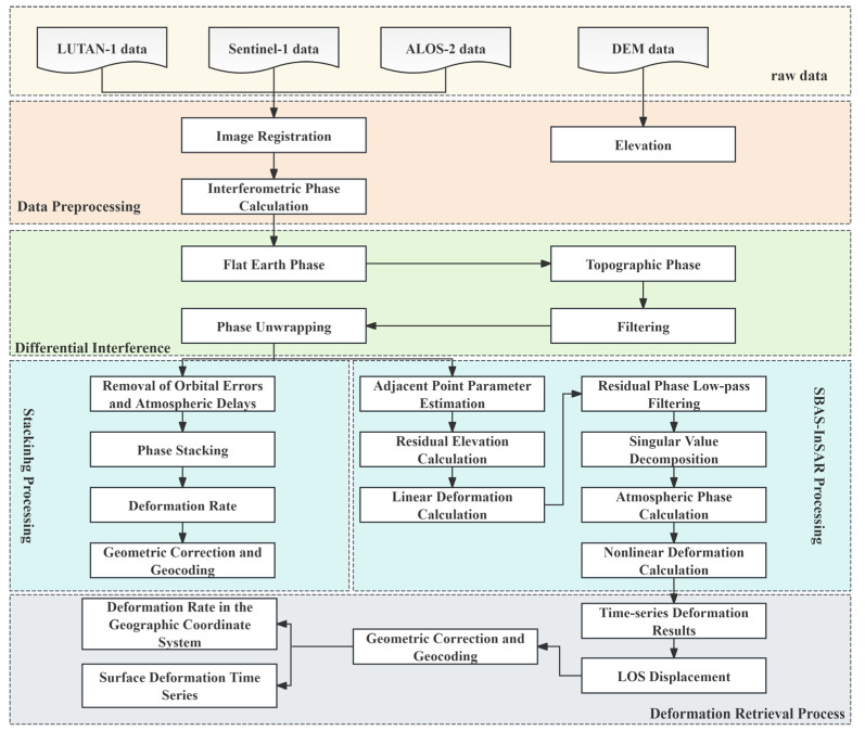 Figure 2
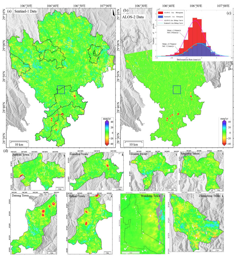 Figure 3
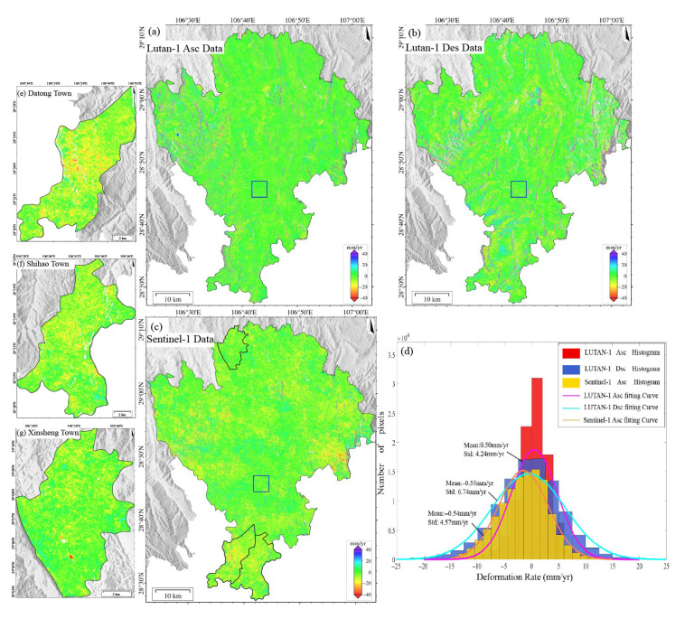 Figure 4
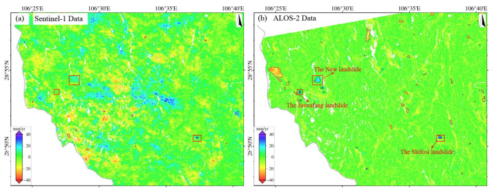 Figure 5
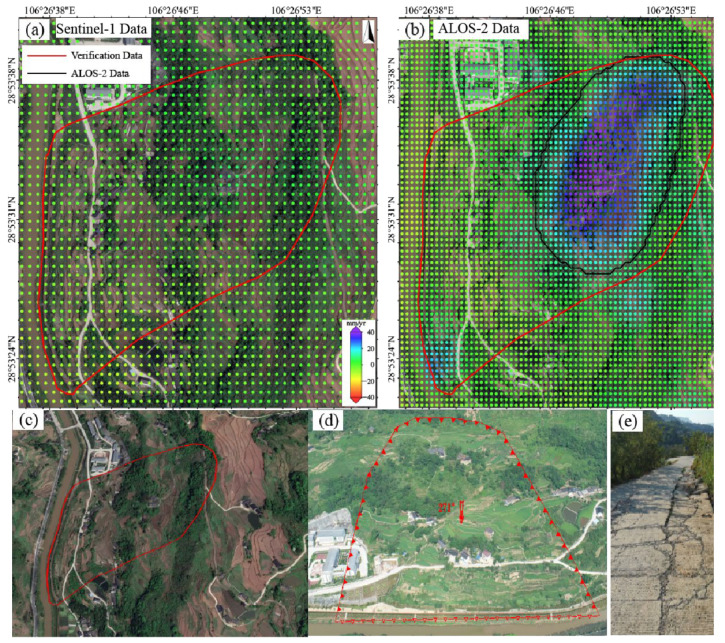 Figure 6
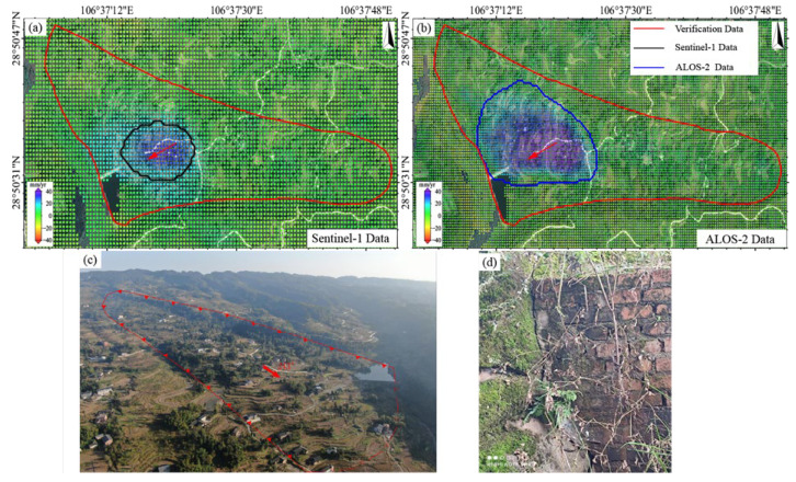 Figure 7
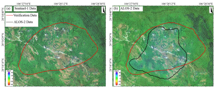 Figure 8
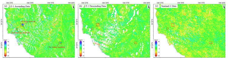 Figure 9
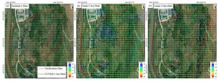 Figure 10
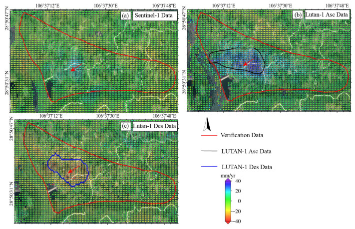 Figure 11
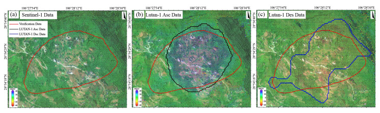 Figure 12
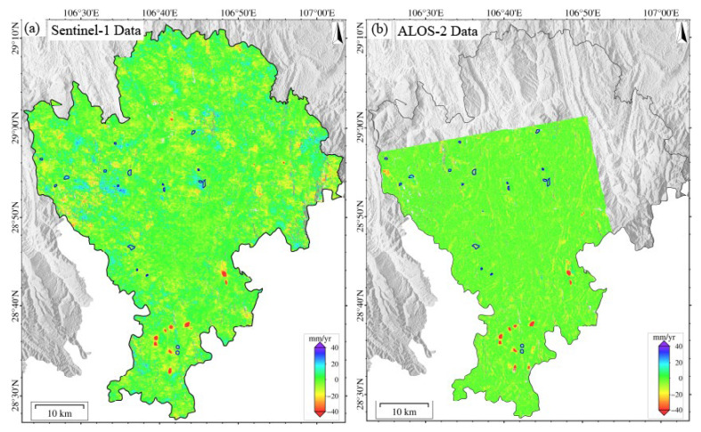 Figure 13
Peer Reviews
No public reviews on file for this paper yet. If you reviewed it on a platform where reviews are public (OpenReview, ICLR, NeurIPS, ICML), you can paste yours below so the community can read it here.
Videos
No videos yet. Explain this paper in a talk, walkthrough, or lecture? Add one.
Taxonomy
TopicsLandslides and related hazards · Synthetic Aperture Radar (SAR) Applications and Techniques · Cryospheric studies and observations