Improvements in PPP by Integrating GNSS with LEO Satellites: A Geometric Simulation
Marianna Alghisi, Nikolina Zallemi, Ludovico Biagi

TL;DR
This paper explores how adding Low Earth Orbit (LEO) satellites to GNSS can improve the speed and accuracy of precise point positioning (PPP).
Contribution
The study introduces a geometric simulation showing that LEO satellites can reduce PPP convergence time and improve positioning performance.
Findings
LEO satellites significantly reduce the time needed for a reliable PPP solution under good sky visibility.
Including LEO satellites lowers PDOP values and convergence time even with limited satellite visibility.
The simulated LEO constellation enhances positioning performance compared to using only current GNSS satellites.
Abstract
The precise point positioning (PPP) method in GNSS is based on the processing of undifferenced phase observations. For long static sessions, this method provides results characterized by accuracies better than one centimeter, and has become a standard practice in the processing of geodetic permanent stations data. However, a drawback of the PPP method is its slow convergence, which results from the necessity of jointly estimating the coordinates and the initial phase ambiguities. This poses a challenge for very short sessions or kinematic applications. The introduction of new satellites in Low Earth Orbits (LEO) that provide phase observations for positioning, such as those currently provided by GNSS constellations, has the potential to radically improve this scenario. In this work, a preliminary case study is discussed. For a given day, two configurations are analyzed: the first…
Genes, proteins, chemicals, diseases, species, mutations and cell lines named across the full text — each resolved to its canonical identifier and authoritative record.
Click any figure to enlarge with its caption.
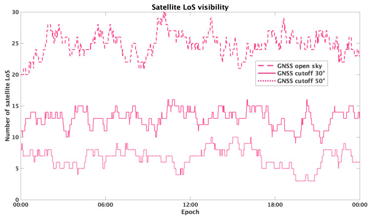 Figure 1
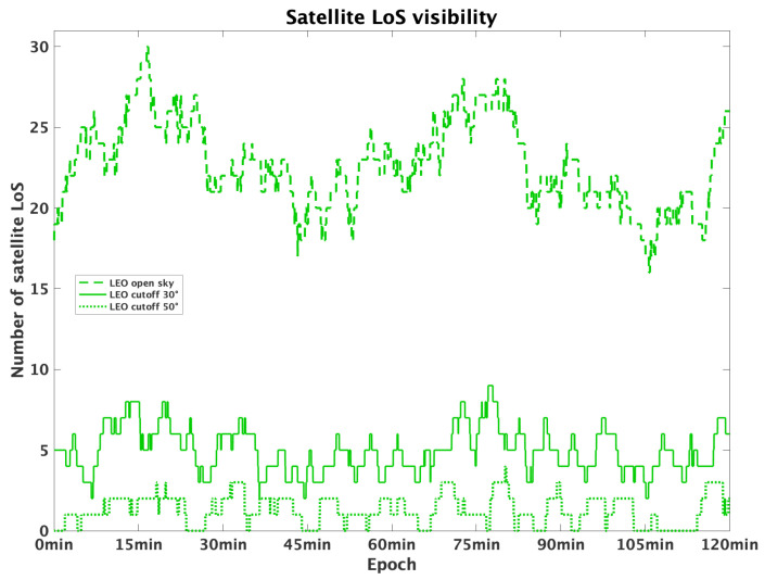 Figure 2
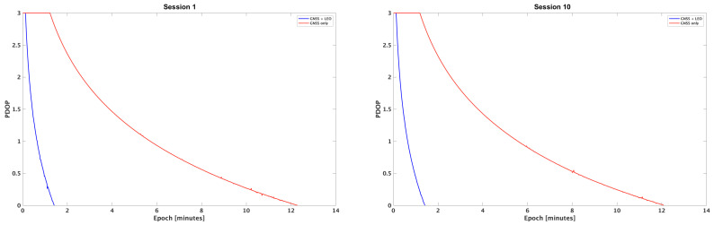 Figure 3
Peer Reviews
No public reviews on file for this paper yet. If you reviewed it on a platform where reviews are public (OpenReview, ICLR, NeurIPS, ICML), you can paste yours below so the community can read it here.
Videos
No videos yet. Explain this paper in a talk, walkthrough, or lecture? Add one.
Taxonomy
TopicsGNSS positioning and interference · Geophysics and Gravity Measurements · Ionosphere and magnetosphere dynamics