Spatiotemporal Land Use Change Detection Through Automated Sampling and Multi-Feature Composite Analysis: A Case Study of the Ebinur Lake Basin
Yi Yang, Liang Zhao, Ya Guo, Shihua Liu, Xiang Qin, Yixiao Li, Xiaoqiong Jiang

TL;DR
This paper introduces a new automated framework for detecting land use changes over time in the Ebinur Lake Basin using advanced data analysis techniques.
Contribution
The study introduces an automated framework combining multi-feature analysis and machine learning to improve land use classification accuracy and spatiotemporal analysis.
Findings
The proposed framework achieved 93.17% overall accuracy and 92.03% Kappa coefficient in land use classification.
Multi-temporal composite data reduced from 48 to 23 features using Gini coefficient and OOBE methods improved classification efficiency.
The framework enabled detailed spatiotemporal analysis of land use changes over two decades in the Ebinur Lake Basin.
Abstract
Land use change plays a pivotal role in understanding surface processes and environmental dynamics, exerting considerable influence on regional ecosystem management. Traditional monitoring approaches, which often rely on manual sampling and single spectral features, exhibit limitations in efficiency and accuracy. This study proposes an innovative technical framework that integrates automated sample generation, multi-feature optimization, and classification model refinement to enhance the accuracy of land use classification and enable detailed spatiotemporal analysis in the Ebinur Lake Basin. By integrating Landsat data with multi-temporal European Space Agency (ESA) products, we acquired 14,000 pixels of 2021 land use samples, with multi-temporal spectral features enabling robust sample transfer to 12028 pixels in 2011 and 10,997 pixels in 2001. Multi-temporal composite data were…
Genes, proteins, chemicals, diseases, species, mutations and cell lines named across the full text — each resolved to its canonical identifier and authoritative record.
Click any figure to enlarge with its caption.
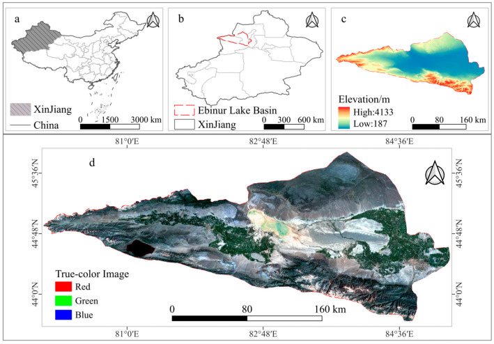 Figure 1
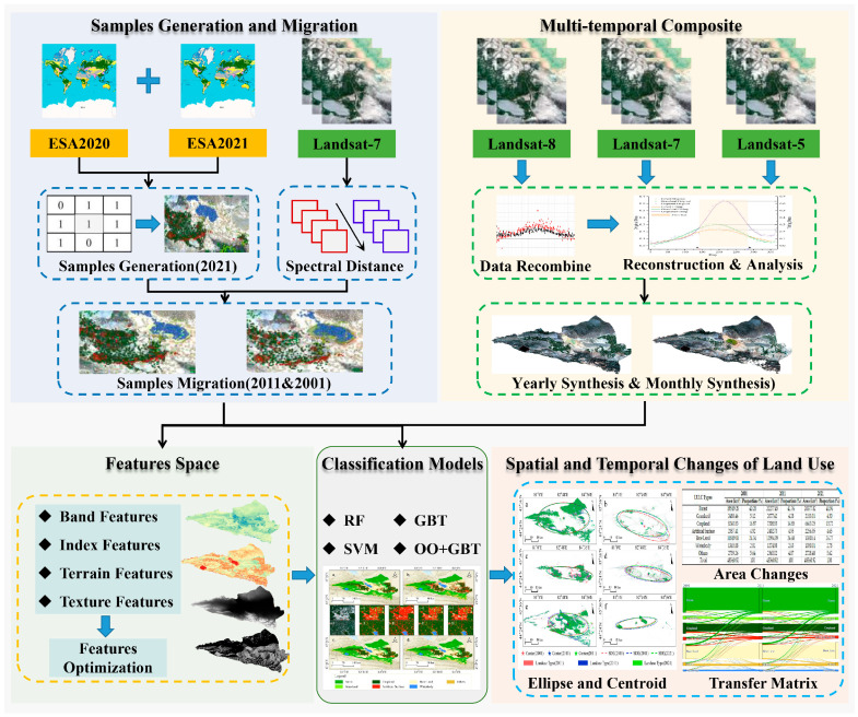 Figure 2
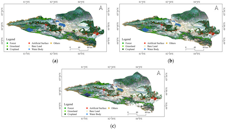 Figure 3
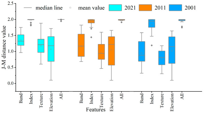 Figure 4
 Figure 5
 Figure 6
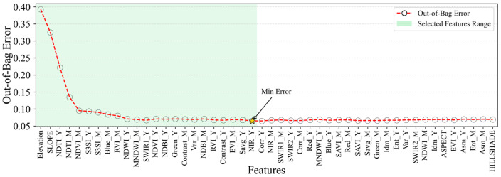 Figure 7
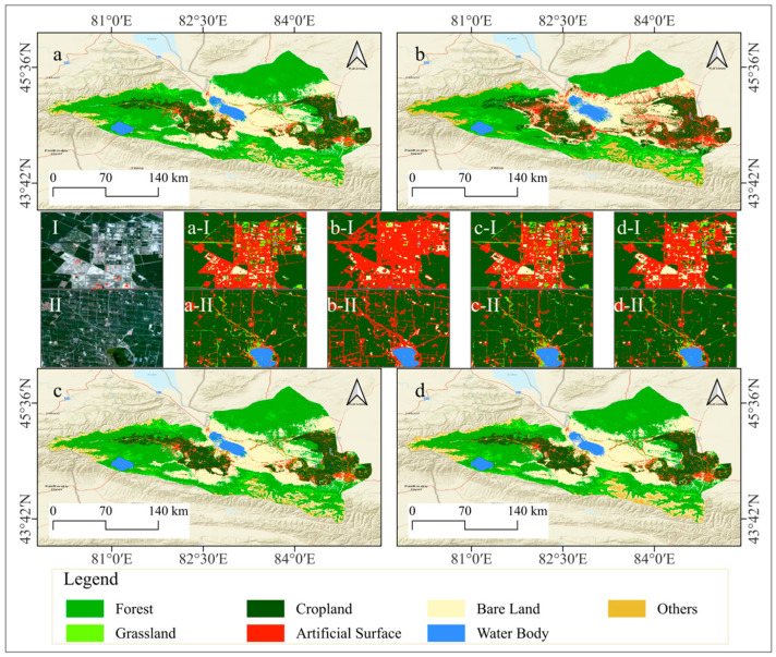 Figure 8
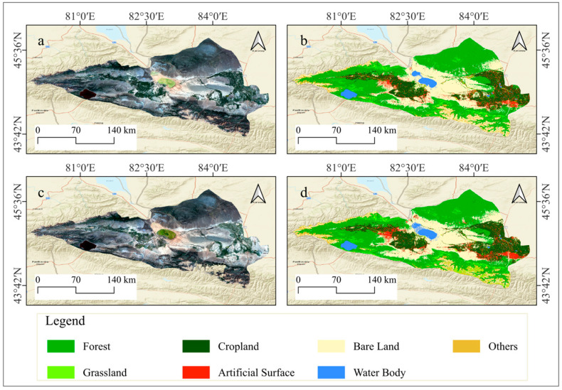 Figure 9
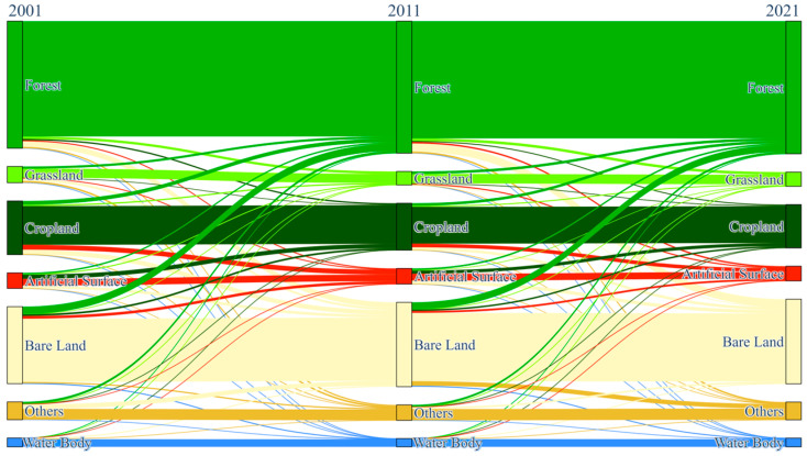 Figure 10
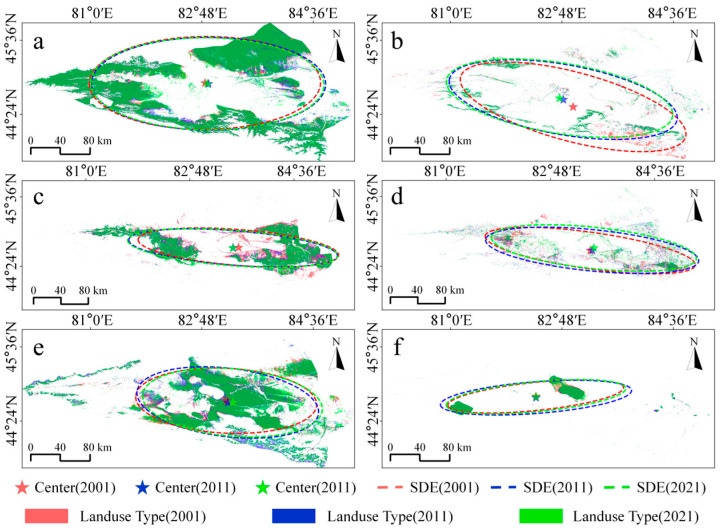 Figure 11
Peer Reviews
No public reviews on file for this paper yet. If you reviewed it on a platform where reviews are public (OpenReview, ICLR, NeurIPS, ICML), you can paste yours below so the community can read it here.
Videos
No videos yet. Explain this paper in a talk, walkthrough, or lecture? Add one.
Taxonomy
TopicsRemote Sensing in Agriculture · Land Use and Ecosystem Services · Remote-Sensing Image Classification