Urban morphology dataset of Reunion Island based on the local climate zone classification using satellite imagery and GIS data
Alexandre Lefevre, Bruno Malet-Damour, Fiona Benard, Harry Boyer, Garry Rivière

TL;DR
This paper presents a detailed urban morphology dataset for Reunion Island using satellite and GIS data to classify urban areas for climate and planning studies.
Contribution
The paper introduces a high-resolution LCZ-based urban morphology dataset for Reunion Island, integrating satellite and GIS data for climate and urban planning analysis.
Findings
The dataset includes LCZ classifications, building heights, and surface fractions at 100 m x 100 m resolution.
Compact urban zones (LCZ 1-3) are mapped to identify areas at high risk of climatic impacts.
The dataset supports comparative urban climate studies with other small island states like Mauritius.
Abstract
This dataset provides a high-resolution spatial classification of urban morphology on Reunion Island, France, using a 100 m x 100 m grid based on the Local Climate Zone (LCZ) framework. The data were generated through a combination of satellite imagery analysis using the World Urban Database and Access Portal Tools (WUDAPT) method and Geographic Information System (GIS) data integration. The classification was refined using building height and surface fraction data from the BD TOPO 2018 database, improving the accuracy of urban form representation. The dataset is provided in shapefile format, facilitating its use in GIS software by urban planners, researchers, and policymakers. Each grid point contains geospatial and morphological attributes, including LCZ classification, average building height (m), and built surface fraction (%). These parameters allow researchers to spatially…
Genes, proteins, chemicals, diseases, species, mutations and cell lines named across the full text — each resolved to its canonical identifier and authoritative record.
Click any figure to enlarge with its caption.
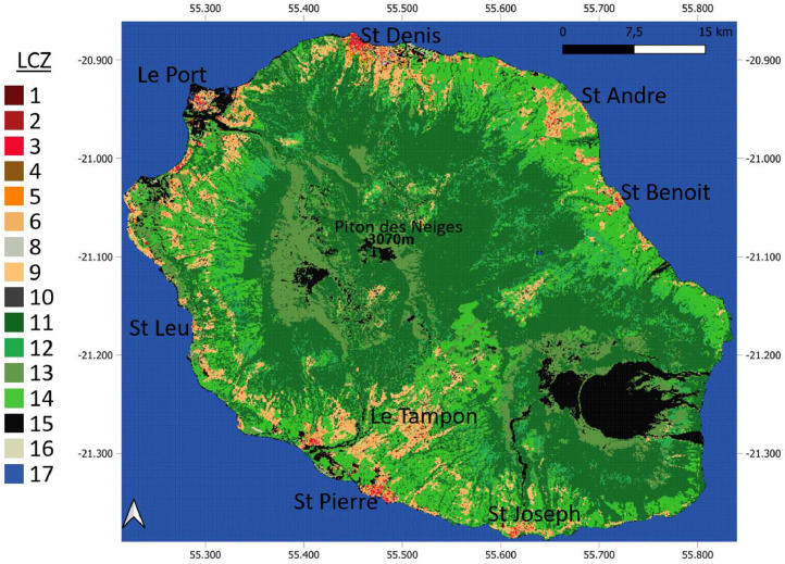 Figure 1
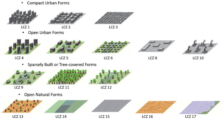 Figure 2
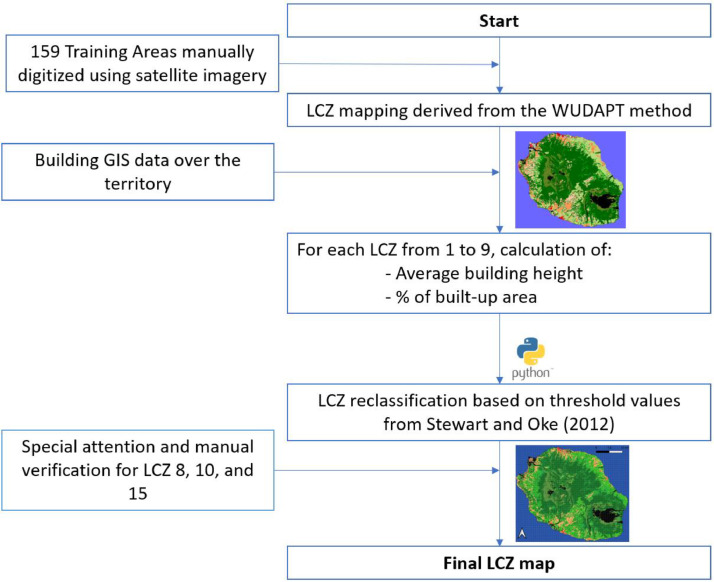 Figure 3
 Figure 4
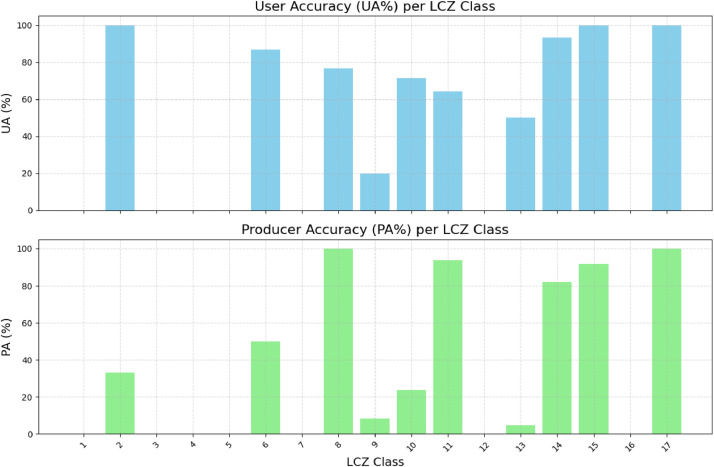 Figure 5
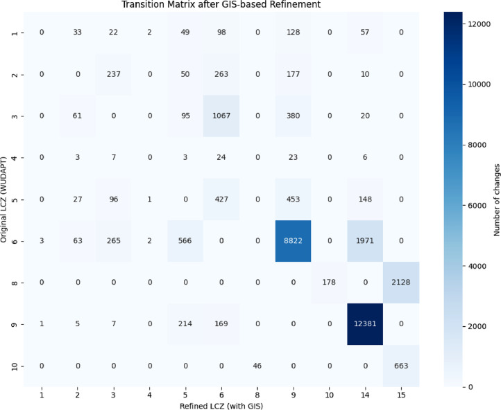 Figure 6
Peer Reviews
No public reviews on file for this paper yet. If you reviewed it on a platform where reviews are public (OpenReview, ICLR, NeurIPS, ICML), you can paste yours below so the community can read it here.
Videos
No videos yet. Explain this paper in a talk, walkthrough, or lecture? Add one.
Taxonomy
TopicsUrban Heat Island Mitigation · Remote Sensing and Land Use · Land Use and Ecosystem Services