Lightweight dynamic model for fusion of three-dimensional surface–stratum underground structures
Cuiying Zhou, Yusen Zhong, Ziyu Tao, Chunhui Lan, Wei Hu, Zhen Liu

TL;DR
This paper introduces a lightweight 3D model that integrates surface, stratum, and underground structure data for geotechnical engineering.
Contribution
The novel contribution is a dynamic, lightweight 3D modeling method that fuses heterogeneous geotechnical data using Kriging interpolation and Boolean operations.
Findings
A geometric fusion method using Boolean difference set operations was developed for 3D surface-strata-underground structures.
A lightweight dynamic model was created using layered rendering technology for efficient visualization.
The proposed method was verified through engineering applications, showing feasibility and reliability.
Abstract
Three-dimensional visual modeling of surface-stratum-structure is an inevitable requirement for intelligent geotechnical engineering. However, the heterogeneity of surface, stratigraphic and structural data sources and modeling methods leads to incompatibility of model attributes. Only a few studies have directly realized the three-dimensional (3D) modeling of surface-strata-structure. In order to solve this problem, this study uses the Kriging interpolation method based on relative elevation to realize the fusion of borehole data and surface data, and establishes a 3D surface-strata model. The Boolean difference set operation based on the bounding box method is used to propose a geometric fusion method for the 3D surface-strata-underground structure model. In addition, an attribute fusion method of 3D surface-stratum-underground structure model is introduced by using variable storage…
Genes, proteins, chemicals, diseases, species, mutations and cell lines named across the full text — each resolved to its canonical identifier and authoritative record.
Click any figure to enlarge with its caption.
 Figure 1
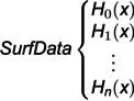 Figure 2
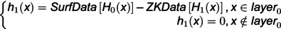 Figure 3
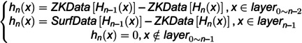 Figure 4
 Figure 5
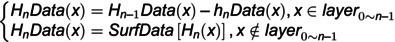 Figure 6
 Figure 7
 Figure 8
 Figure 9
 Figure 10
 Figure 11
 Figure 12
 Figure 13
 Figure 14
 Figure 15
 Figure 16
 Figure 17
 Figure 18
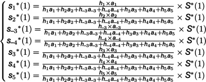 Figure 19
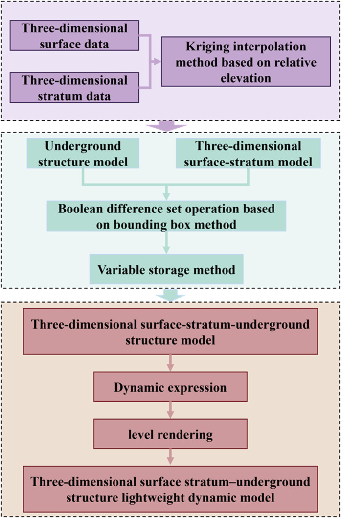 Figure 20
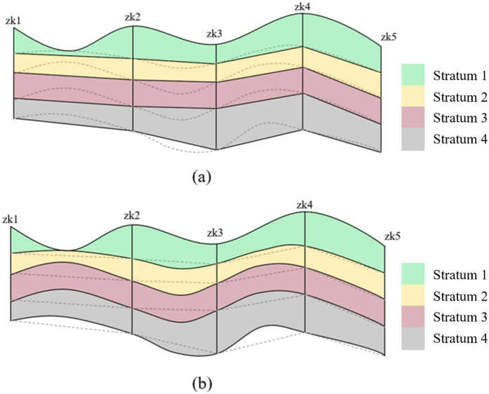 Figure 21
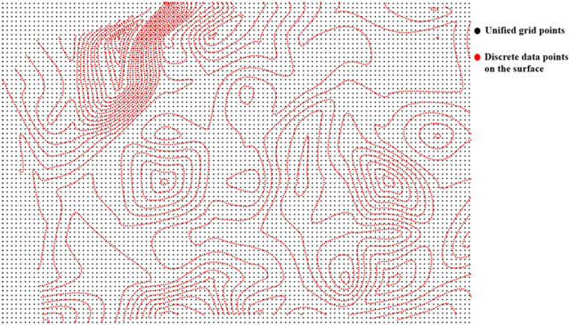 Figure 22
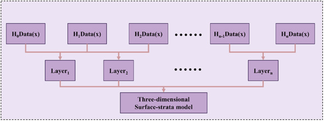 Figure 23
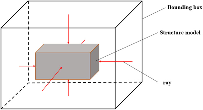 Figure 24
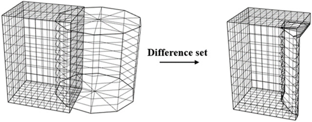 Figure 25
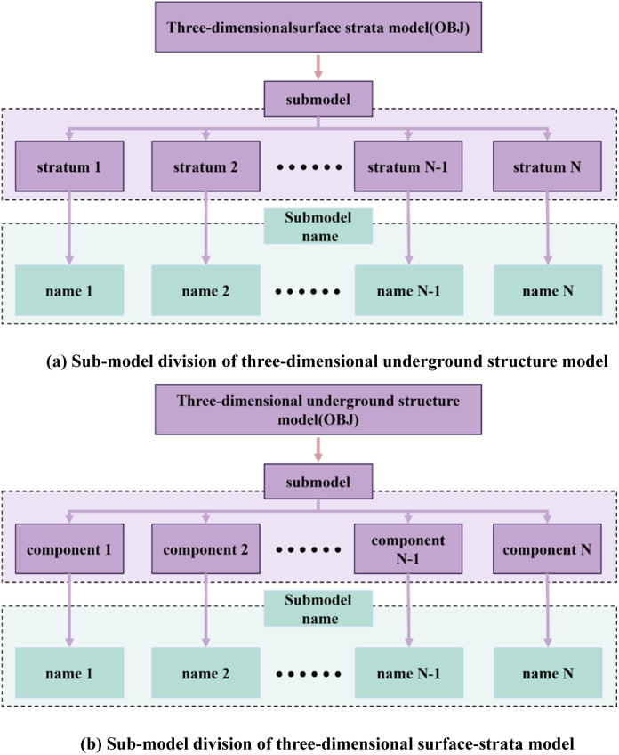 Figure 26
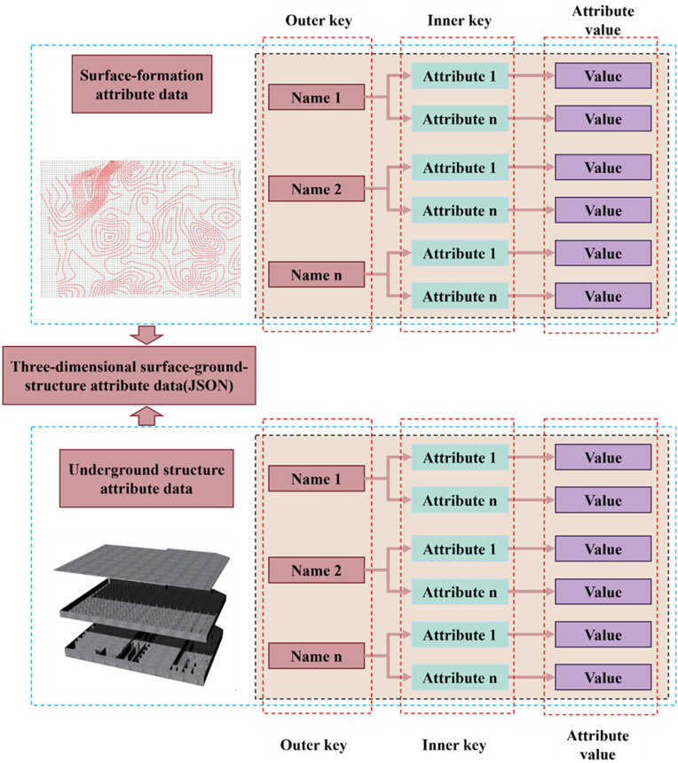 Figure 27
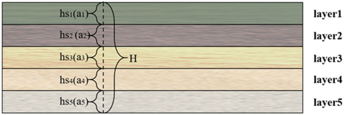 Figure 28
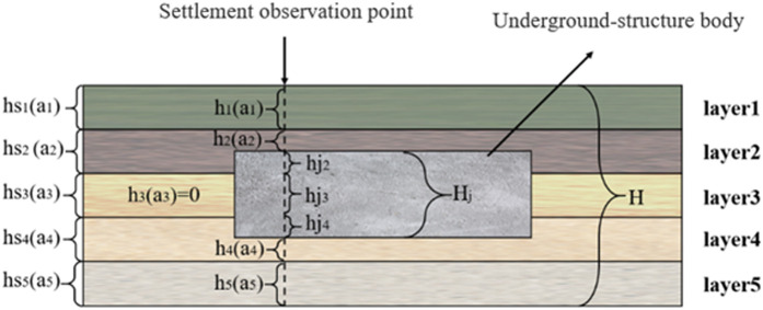 Figure 29
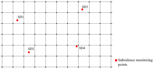 Figure 30
 Figure 31
 Figure 32
 Figure 33
 Figure 34
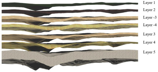 Figure 35
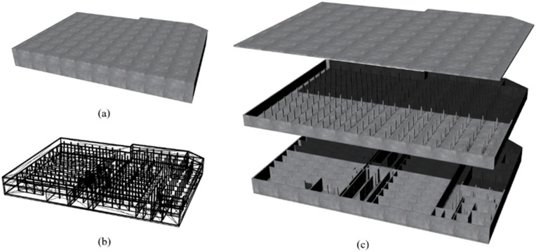 Figure 36
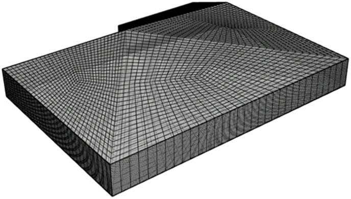 Figure 37
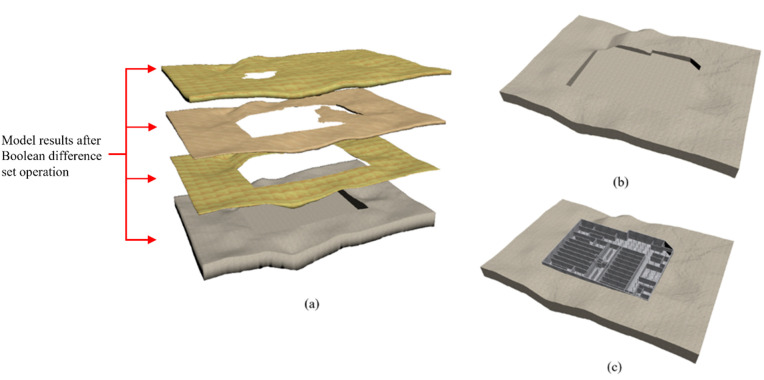 Figure 38
 Figure 39
 Figure 40
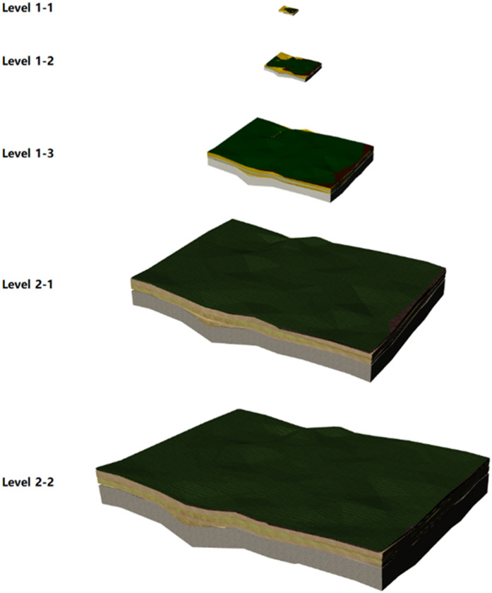 Figure 41
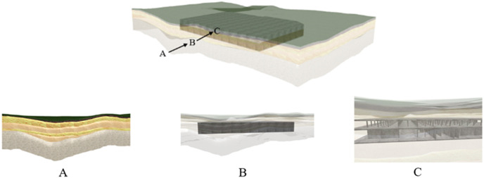 Figure 42
 Figure 43
 Figure 44
 Figure 45
 Figure 46
 Figure 47
 Figure 48
 Figure 49
 Figure 50
Peer Reviews
No public reviews on file for this paper yet. If you reviewed it on a platform where reviews are public (OpenReview, ICLR, NeurIPS, ICML), you can paste yours below so the community can read it here.
Videos
No videos yet. Explain this paper in a talk, walkthrough, or lecture? Add one.
Taxonomy
TopicsGeological Modeling and Analysis · 3D Surveying and Cultural Heritage · 3D Modeling in Geospatial Applications