Building extraction from remote sensing images based on multi-scale attention gate and enhanced positional information
Rui Xu, Renzhong Mao, Zhenxing Zhuang, Fenghua Huang, Yihui Yang

TL;DR
This paper introduces a new method for extracting buildings from satellite images using deep learning with improved edge accuracy and structure preservation.
Contribution
A novel building extraction framework combining multi-scale attention gates and enhanced positional information for better accuracy and detail.
Findings
The proposed method outperforms six state-of-the-art models on three benchmark datasets in building extraction.
Multi-scale attention gate improves multi-scale feature capture, while enhanced positional information sharpens building edges.
Intersection over union (IoU) metrics show consistent improvements across datasets.
Abstract
Extracting buildings from high-resolution remote sensing images is currently a research hotspot in the field of remote sensing applications. Deep learning methods have significantly improved the accuracy of building extraction, but there are still deficiencies such as blurred edges, incomplete structures and loss of details in the extraction results. To obtain accurate contours and clear boundaries of buildings, this article proposes a novel building extraction method utilizing multi-scale attention gate and enhanced positional information. By employing U-Net as the main framework, this article introduces a multi-scale attention gate module in the encoder, which effectively improves the ability to capture multi-scale information, and designs a module in the decoder to enhance the positional information of the features, allowing for more precise localization and extraction of the shape…
Click any figure to enlarge with its caption.
 Figure 1
 Figure 2
 Figure 3
 Figure 4
 Figure 5
 Figure 6
 Figure 7
 Figure 8
 Figure 9
 Figure 10
 Figure 11
 Figure 12
 Figure 13
 Figure 14
 Figure 15
 Figure 16
 Figure 17
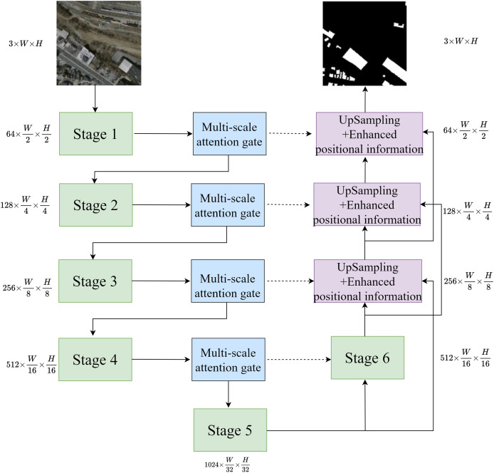 Figure 18
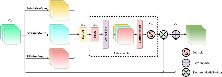 Figure 19
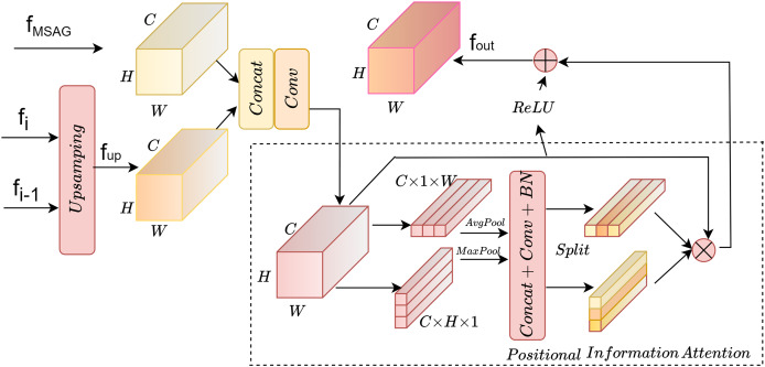 Figure 20
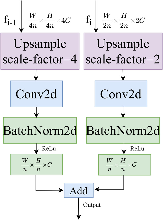 Figure 21
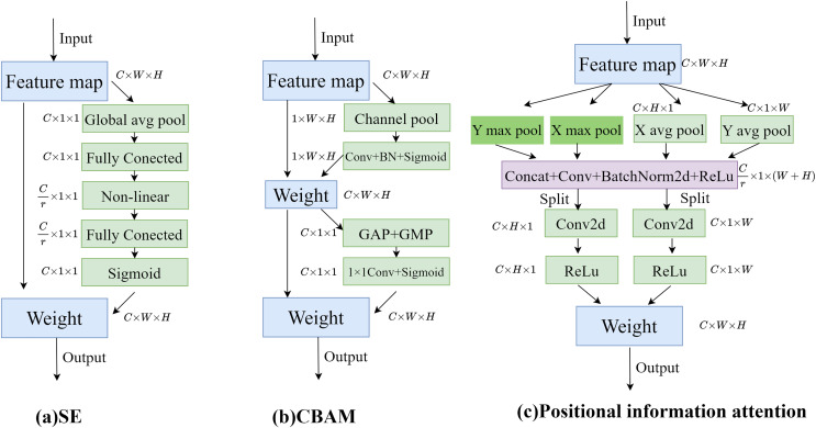 Figure 22
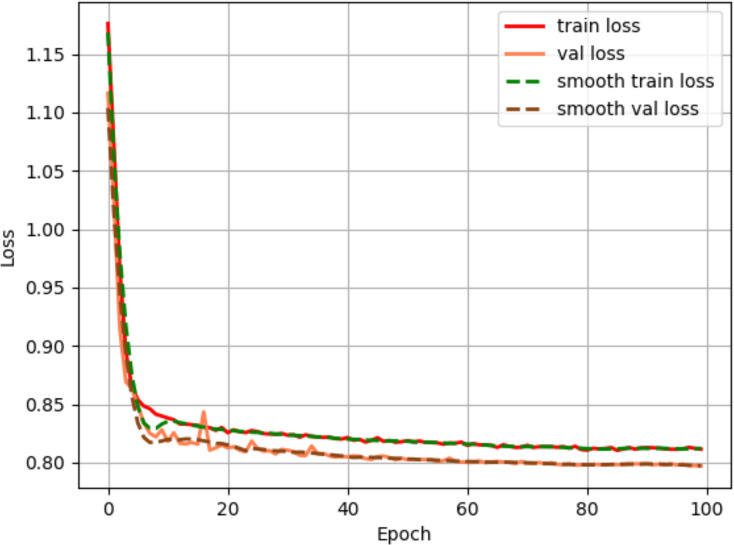 Figure 23
 Figure 24
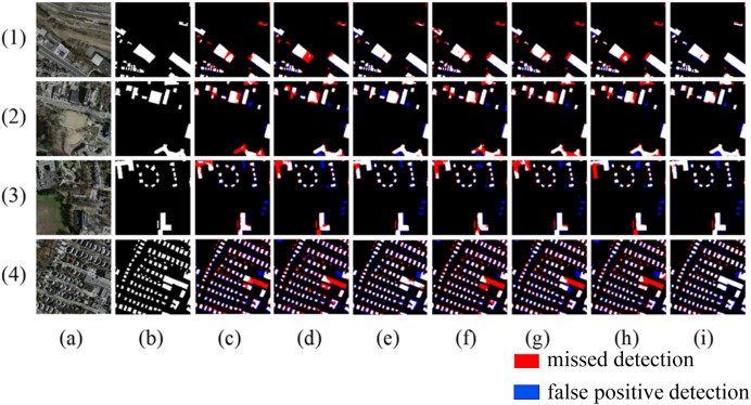 Figure 25
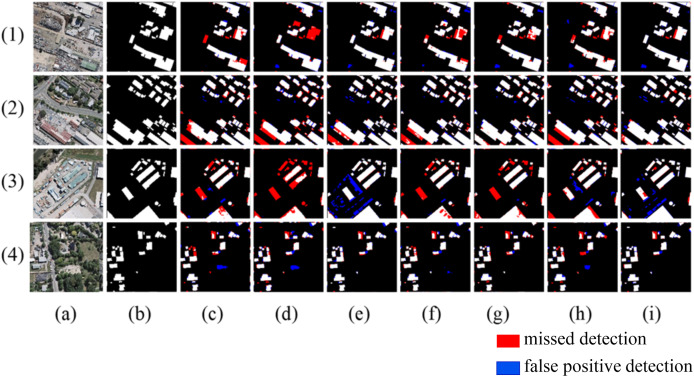 Figure 26
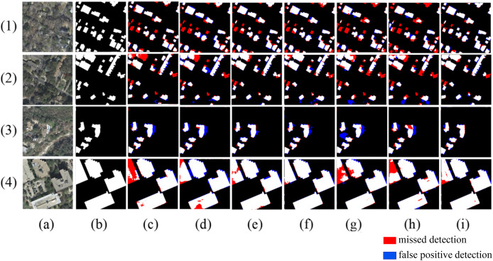 Figure 27
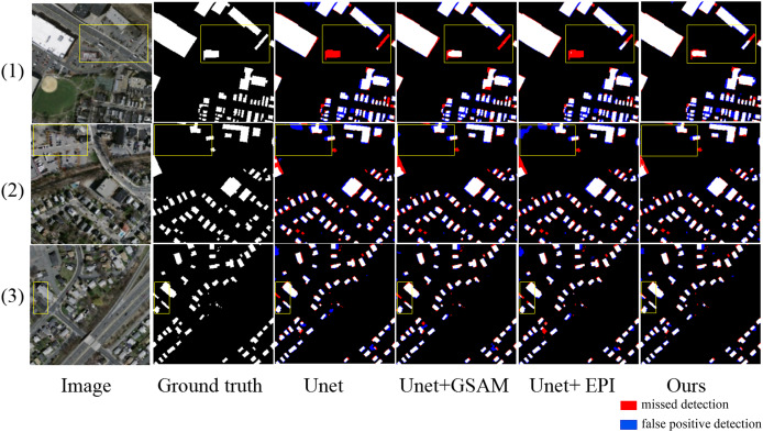 Figure 28
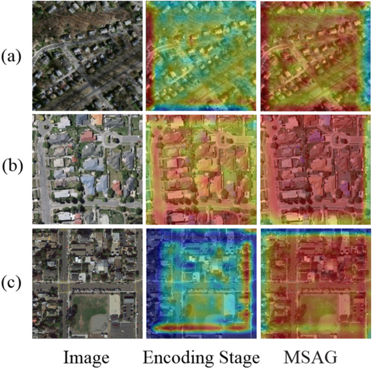 Figure 29
 Figure 30
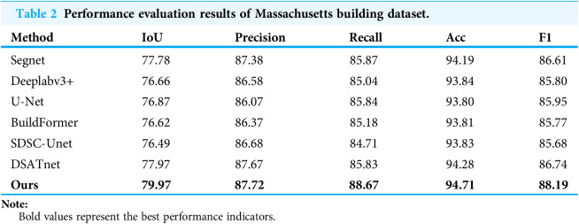 Figure 31
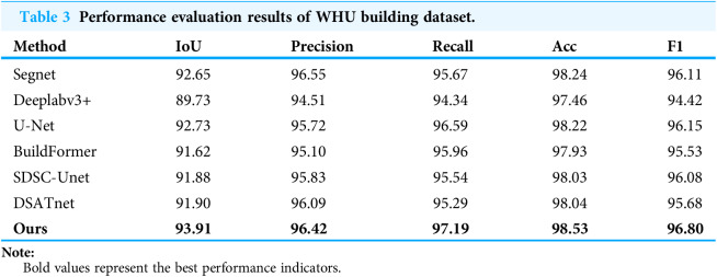 Figure 32
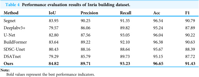 Figure 33
 Figure 34
 Figure 35
 Figure 36
Peer Reviews
No public reviews on file for this paper yet. If you reviewed it on a platform where reviews are public (OpenReview, ICLR, NeurIPS, ICML), you can paste yours below so the community can read it here.
Videos
No videos yet. Explain this paper in a talk, walkthrough, or lecture? Add one.
Taxonomy
TopicsAutomated Road and Building Extraction · Remote-Sensing Image Classification · Remote Sensing and Land Use