Optimization of Control Point Layout for Orthophoto Generation of Indoor Murals
Dingfei Yan, Yongming Yang

TL;DR
This study finds that using 24 control points per 16 square meters optimizes the accuracy of digital images of indoor murals for preservation.
Contribution
Proposes an optimal control point layout for high-precision orthophoto generation of indoor murals.
Findings
Image accuracy improves with more control points but stabilizes at 24 points.
24 control points per 16 square meters meet millimeter-level precision requirements.
The layout reduces time costs while ensuring reliable data for mural preservation.
Abstract
This study focuses on the preservation of indoor murals, which can be supported by combining RTK and total station technology to explore the optimization of image geometric accuracy based on a control points layout. The study involves placing varying numbers of control points on the mural surface and processing the collected data using a spatial coordinate transformation model to assess the impact of different layouts on image accuracy. Some control points are used to ensure the spatial positioning accuracy of the images, while others serve as check points to validate the geometric precision of the images. After data processing, high-precision digital orthophotos are generated using Agisoft PhotoScan2.0.1 software, with accuracy verified by the check points. The experimental results show that as the number of control points increases, image accuracy improves gradually. When the number…
Genes, proteins, chemicals, diseases, species, mutations and cell lines named across the full text — each resolved to its canonical identifier and authoritative record.
Click any figure to enlarge with its caption.
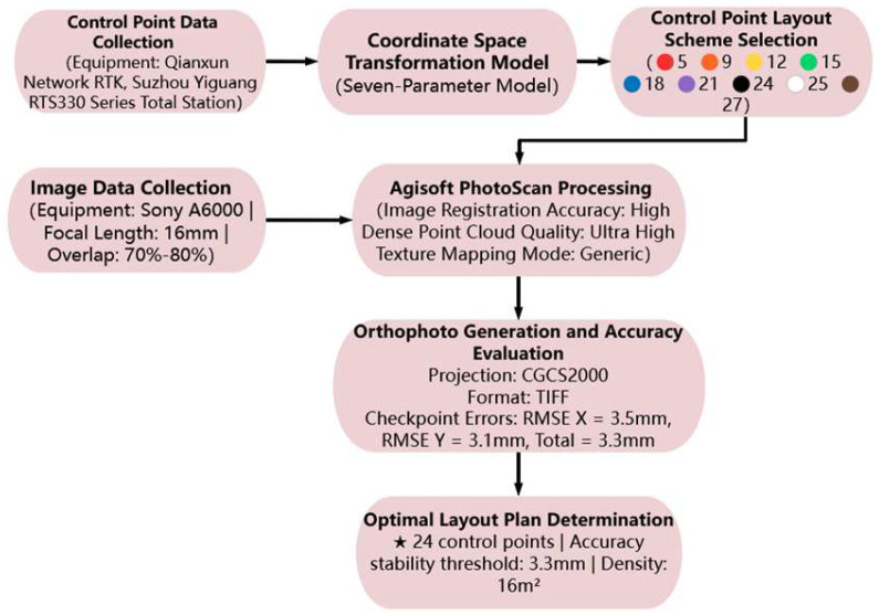 Figure 1
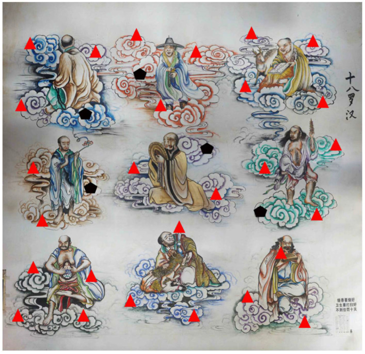 Figure 2
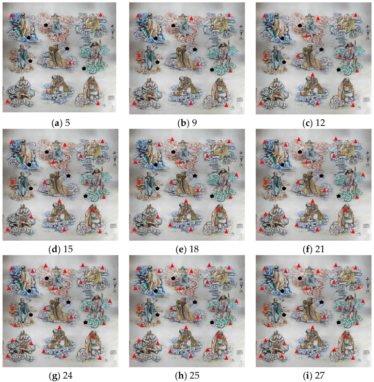 Figure 3
 Figure 4
 Figure 5
 Figure 6
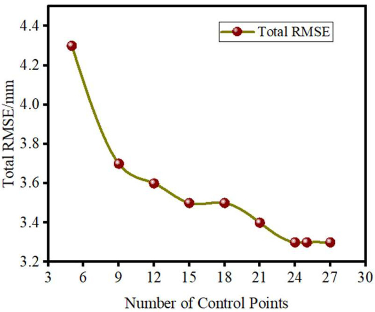 Figure 7
Peer Reviews
No public reviews on file for this paper yet. If you reviewed it on a platform where reviews are public (OpenReview, ICLR, NeurIPS, ICML), you can paste yours below so the community can read it here.
Videos
No videos yet. Explain this paper in a talk, walkthrough, or lecture? Add one.
Taxonomy
Topics3D Surveying and Cultural Heritage · Remote Sensing and LiDAR Applications · Archaeological Research and Protection