Gravity Data Fusion and Imaging of Geological Structures in the Red River Fault Zone and Adjacent Areas
Guiju Wu, Fei Yu, Hongbo Tan, Jiapei Wang, Weihua Liu

TL;DR
This study improves gravity data analysis in the Red River Fault Zone to better understand geological structures and crustal density variations.
Contribution
A new gravity data-fusion method is proposed to enhance crustal imaging in data-scarce regions.
Findings
Fused gravity data accurately reflect both regional and local anomaly trends with high precision.
Low-density zones in the northern and southern parts of the fault are shallower (~20 km) compared to the middle section.
The method achieves a root-mean-square error of less than 5% and a correlation coefficient over 90%.
Abstract
The geological structure in the Red River fault zone (RRF) and adjacent areas is complex. Due to the lack of high-precision gravity data in the study area, it is difficult to obtain the distribution of materials within the Earth’s crust. In this study, a gravity data-fused method is proposed. The Moho depth model data are utilized to construct the gravity anomaly trend, and the mapping relation between the gravity field model data and the measured gravity data is established. Using 934 high-precision measured gravity data as control points, the bilinear interpolation method is used to calculate high-precision grid data of the RRF. Finally, the apparent density inversion method is used to obtain clear crustal density images across the RRF. The experimental results show that the fuses data not only reflect the regional anomaly trend but also maintain the local anomaly information; the…
Genes, proteins, chemicals, diseases, species, mutations and cell lines named across the full text — each resolved to its canonical identifier and authoritative record.
Click any figure to enlarge with its caption.
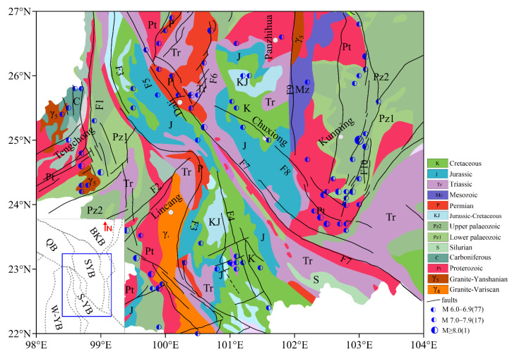 Figure 1
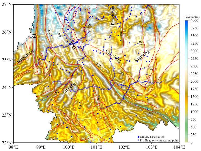 Figure 2
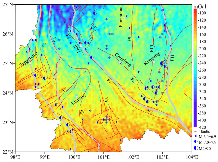 Figure 3
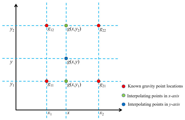 Figure 4
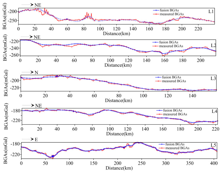 Figure 5
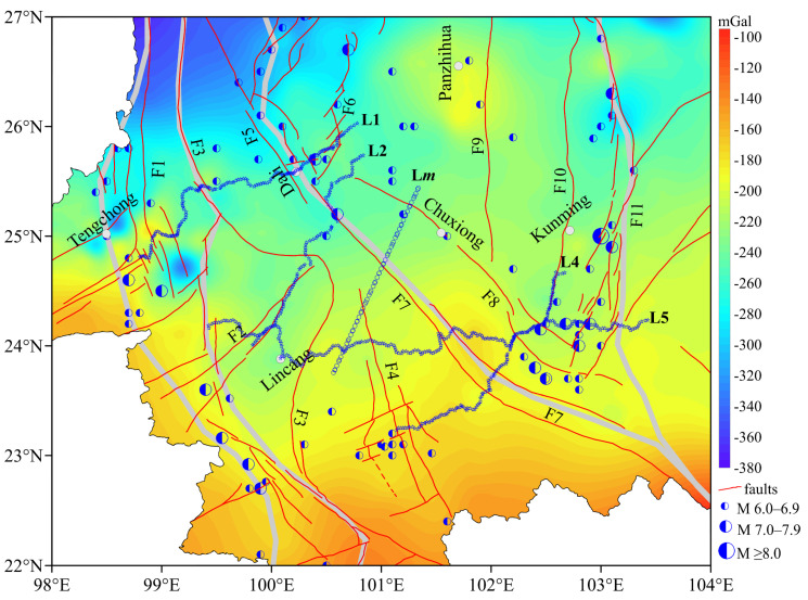 Figure 6
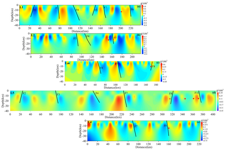 Figure 7
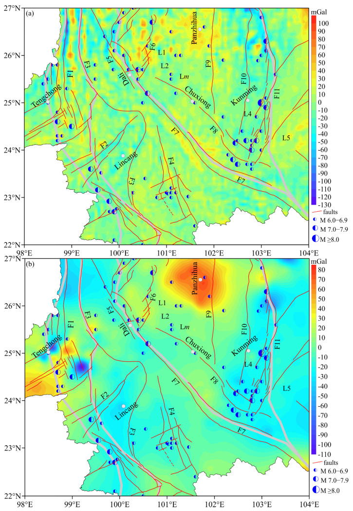 Figure 8
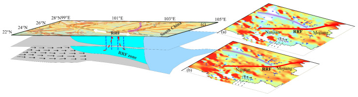 Figure 9
Peer Reviews
No public reviews on file for this paper yet. If you reviewed it on a platform where reviews are public (OpenReview, ICLR, NeurIPS, ICML), you can paste yours below so the community can read it here.
Videos
No videos yet. Explain this paper in a talk, walkthrough, or lecture? Add one.
Taxonomy
TopicsSeismic Imaging and Inversion Techniques · Geological and Geophysical Studies · earthquake and tectonic studies