River Surface Velocity Measurement for Rapid Levee Breach Emergency Response Based on DFP-P-LK Algorithm
Zhao-Dong Xu, Zhi-Wei Zhang, Ying-Qing Guo, Yan Zhang, Yang Zhan

TL;DR
A new algorithm for measuring river surface velocity helps improve emergency responses to levee breaches.
Contribution
The DFP-P-LK algorithm introduces a dynamic feature point fusion strategy for more accurate and reliable optical flow estimation.
Findings
The DFP-P-LK algorithm reduces measurement errors in river surface velocity estimation.
The model achieves an average error below 15% in the velocity range of 0.43 to 2.06 m/s.
The method provides reliable data for rapid levee breach emergency response planning.
Abstract
In recent years, the increasing frequency of climate change and extreme weather events has significantly elevated the risk of levee breaches, potentially triggering large-scale floods that threaten surrounding environments and public safety. Rapid and accurate measurement of river surface velocities is crucial for developing effective emergency response plans. Video image velocimetry has emerged as a powerful new approach due to its non-invasive nature, ease of operation, and low cost. This paper introduces the Dynamic Feature Point Pyramid Lucas–Kanade (DFP-P-LK) optical flow algorithm, which employs a feature point dynamic update fusion strategy. The algorithm ensures accurate feature point extraction and reliable tracking through feature point fusion detection and dynamic update mechanisms, enhancing the robustness of optical flow estimation. Based on the DFP-P-LK, we propose a river…
Genes, proteins, chemicals, diseases, species, mutations and cell lines named across the full text — each resolved to its canonical identifier and authoritative record.
Click any figure to enlarge with its caption.
 Figure 1
 Figure 2
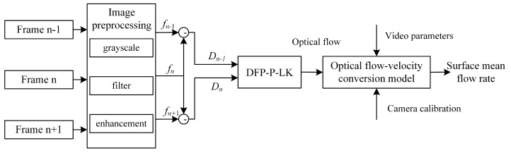 Figure 3
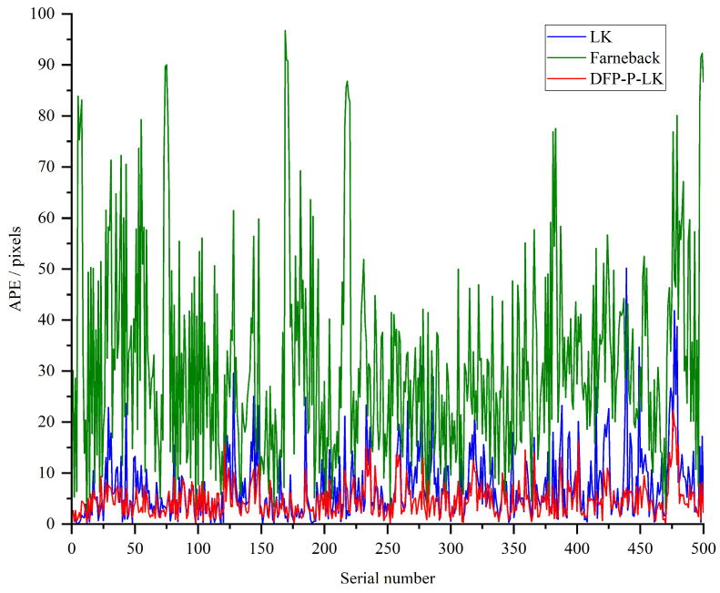 Figure 4
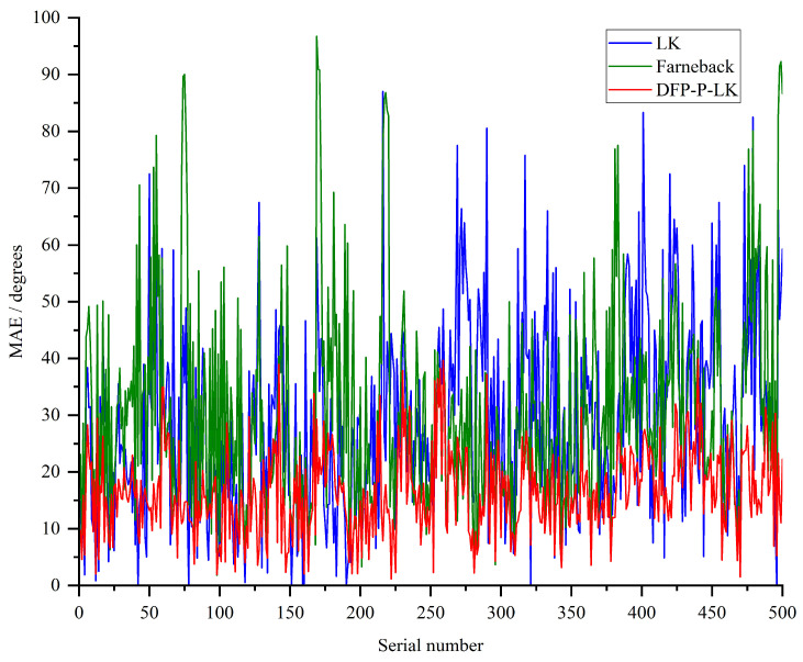 Figure 5
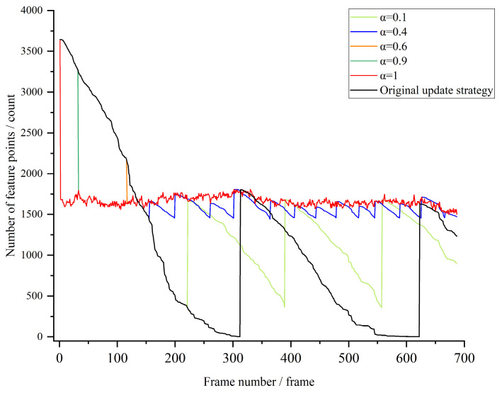 Figure 6
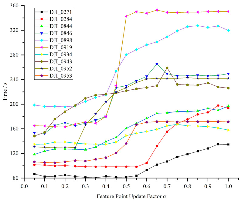 Figure 7
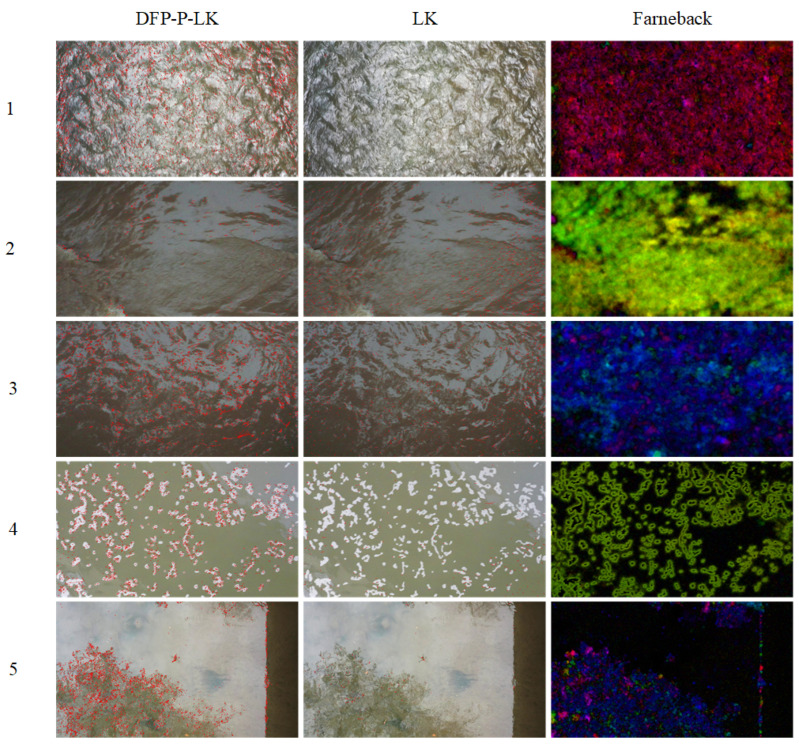 Figure 8
Peer Reviews
No public reviews on file for this paper yet. If you reviewed it on a platform where reviews are public (OpenReview, ICLR, NeurIPS, ICML), you can paste yours below so the community can read it here.
Videos
No videos yet. Explain this paper in a talk, walkthrough, or lecture? Add one.
Taxonomy
TopicsHydrology and Sediment Transport Processes · Flood Risk Assessment and Management · Remote Sensing and LiDAR Applications