Ground penetrating radar scanning and historical interpretation of the location of the destroyed Epiphany Cathedral in Kyiv Brotherhood Monastery (Ukraine)
Kseniia Bondar, Sergiy Taranenko, Yaroslav Zatyliuk, Olena Popelnytska, Tetiana Osinchuk, IŞIK Nursen, Mercedes Solla, Caglayan Balkaya, Vicente Bayarri, Nikos Papadopoulos

TL;DR
This paper uses ground penetrating radar and historical records to locate the foundations of a destroyed cathedral in Kyiv, which was a significant cultural and historical site.
Contribution
The study integrates GPR scanning with historical analysis to identify and preserve the cathedral's remains as a cultural heritage site.
Findings
GPR scanning identified the best-preserved foundations of the cathedral's western wall.
Historical and geophysical data confirmed the site's significance for cultural heritage preservation.
Archaeological research was facilitated by the integration of historical records and GPR results.
Abstract
The article presents results of a ground penetrating radar (GPR) scanning carried out in a site of the Epiphany Cathedral of Brotherhood Monastery in Kyiv, Ukraine, destroyed in 1936 by the Soviets. The Cathedral is known as a burial site of Hetman Petro Sahaidachnyi (1582–1622), a Ukrainian Cossack political and civic leader, guardian and patron of Kyiv Brotherhood Monastery. The collection of archival documents, blueprints, stock sources, photographs and cartographic materials of the 17th-19th centuries, as well as historical works of the 19th-21st centuries, were thoroughly analyzed and used as a basis for the interpretation of geophysical results. The set of historical data covers the period from 1615, that is, from the beginning of the construction of the wooden Epiphany Church, the predecessor of the cathedral, to the present day. Summarized information about the construction,…
Genes, proteins, chemicals, diseases, species, mutations and cell lines named across the full text — each resolved to its canonical identifier and authoritative record.
Click any figure to enlarge with its caption.
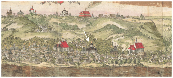 Figure 1
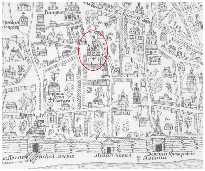 Figure 2
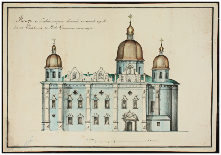 Figure 3
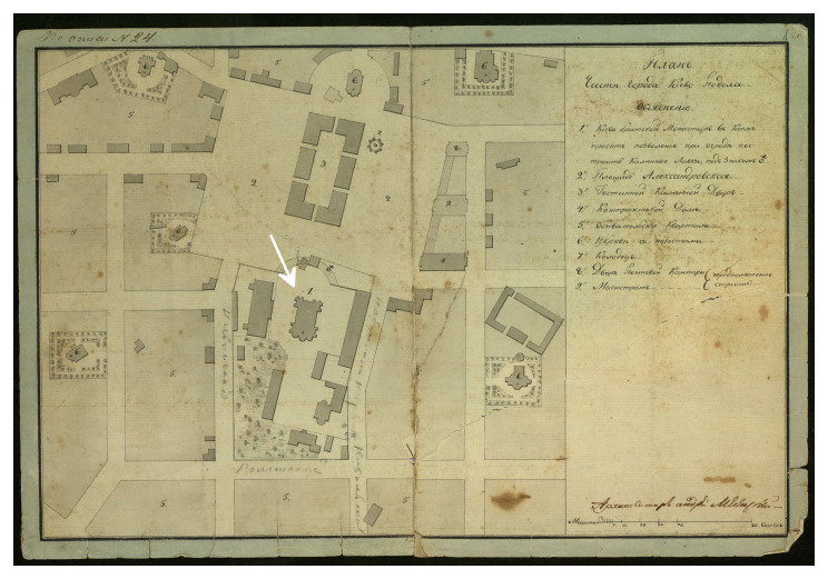 Figure 4
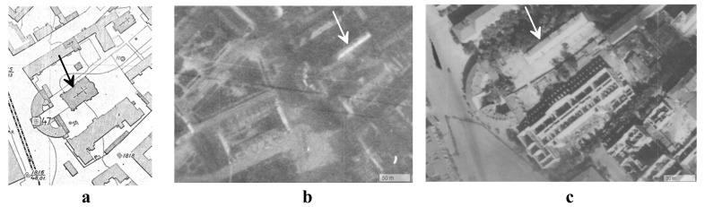 Figure 5
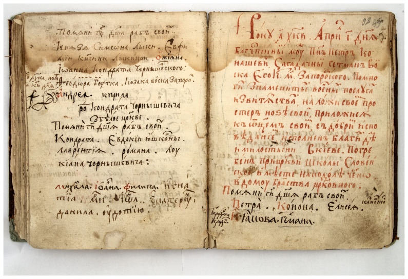 Figure 6
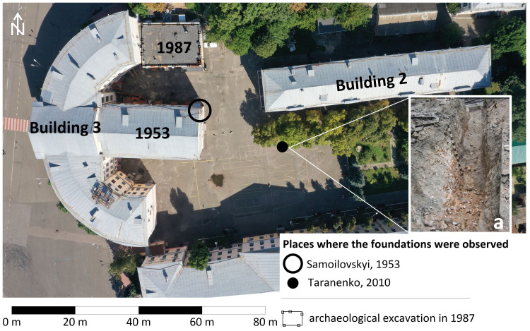 Figure 7
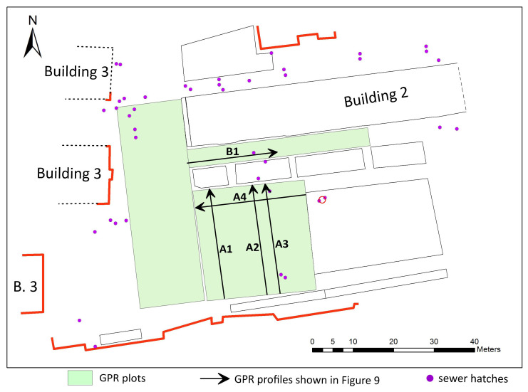 Figure 8
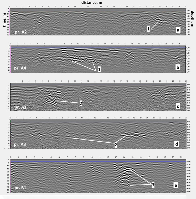 Figure 9
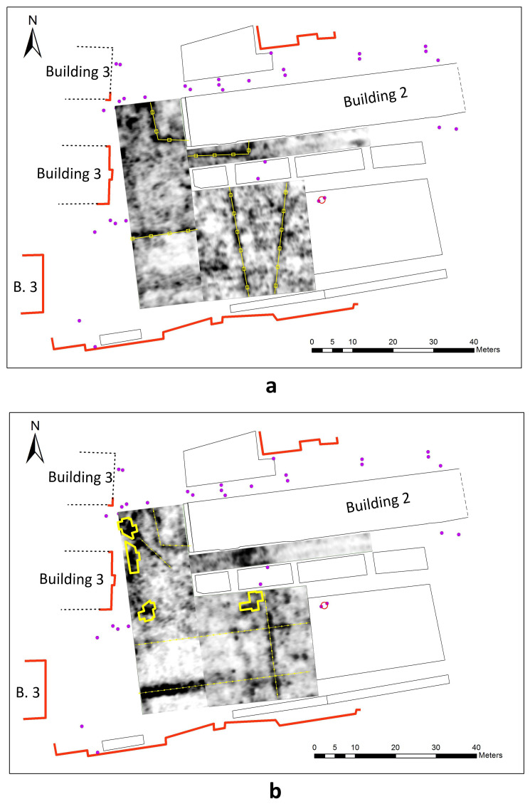 Figure 10
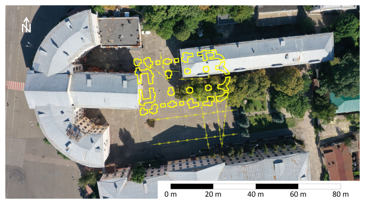 Figure 11
Peer Reviews
No public reviews on file for this paper yet. If you reviewed it on a platform where reviews are public (OpenReview, ICLR, NeurIPS, ICML), you can paste yours below so the community can read it here.
Videos
No videos yet. Explain this paper in a talk, walkthrough, or lecture? Add one.
Taxonomy
TopicsGeophysical Methods and Applications · Archaeological Research and Protection · 3D Surveying and Cultural Heritage