Free roaming of 3D stratum models based on internal and external boundary identification
Yusen Zhong, Zhen Liu, Cuiying Zhou, Vijayalakshmi Kakulapati, Vijayalakshmi Kakulapati, Vijayalakshmi Kakulapati

TL;DR
This paper introduces a new method for 3D stratum roaming that allows efficient switching between internal and external views of geological models.
Contribution
The novel approach combines internal and external roaming using a stratum virtual surface and lightweight loading.
Findings
A three-dimensional roaming engine was developed to connect internal and external roaming of 3D stratum models.
The method uses a stratum virtual surface for boundary identification and efficient switching between roaming modes.
Lightweight loading enhances performance and provides more intuitive geological information for engineering applications.
Abstract
3D stratum roaming can visualize the complex geomorphology, underground structure and stratum distribution of geotechnical engineering. Conventional 3D stratum roaming technology is generally aimed at roaming outside the 3D stratum model but rarely roams inside the 3D stratum model, and the efficiency of switching between external and internal roaming is low. In practical engineering, especially in geological and geotechnical engineering, the underground structure and stratum situation are critical. Therefore, focusing on this problem, this paper adopts a three-dimensional roaming engine to connect the inside and outside of a three-dimensional model. Based on an internal and external boundary identification method, the combination of external roaming and internal roaming of the three-dimensional stratum model is implemented by using a stratum virtual surface, and lightweight loading is…
Genes, proteins, chemicals, diseases, species, mutations and cell lines named across the full text — each resolved to its canonical identifier and authoritative record.
Click any figure to enlarge with its caption.
 Figure 1
 Figure 2
 Figure 3
 Figure 4
 Figure 5
 Figure 6
 Figure 7
 Figure 8
 Figure 9
 Figure 10
 Figure 11
 Figure 12
 Figure 13
 Figure 14
 Figure 15
 Figure 16
 Figure 17
 Figure 18
 Figure 19
 Figure 20
 Figure 21
 Figure 22
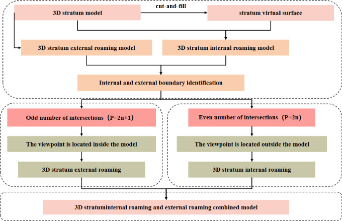 Figure 23
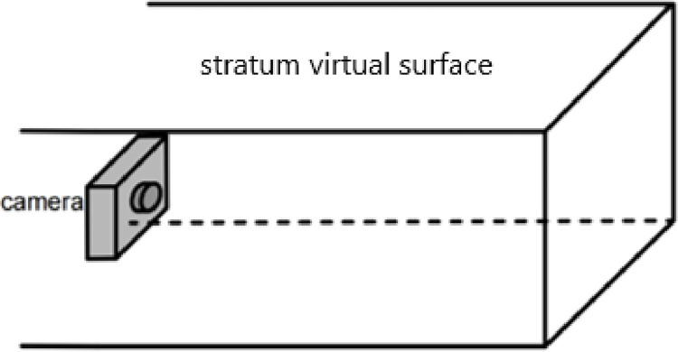 Figure 24
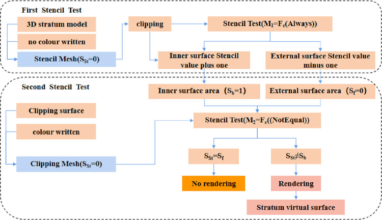 Figure 25
 Figure 26
 Figure 27
 Figure 28
 Figure 29
 Figure 30
 Figure 31
 Figure 32
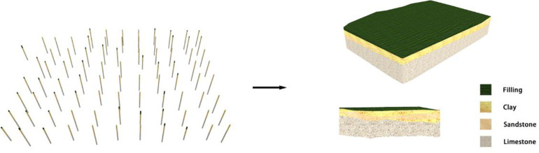 Figure 33
 Figure 34
 Figure 35
 Figure 36
 Figure 37
Peer Reviews
No public reviews on file for this paper yet. If you reviewed it on a platform where reviews are public (OpenReview, ICLR, NeurIPS, ICML), you can paste yours below so the community can read it here.
Videos
No videos yet. Explain this paper in a talk, walkthrough, or lecture? Add one.
Taxonomy
Topics3D Surveying and Cultural Heritage · Image Processing and 3D Reconstruction · Geological Modeling and Analysis