Spatial utilization of historical topographic map and its application in land reconstruction of ancient Chinese urban land use
Zhiwei Wan, Hongqi Wu

TL;DR
This study uses historical maps and GIS to reconstruct urban land use in ancient China, revealing regional patterns and core areas of urbanization during the late Qing Dynasty.
Contribution
A novel method combining historical topographic data and GIS to quantitatively reconstruct ancient urban land use at a high spatial resolution.
Findings
Urban land in late Qing China totaled 1456.015 km², with the highest concentration in Beijing-Tianjin-Hebei and lowest in Qinghai.
Urban land was heavily concentrated east of the Hu Line, with 87.5% of grids located there.
Three urban agglomeration cores were identified: North China Plain, Jiangsu-Shanghai-Zhejiang-Anhui, and Sichuan-Chongqing.
Abstract
The historical topographic map preserves rich geographic information and can provide direct assistance for the reconstruction of various geographic elements. Based on the historical data of cities throughout the Qing Dynasty, the land use scale data of cities across the country was obtained using GIS and urban perimeter conversion models. This study combines city information and city circumference records from the historical maps and archives of the late Qing Dynasty to quantitatively reconstruct the use patterns of ancient China’s urban land at a spatial resolution of 1° × 1°. Uncertainty analysis of the reconstruction results was conducted using modern remote sensing image data as the validation data set. The results showed the following. (1) During the late Qing Dynasty, the total area of urban land in the various provinces and regions was 1456.015 km2. The maximum value was 208.691…
Genes, proteins, chemicals, diseases, species, mutations and cell lines named across the full text — each resolved to its canonical identifier and authoritative record.
Click any figure to enlarge with its caption.
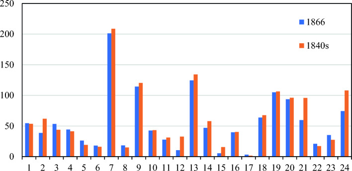 Figure 10
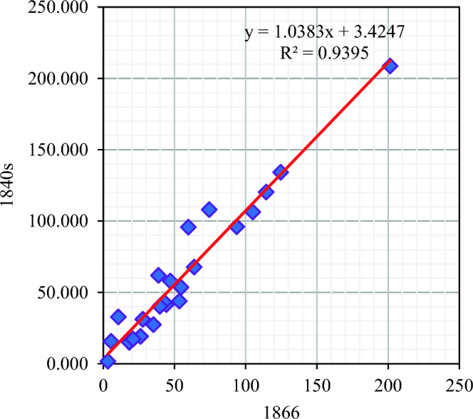 Figure 11
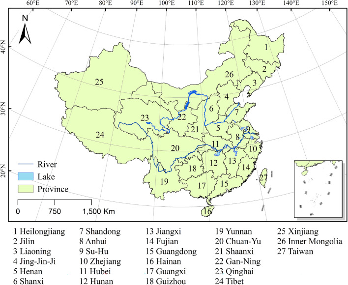 Figure 1
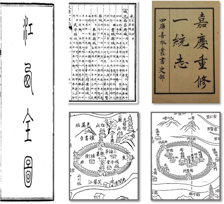 Figure 2
 Figure 3
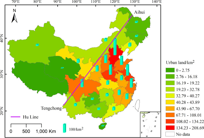 Figure 4
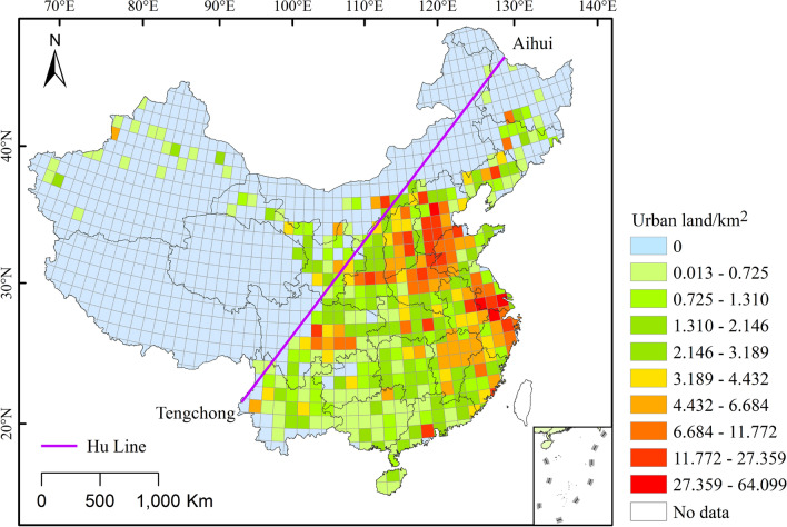 Figure 5
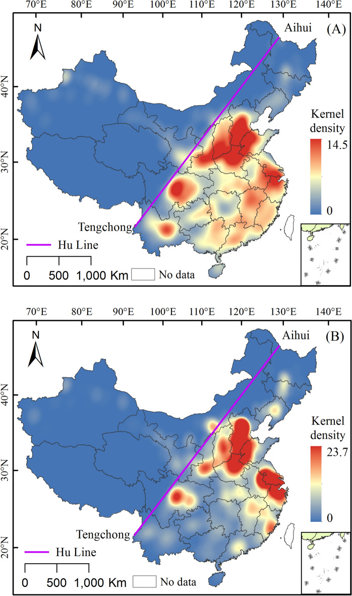 Figure 6
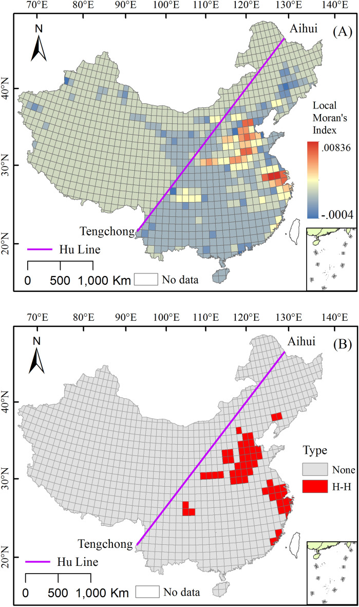 Figure 7
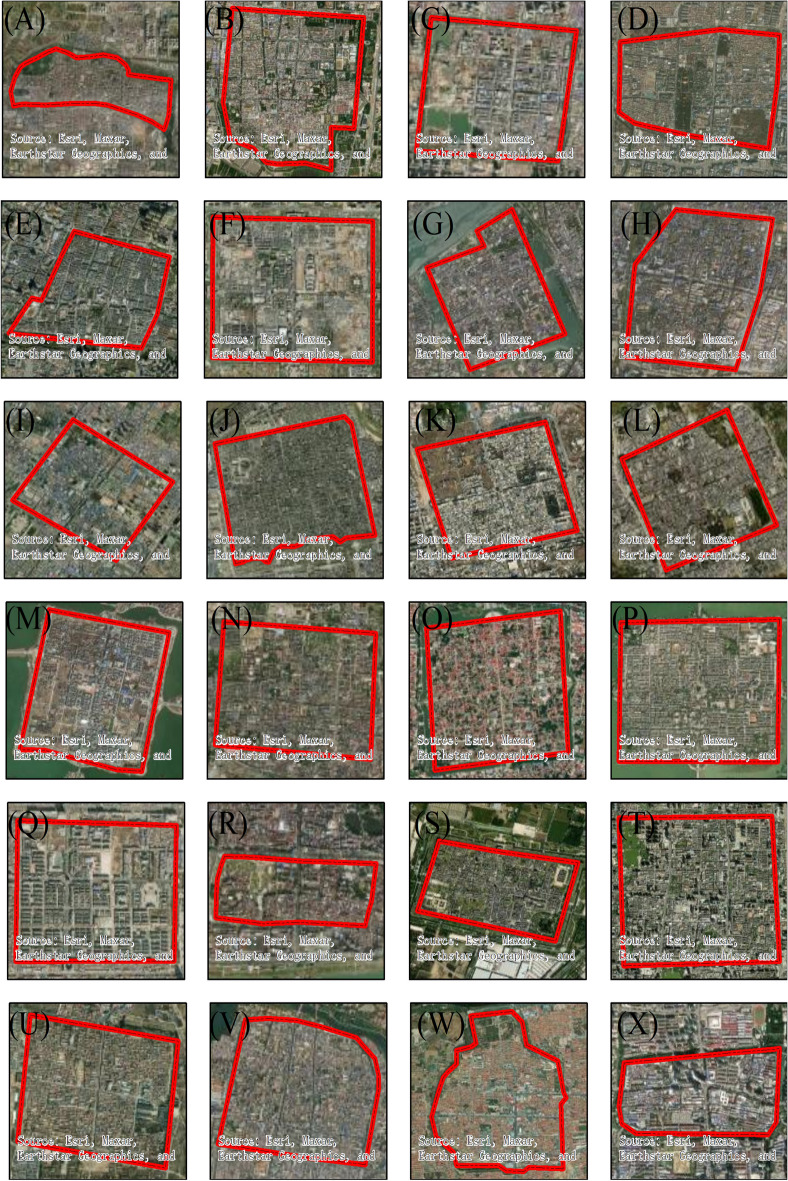 Figure 8
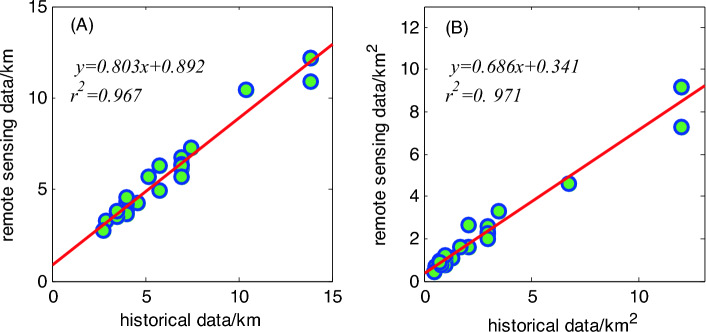 Figure 9
Peer Reviews
No public reviews on file for this paper yet. If you reviewed it on a platform where reviews are public (OpenReview, ICLR, NeurIPS, ICML), you can paste yours below so the community can read it here.
Videos
No videos yet. Explain this paper in a talk, walkthrough, or lecture? Add one.
Taxonomy
TopicsLand Use and Ecosystem Services · Remote Sensing and Land Use · Environmental Changes in China