The rectangular tile classification model based on Sentinel integrated images enhances grassland mapping accuracy: A case study in Ordos, China
Fuchen Guo, Liangxin Fan, Weinan Chen, Dongyang Xiao, Haipeng Niu

TL;DR
This study improves grassland mapping in arid regions using a new classification model and combined satellite data, achieving higher accuracy in Ordos, China.
Contribution
A novel rectangular tile classification model using integrated Sentinel-1A and Sentinel-2 images enhances grassland mapping accuracy in arid zones.
Findings
The integration of vegetation and texture features improved grassland mapping accuracy to 88.23%.
The rectangular tile model outperformed the global model by 1.20% to 13.99% across seven experiments.
The model is flexible and scalable, suitable for various geographical locations and time periods.
Abstract
Arid zone grassland is a crucial component of terrestrial ecosystems and plays a significant role in ecosystem protection and soil erosion prevention. However, accurately mapping grassland spatial information in arid zones presents a great challenge. The accuracy of remote sensing grassland mapping in arid zones is affected by spectral variability caused by the highly diverse landscapes. In this study, we explored the potential of a rectangular tile classification model, constructed using the random forest algorithm and integrated images from Sentinel-1A (synthetic aperture radar imagery) and Sentinel-2 (optical imagery), to enhance the accuracy of grassland mapping in the semiarid to arid regions of Ordos, China. Monthly Sentinel-1A median value images were synthesised, and four MODIS vegetation index mean value curves (NDVI, MSAVI, NDWI and NDBI) were used to determine the optimal…
Genes, proteins, chemicals, diseases, species, mutations and cell lines named across the full text — each resolved to its canonical identifier and authoritative record.
Click any figure to enlarge with its caption.
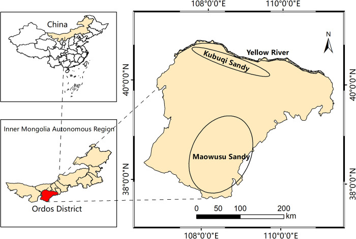 Figure 1
 Figure 2
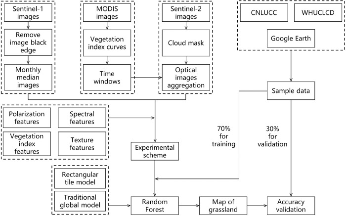 Figure 3
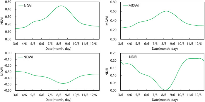 Figure 4
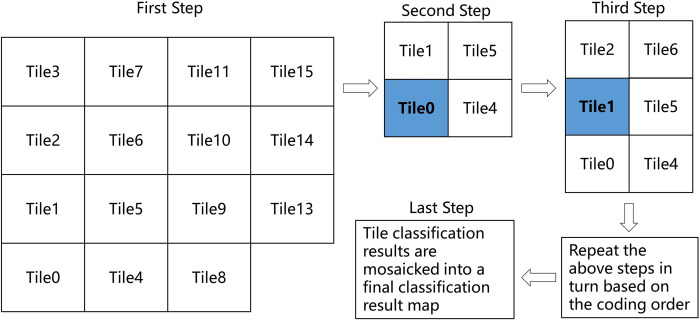 Figure 5
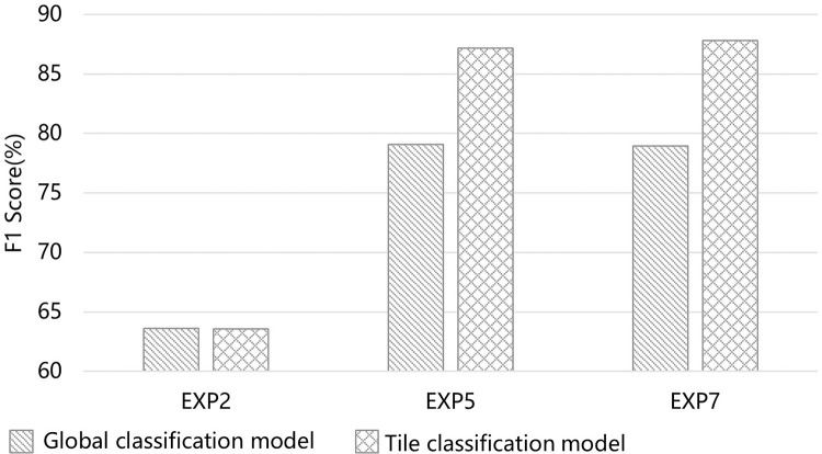 Figure 6
 Figure 7
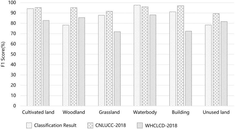 Figure 8
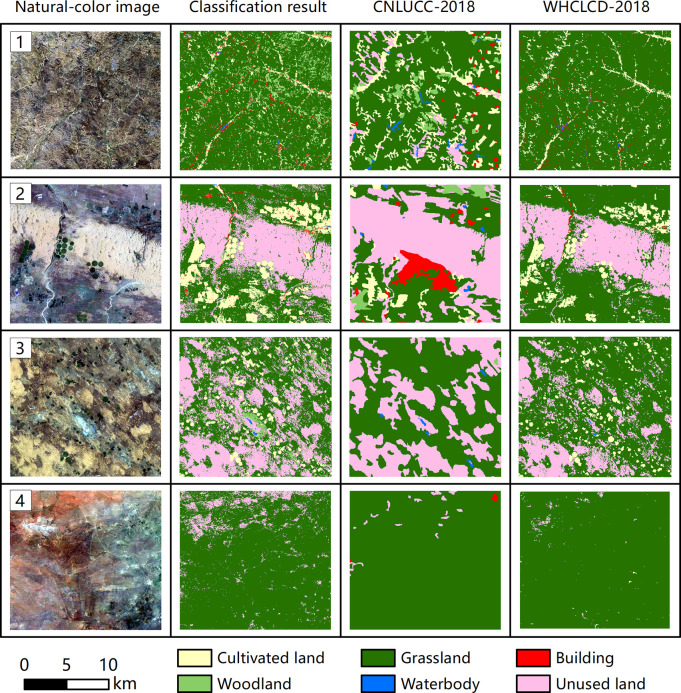 Figure 9
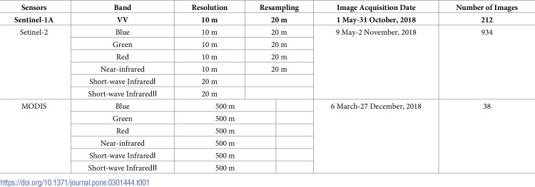 Figure 10
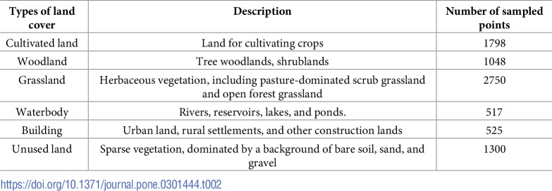 Figure 11
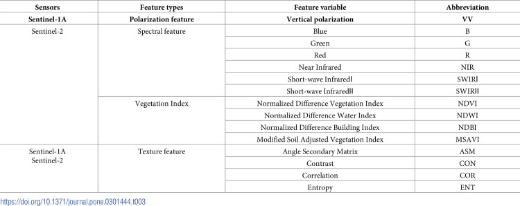 Figure 12
 Figure 13
 Figure 14
 Figure 15
Peer Reviews
No public reviews on file for this paper yet. If you reviewed it on a platform where reviews are public (OpenReview, ICLR, NeurIPS, ICML), you can paste yours below so the community can read it here.
Videos
No videos yet. Explain this paper in a talk, walkthrough, or lecture? Add one.
Taxonomy
TopicsRemote Sensing in Agriculture · Remote Sensing and LiDAR Applications · Remote Sensing and Land Use